Data Visualisation in Map

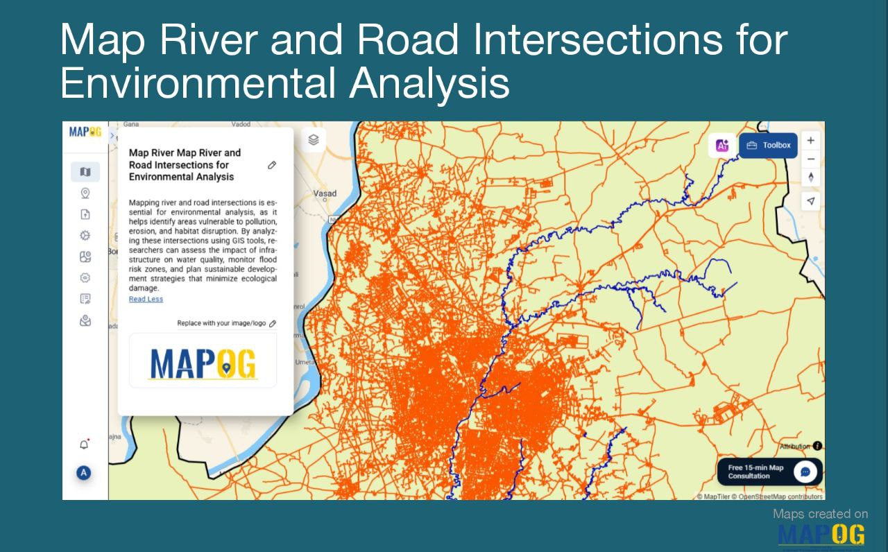
How to Highlight and Manage Your Franchise Reach Using Interactive Maps

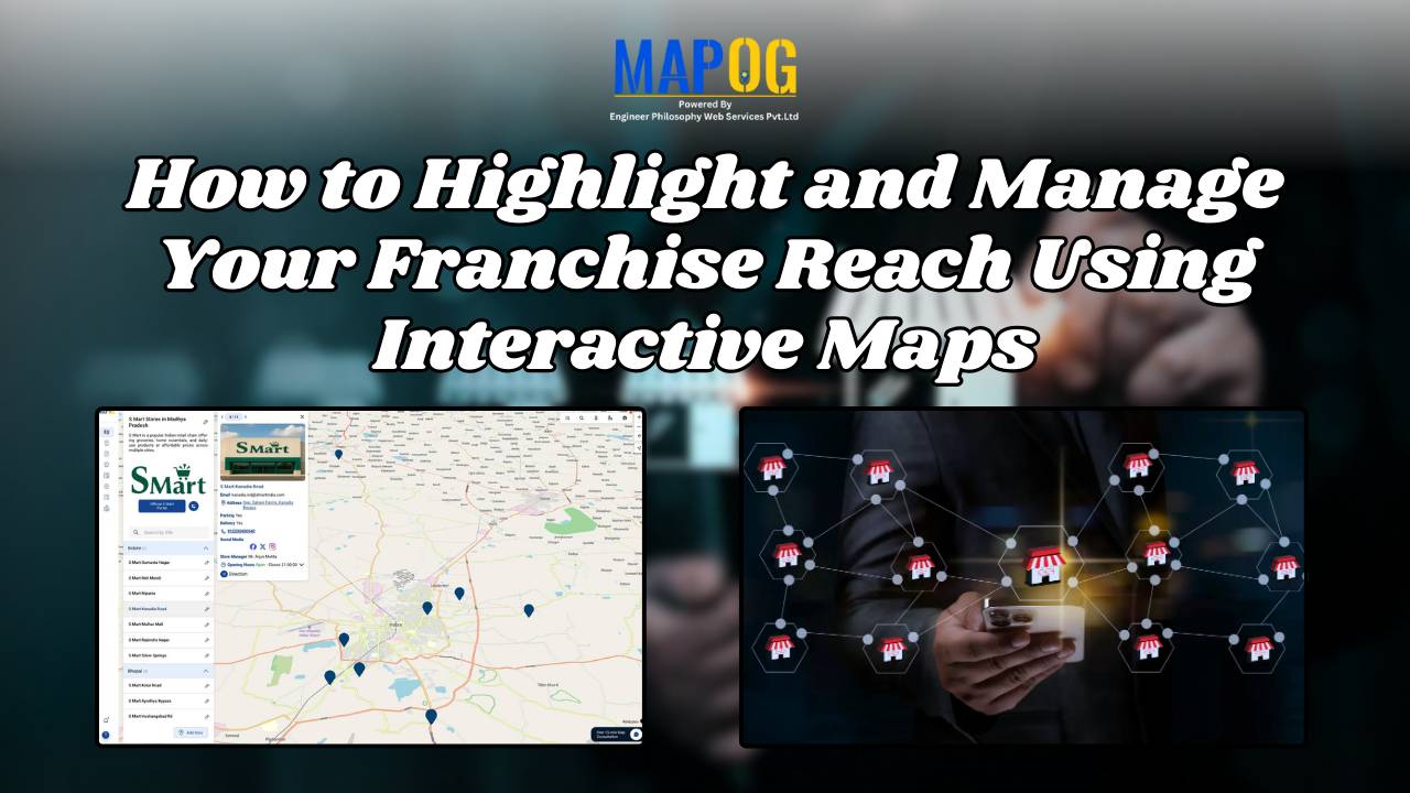
Want to show franchise stores on a map and manage them easily? If you run a franchise spread across India, you already know how tough it gets to keep track of store locations, managers, services, and updates. That’s where interactive maps step in—not just as a tool to display your presence, but as a powerful … Read more

Map River and Road Intersections for Environmental Analysis

Create a Map of River and Road Intersections for Environmental Analysis

To begin with, understanding the intersection between rivers and road networks is essential for effective environmental planning and risk management. In particular, these road and river intersections can indicate areas vulnerable to flooding, erosion, or pollution. By doing so, urban planners, environmental analysts, and disaster response teams to make data-driven decisions that improve sustainability and … Read more

The Ultimate Guide to Uploading GIS Data Formats (CSV, KML, Shapefile)

Uploading GIS data is the crucial first step in any spatial analysis workflow. Whether for urban planning, environment, infrastructure, or disaster response, clean and structured data ensures accuracy in representing real-world features and relationships. Using correct formats allows mapping software to interpret boundaries and attributes effectively. MAPOG, a leading cloud-based GIS platform, supports various formats … Read more

Story Map Online Free: How to Create One Without GIS Skills

Learn how to create a story map online free using MAPOG—no GIS skills needed, just intuitive storytelling with images, text, and location. Whether you’re showcasing heritage sites, tracking environmental changes, or exploring social patterns, Story Maps convert static information into engaging experiences. For example, you can plan travel routes with story maps or explore the … Read more

Creating a Story Map of Monuments and Share or Embed It Anywhere

A Story Map of Monuments using MAPOG transforms how we explore cultural heritage. Instead of static lists, it offers a visual journey through India’s architectural legacy—organized by district or state. Whether you’re promoting tourism, documenting history, or supporting heritage conservation, a story Map of Monuments using MAPOG brings depth and context that traditional formats can’t … Read more

Ambulance Accessibility & Response Time Analysis

In life-threatening emergencies, every second counts. Consequently, ambulances must reach patients quickly. However, in many cities, emergency response times are slowed down by poor planning, traffic congestion, or lack of infrastructure. This is precisely where Geographic Information Systems (GIS) step in. Platforms like MAPOG are transforming how cities visualize Ambulance Accessibility & Response all without … Read more

How to create Major Historical Battles and War Sites Map

History isn’t just about events it’s about where they happened. From ancient conquests to world wars, every major battle unfolded on a map. In this guide, we’ll walk through how to build a stunning “Historical Battles and War Sites” story map using MAPOG. you can transform history into an interactive journey by creating a “Major … Read more

Mapping Crime Hotspots

Mapping Crime Hotspots Using Grids and Heat Bubble Tools

Mapping crime hotspots is a critical approach in understanding and preventing urban crime. By visualizing clusters of criminal activity, law enforcement and urban planners can make informed, data-driven decisions. One modern way to do this effectively is through interactive mapping platforms that offer grid-based analysis and visual heat bubble styles—such as MAPOG’s intuitive tools. This … Read more

Mapping Healthcare Deserts in India

Identifying Areas with Limited Access to Doctors and Medical Facilities Mapping healthcare deserts in India helps expose one of the biggest barriers to healthcare access: geography. Although access to healthcare is a fundamental right, how soon someone can reach a hospital often depends more on location than need. Healthcare desert mapping—regions where timely access to … Read more

How to Upload and Visualize CSV Data on a Map

How to Upload and Visualize CSV Data on a Map

In today’s digital world, knowing how to upload and visualize CSV data on a map is essential for urban planning, environmental monitoring, and compelling visual storytelling. Moreover, with the growing importance of data-driven storytelling and location-based insights, MAPOG provides an intuitive platform to transform your spreadsheet data into interactive maps. As a result, users can … Read more