Forest Conservation

How to Create a Safari Itinerary Map for Your Trip

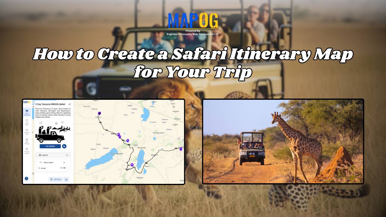
Create & Share a Safari Itinerary Map for Your Trip

If you’re planning a safari, visualizing your journey on a map can turn your travel plans into an interactive and shareable experience. From visiting to all safari locations and back, mapping your safari helps you track routes, highlight wildlife hotspots, and organize activities. Using MAPOG, you can create a rich safari itinerary map that’s engaging, … Read more

How Mapping Community Water, Energy and Environmental Projects Can Drive Sustainable Development

How Interactive Maps Drive Community Water, Energy, and Environmental Projects

Sustainable development cannot be achieved without community-driven initiatives that focus on water, energy, and environmental needs. Moreover, Mapping Community Water, energy, and environmental projects offers a practical way to visualise data, highlight impact, and ensure transparency. In fact, by creating interactive maps, decision-makers, NGOs, and local communities can track project status, monitor beneficiaries, and share … Read more

GIS for Deforestation Tracking

How to Use GIS for Deforestation Tracking and Forest Loss Analysis

Using GIS for deforestation tracking has become a powerful approach in environmental research. Every year, massive tree cover disappears. Therefore, tracking these changes accurately becomes essential for timely forest conservation efforts. GIS helps researchers and conservationists visualize forest loss clearly and over time. Consequently, it enables faster and smarter decision-making. One of the simplest tools … Read more