District-Level Irrigation Planning with GIS: Tools, Techniques, and Real-Life Use Cases
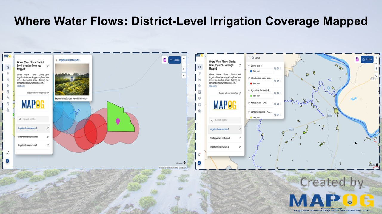
Visualization of water access and district-level irrigation coverage using GIS
Visualization of water access and district-level irrigation coverage using GIS
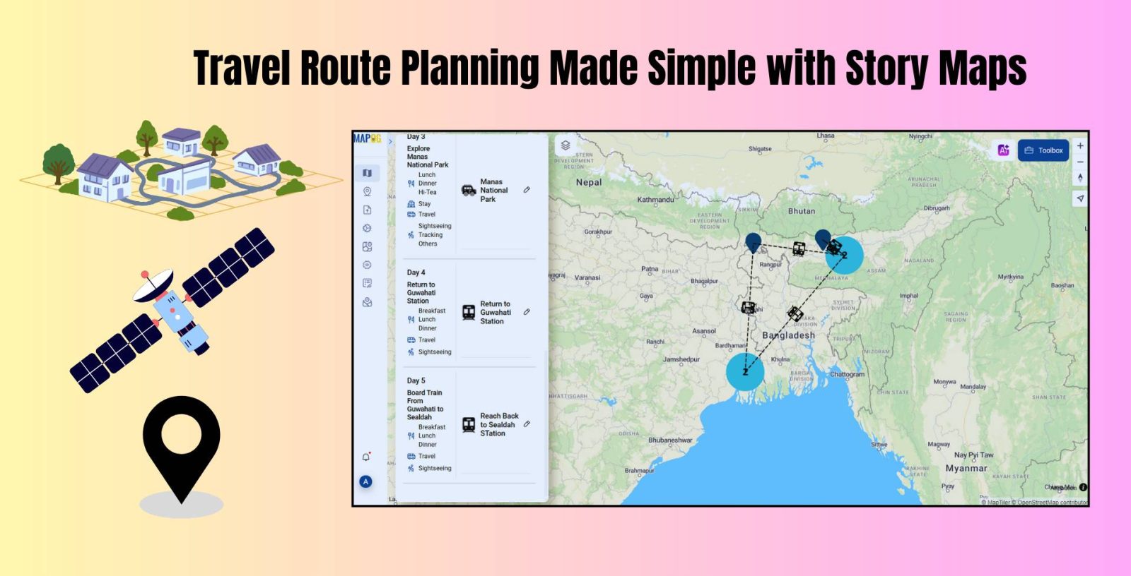
Travel Route Planning Made Simple with Story Maps, Story maps are a creative way to integrate storytelling and geographic data, enabling users to see events, experiences, and manage plans on an interactive map combine narrative text, multimedia, and maps to produce a dynamic, captivating format that improves comprehension and sharing. Users can view events, experiences, … Read more
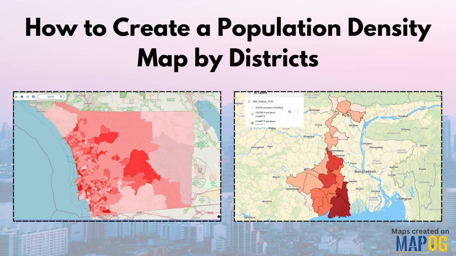
Visualizing population density map by districts helps uncover patterns in urban growth, resource distribution, and planning needs. Whether you’re working on development plans, healthcare access, or disaster preparedness, mapping this data by district brings clarity that raw tables cannot. Thanks to MAPOG, users can create, style, and share interactive maps easily—no advanced GIS degree needed. … Read more
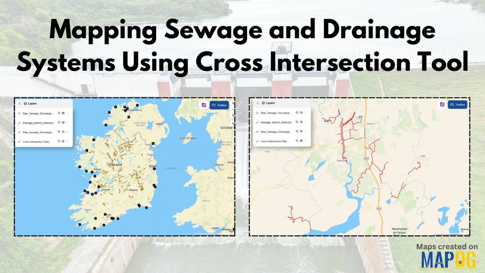
Nowadays, mapping sewage and drainage systems has become a smarter and more data-driven approach to urban planning and environmental safety. In particular, mapping such infrastructures helps identify pollution risks, optimise maintenance, and prevent disasters. One powerful way to achieve this is through the use of spatial tools like buffer zones and cross-intersection methods. By doing … Read more
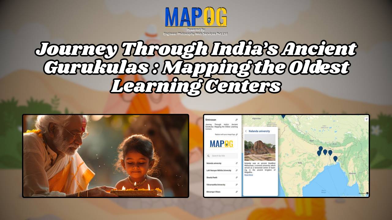
India has long been recognized as a cradle of knowledge and wisdom. Indeed, the foundations of education were laid centuries ago through a unique and immersive learning system known as the ashram. Rooted in the ancient Vedic tradition, ashrams were not merely centers of education; rather, they served as spiritual havens where students lived alongside … Read more
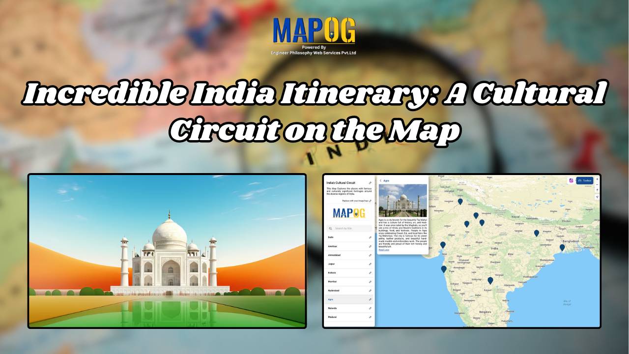
India is a land of diverse cultures, rich heritage, and vibrant traditions. When you think of exploring the true essence of India, it’s not just about ticking off touristy landmarks; it’s about diving deep into the heart of its culture. In this guide, we’ll show you how to create an cultural circuit on map, connecting … Read more
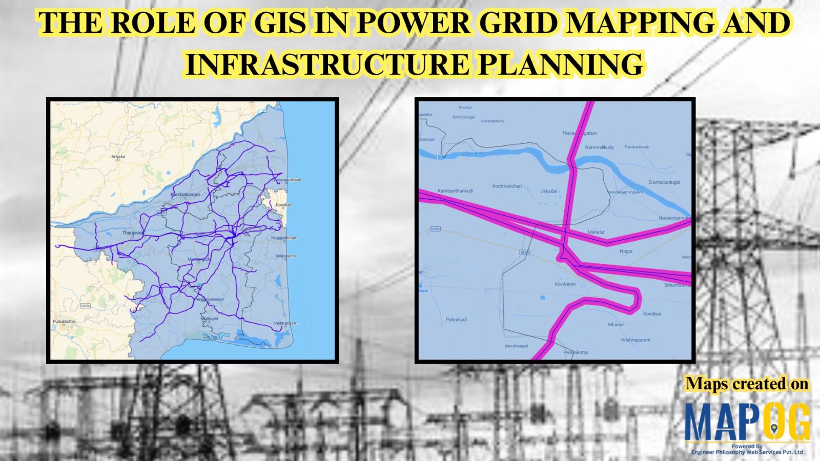
Geographic Information Systems (GIS) are revolutionizing power grid mapping and infrastructure planning. By linking geospatial intelligence with electrical grid data, GIS enables utility companies and energy planners to visualize, assess, and optimize power distribution networks. Furthermore, it supports everything from the planning of substations and transmission lines to the ongoing monitoring of grid performance. As … Read more
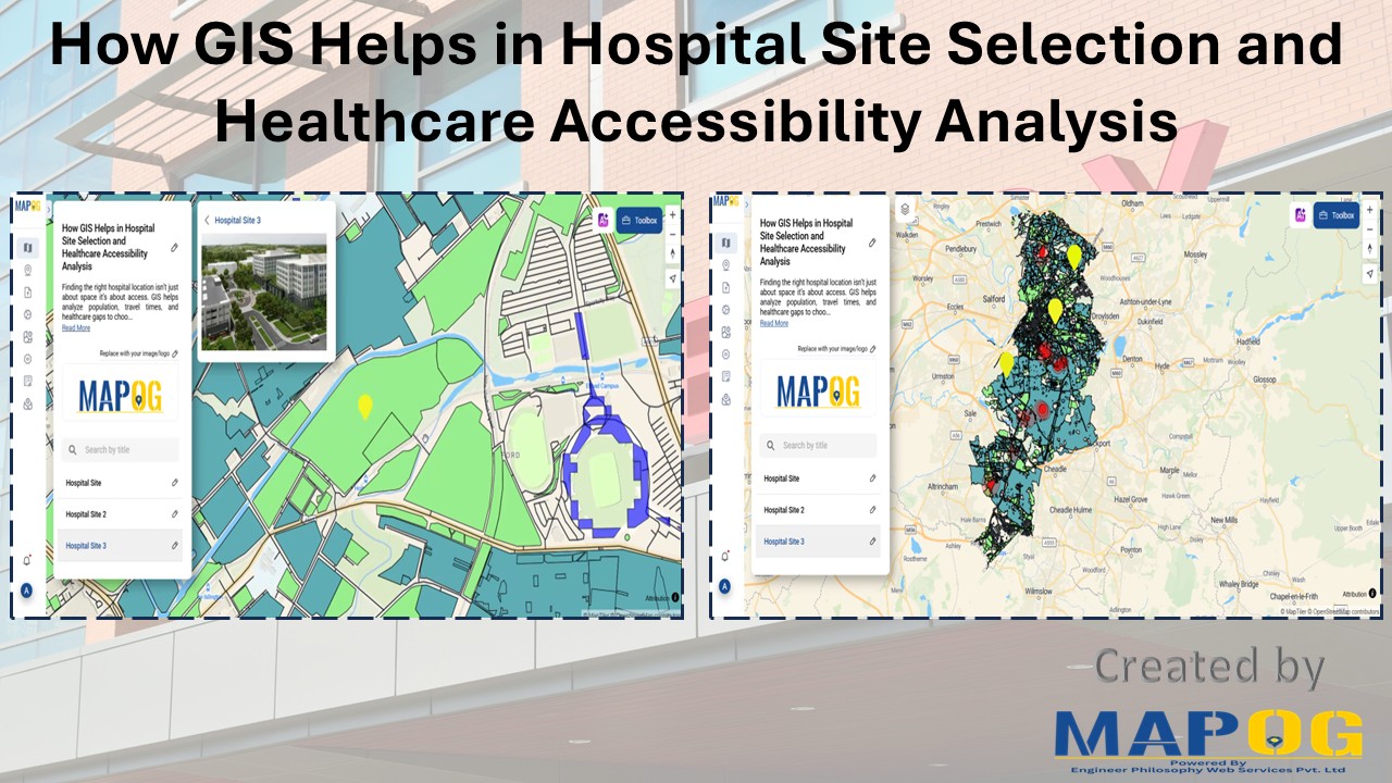
In our fast-evolving cities and growing rural communities, access to healthcare is a basic need which still remains unevenly distributed. The healthcare revolution arises from Geographic information Systems (GIS) which enables complex data to be converted into life-saving decisions such as hospital site selection and healthcare Through integration of several layers, GIS produces an accurate … Read more
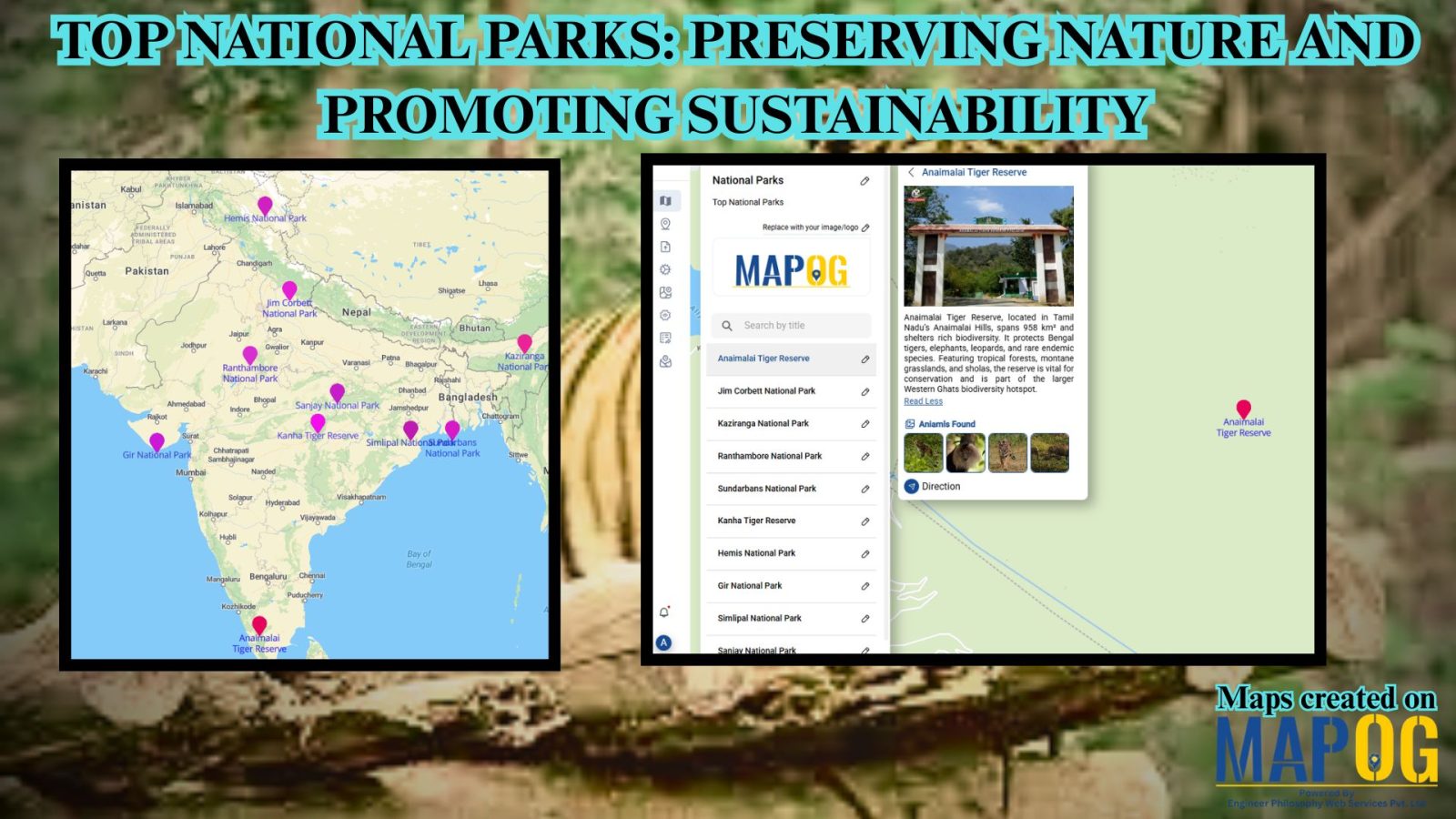
Mapping Top National Parks play a vital role in conserving biodiversity and protecting natural landscapes while offering recreational opportunities that connect people with the environment. Additionally, these protected areas serve as sanctuaries for endangered species, geological wonders, and cultural heritage. From towering mountain ranges to vast desert expanses, national parks also support sustainable tourism, scientific … Read more
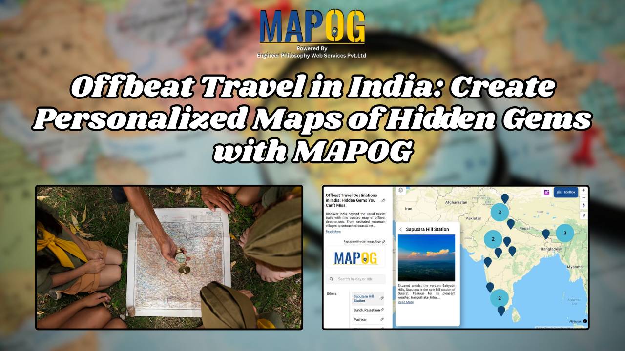
Nowadays, when traveling is about more than just checking places off a list, offbeat destinations in India offer a deeper and more meaningful experience for the curious traveler. With its vast cultural heritage and varied topography, India is home to countless hidden gems untouched by mass tourism. So, discovering these offbeat destinations in India isn’t … Read more