Juhi

Mapping ancient universities

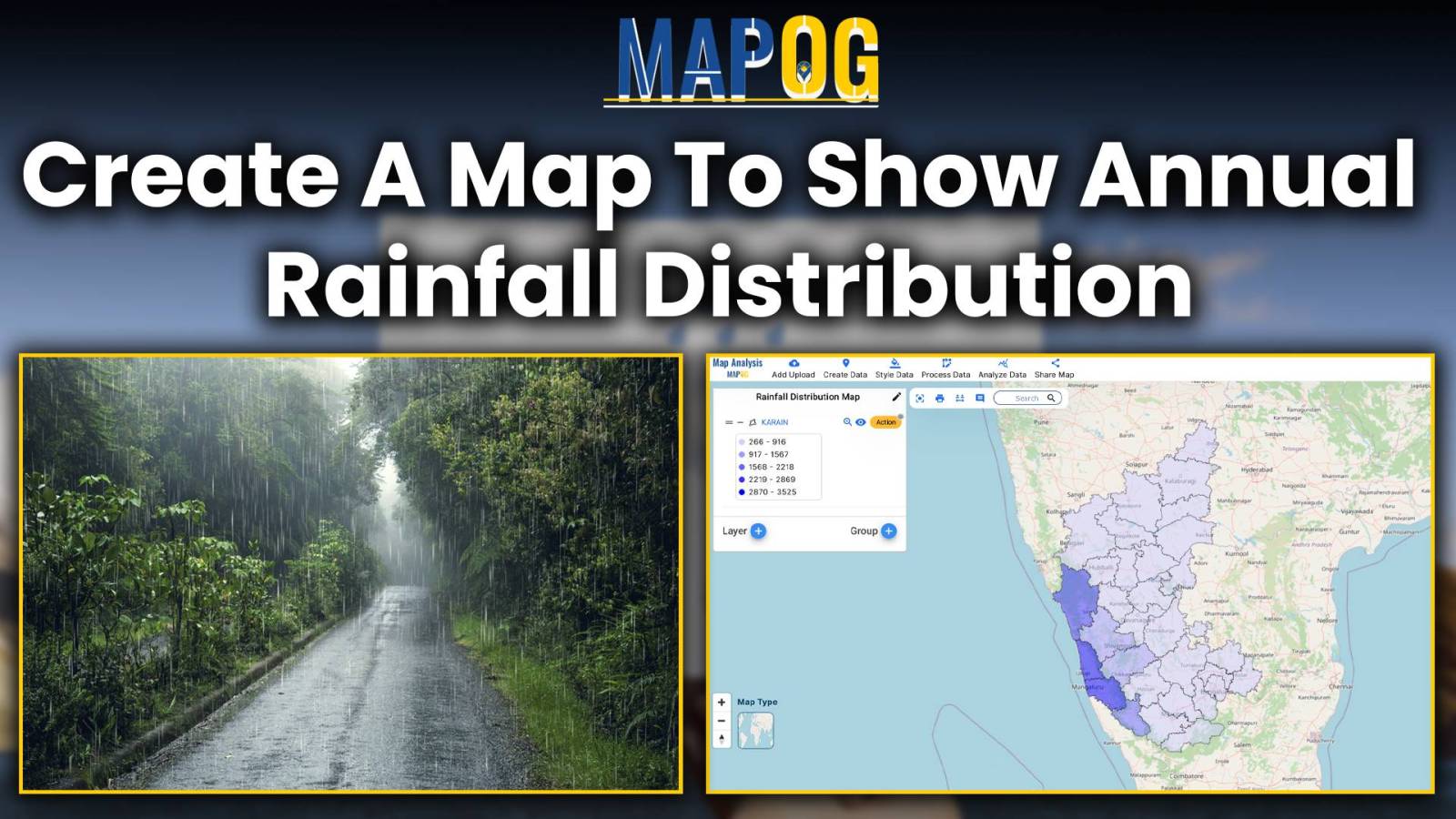
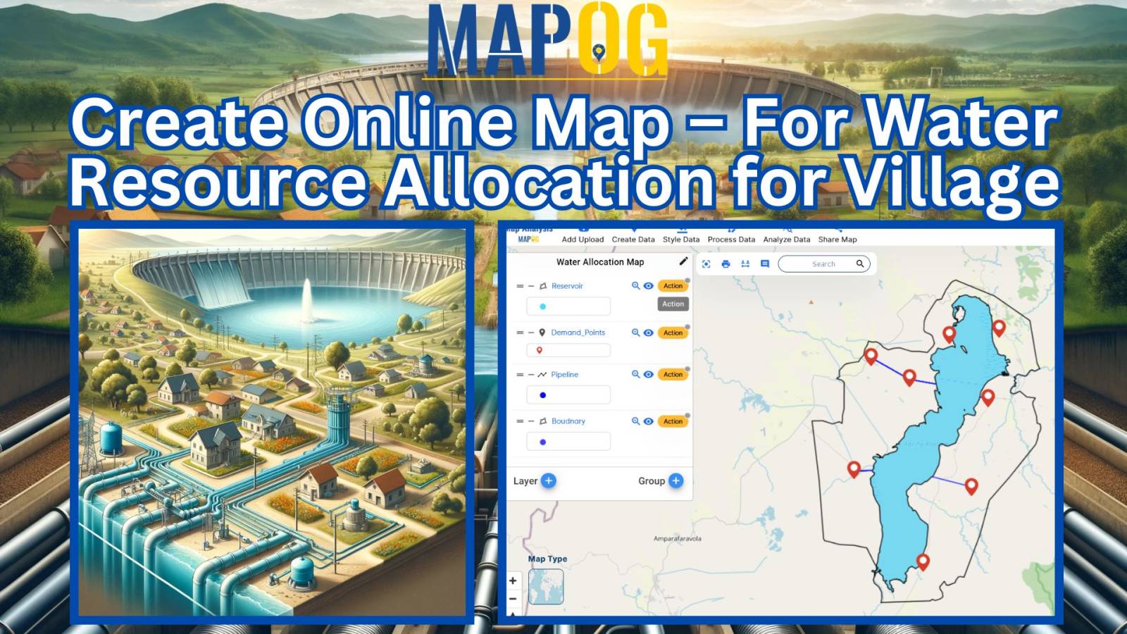
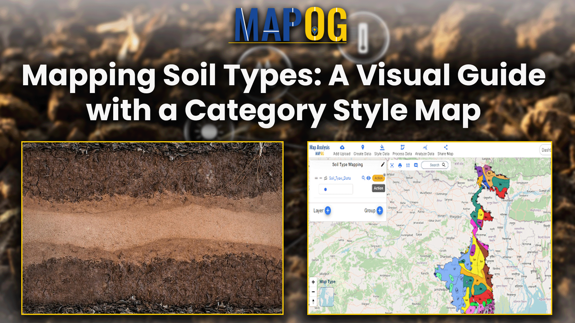
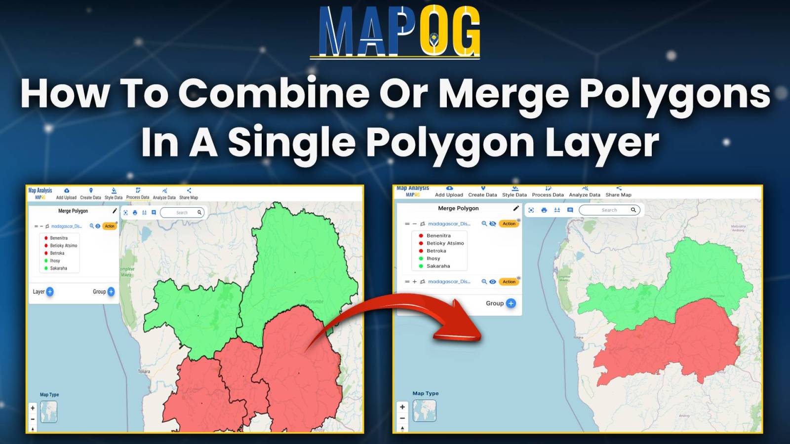
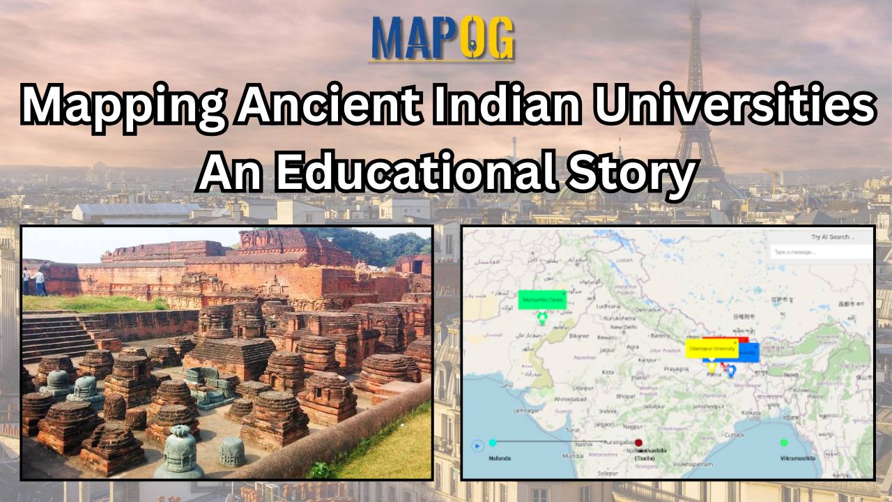
Mapping Ancient Indian Universities: Creating a story with description on Map

Delve into the rich legacy of ancient Indian universities with MAPOG’s Map Story feature. Through dynamic mapping technology, we uncover the profound significance of institutions like Nalanda and Taxila.  Join us on a captivating journey to explore the vibrant history and enduring impact of these centers of knowledge. KEY CONCEPTS Our goal is to display … Read more

Mapping ground water with heat maps

Mapping Groundwater Concentration with Heat Maps

Learn how to map groundwater concentrations with MAPOG MAP ANALYSIS. In this article, we explore the transformative power of heat maps in mapping groundwater concentration.  Discover how this innovative approach revolutionizes our understanding of groundwater quality and aids in the protection of vital water resources. KEY CONCEPTS Our goal is to create a simple and … Read more

create a map to show annual rainfall distribution

Create a Map to Show Annual Rainfall Distribution

Embark on a journey through the intricate world of mapping annual rainfall distribution, where each droplet paints a picture of climate variation and geographic uniqueness. Leveraging MAPOG’s Map Analysis tools, we unravel the complexities of precipitation patterns with precision and clarity. Join us as we navigate the art and science of visualizing rainfall distribution, offering … Read more

Creating Water Resource Allocation Maps for Villages

Create online Map – For Water Resource Allocation for Village

Water resource allocation maps offer a crucial solution to the challenge of uneven water distribution. This article explores their pivotal role in promoting fairness, sustainability, and resilience in communities. With insights from MAPOG Map Analysis, we unveil how these maps are transforming the water management landscape. KEY CONCEPTS Our goal is to create a map … Read more

Geocode Address From Excel

Upload Excel File to Create Map – Geocode Address From Excel

Mapping locations through addresses using the Geocoder tool is a game-changer in the field of Geographic Information Systems (GIS).  MAPOG Map Analysis leverages this technology to convert addresses into precise geographic coordinates, enhancing accuracy in urban planning, navigation, and emergency services.  Discover how MAPOG’s powerful Geocoder tool can transform your mapping projects. KEY CONCEPTS Our … Read more

How to combine or merge polygons in a single polygon layer

How to combine or merge polygons in a single polygon layer

Unlock the power of seamless spatial data management with MAPOG Map Analysis. In this article, discover how the Merge Polygon tool revolutionizes the process of combining polygons into a single layer. Streamline your map analysis workflow and unleash the full potential of your spatial data with MAPOG KEY CONCEPTS Our goal is to merge the … Read more

mapping heat index

Mapping Air Quality Index: Air Pollution Monitoring

In this article, we examine the utilization of MAP OG’s MAP ANALYSIS techniques for visualizing Air Quality Index (AQI) data and Mapping Air Quality Index. Discover how GIS tools offer insights into pollution patterns, aiding informed decision-making for environmental health. Through sophisticated mapping techniques, we uncover nuanced insights into air pollution distribution. Explore how these … Read more

Grid Mapping for Accurate Spatial Analysis: Divide and Conquer with GRID Map Tool

Grid Mapping for Accurate Spatial Analysis: Divide and Conquer with GRID Map Tool

Navigating the complexities of industrial land use requires a nuanced approach. MAPOG Map Analysis, with its GRID tool, revolutionizes this process, offering a streamlined solution for optimized zoning and development. In this article, we explore how MAPOG empowers decision-makers to balance economic growth with environmental sustainability in industrial areas, setting the stage for smarter urban … Read more