EpNisha

How to Create Heat Maps for Forest Cover Analysis Using GIS

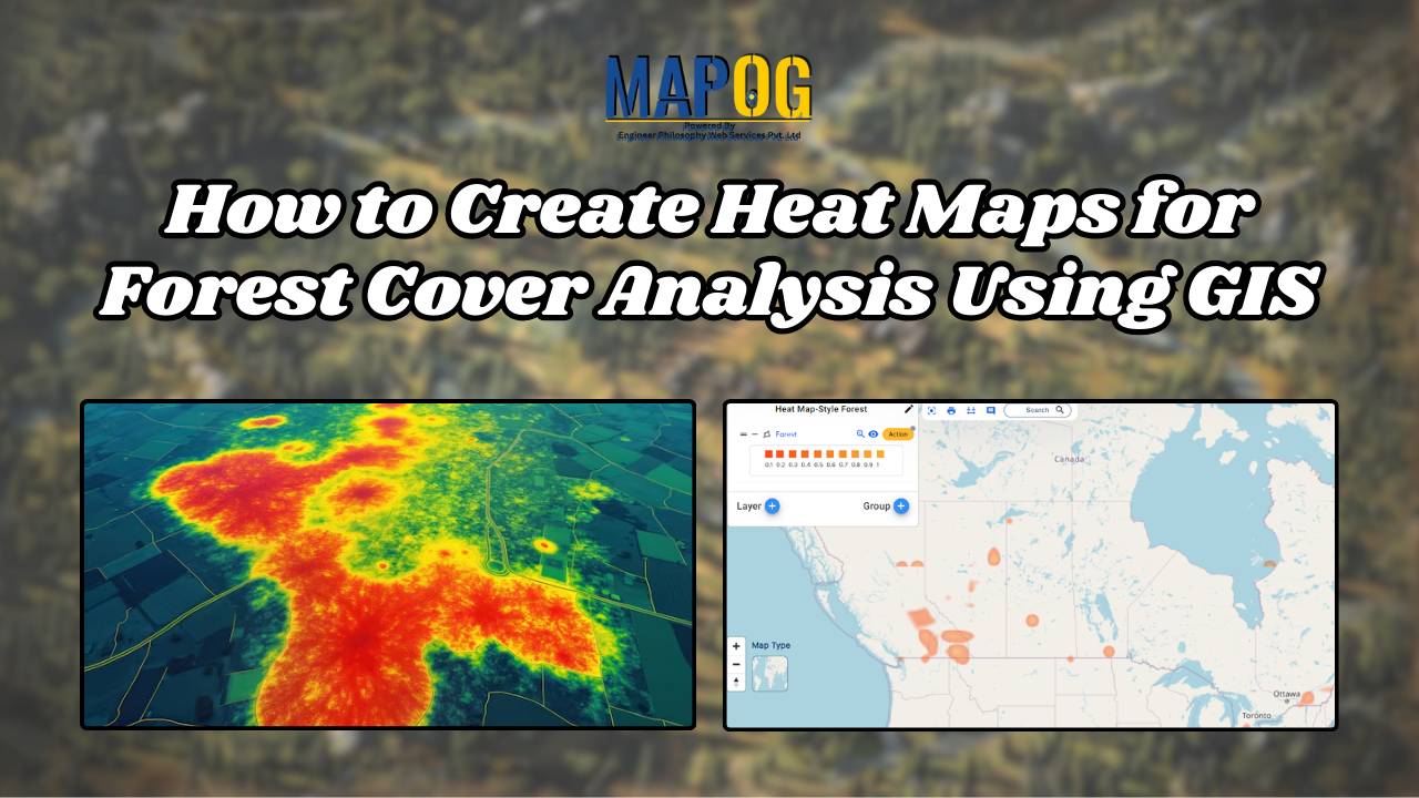
Forest Cover Maps a fundamental tool within GIS, serves as a potent visualization method. It utilizes colors to represent the density or intensity of data across a geographic area, offering valuable insights into various phenomena. Key Concept to Creating Forest Cover Maps: Using Heat Map Style Heat maps are super helpful when we want to … Read more

A Beginner’s Guide to Mapping GIS Data Online

With the advancements in today’s digital world, GIS data is a necessary element for any professional or enthusiast in urban planning, environmental monitoring, or simply the creation of a visual story. The integration of GIS data with an online map is, thus, an indispensable skill. In the following pages, we shall describe how to incorporate … Read more

How to Create Energy Maps for Unpowered Settlements Step-by-Step Guide to Identifying Energy Gaps

How to Create Energy Maps for Unpowered Settlements: Step-by-Step Guide to Identifying Energy Gaps

In an era where energy plays a pivotal role in shaping the economic and social landscapes, equitable distribution of power is paramount. “Creating Energy Maps: Unpowered Settlements”, This article delves into the realm of MAPOG Map Analysis to identify potential energy deserts—areas where settlements lack the crucial infrastructure of energy power lines or towers. By … Read more