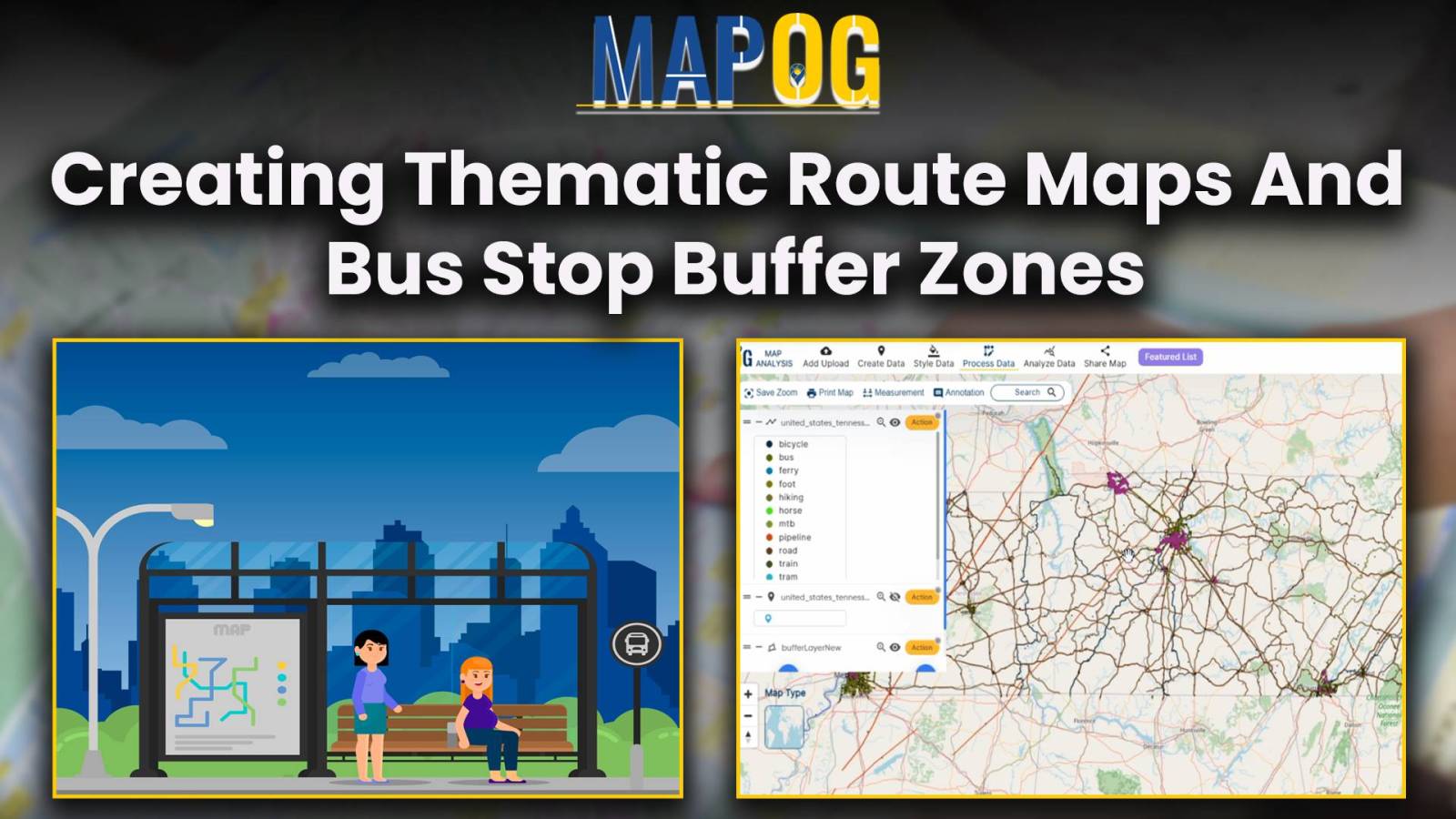
EpNisha

Create Maps to Improve Green Space Access with Isochrone Analysis

Create Maps to Improve Green Space Access with Isochrone Analysis

In “Green Space Accessibility using Isochrones in MAPOG, we utilize isochrone maps to evaluate and improve access to green spaces. This approach helps identify areas with limited accessibility and guides urban planning efforts to enhance community well-being. Key Concepts By using isochrones in MAPOG, we can analyze and optimize the accessibility of these green spaces, … Read more

Create Map for Worldwide Noise Pollution Analysis Using Heat Map

Create Map for Worldwide Noise Pollution Analysis Using Heat Map

Unveiling Noise Pollution: Worldwide Analysis In MAPOG, let us converge our means available and join in the task of using both technology and natural awareness, so that we may initiate a move towards the future of sustainability, using the language of noise, so let´s decipher it with accuracy and clarity. Through MAPOG, we can discover … Read more

Creating an Online Interactive Map for Residential Land Use and Buffer Analysis with Thematic Visualization

MAPOG uses geospatial intelligence to analyze Residential Land Use in Natural Reserves, enabling decision-makers to balance conservation and community needs. It helps identify sustainable development opportunities and informs regulatory frameworks, promoting responsible land management. Key Concepts to Identify Residential Land Use in Natural Reserves! The project’s output map visualizes residential land use in natural reserves, … Read more