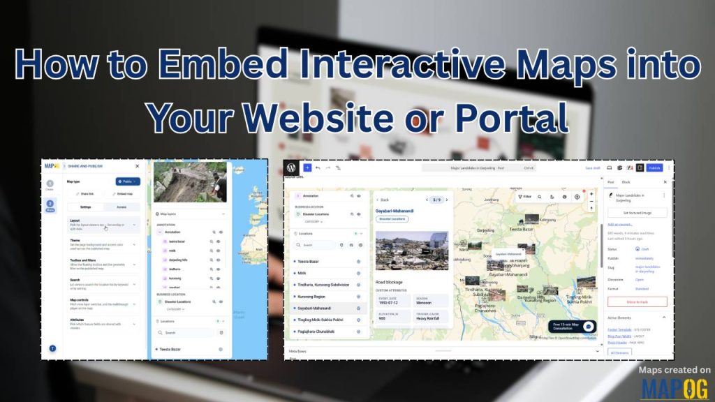
Are you still losing website visitors to boring, flat, static images of maps? Static screenshots frustrate users and cause high bounce rates because they block visitors from interacting with critical location context.
The solution is switching to a digital and interactive MAPOG map, which instantly helps you embed interactive maps. This solves this engagement problem by allowing your audience to zoom, filter, and dive into your location data seamlessly.
Key Concept of Embedding Maps into your Website or Portal
With MAPOG, style your map, switch it to public, and paste the generated HTML snippet directly into your site. This shift enables dynamic real-estate maps or travel itineraries that automatically update in real-time when your cloud data changes. Ditch the stone-age screenshots and give your users an interactive experience they can actually use!
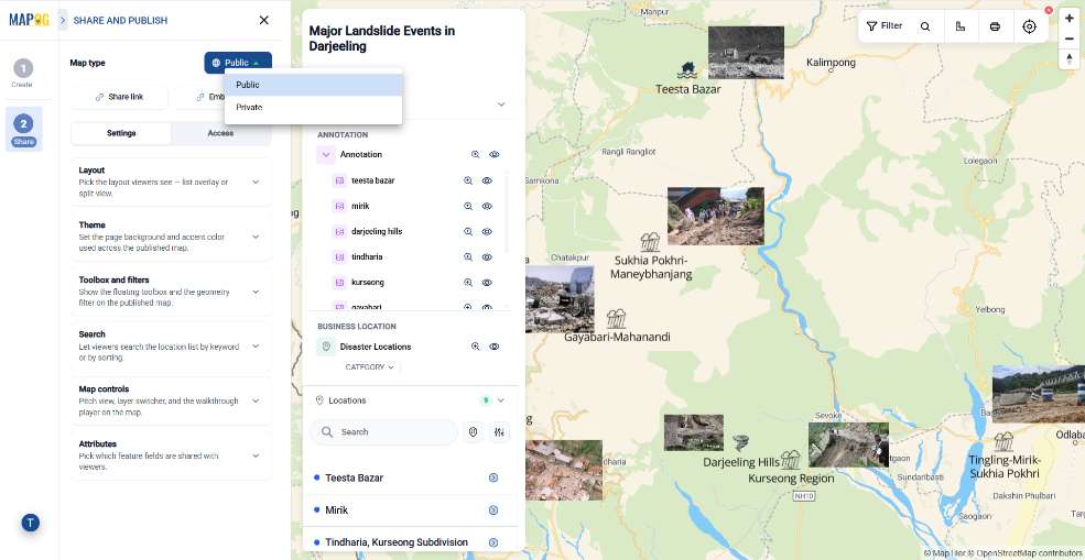
Step-by-Step Workflow of Embedding Maps
Step 1: Setting up the Sharing Option
To display a map on a website, open your map on MAPOG and navigate to the “Preview and Share” section.
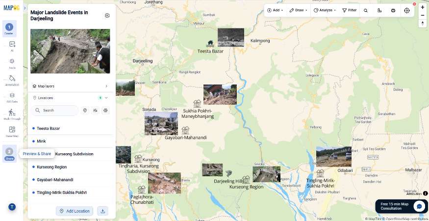
Before publishing, it is crucial to understand your sharing options. Setting your map to Public unlocks advanced embedding tools. Keeping it Private restricts access to your team collaborators.
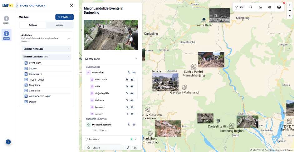
The Public access unlocks left-panel tools. Use them to customize the map’s looks and functions for your website.
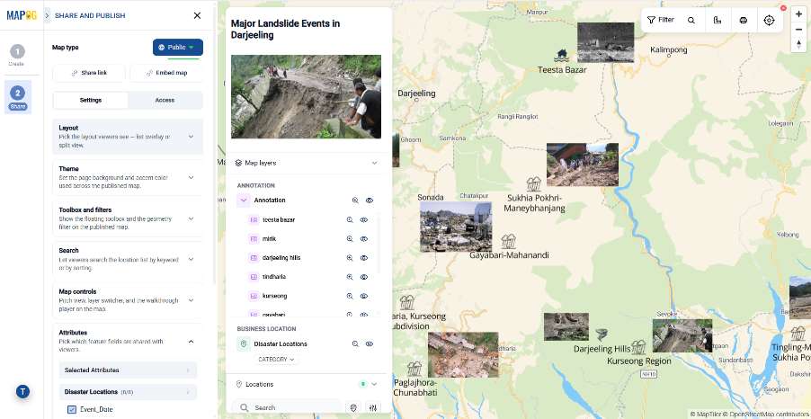
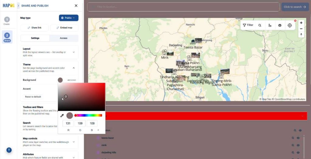
Choose a split or list layout, pick your brand colors, and control active user filters and map tools.
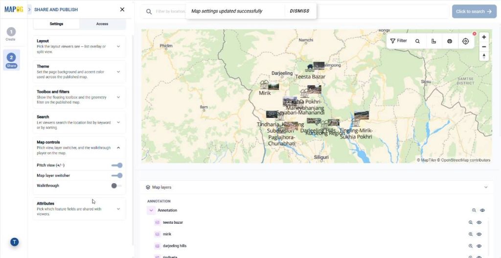
In addition, it includes explicitly toggling on or off the Pitch view, Map layer switcher, and Walkthrough tools to ensure your users have exactly the right amount of control over the interface.
Once your configurations are finalized, you must set the sharing option to Public.
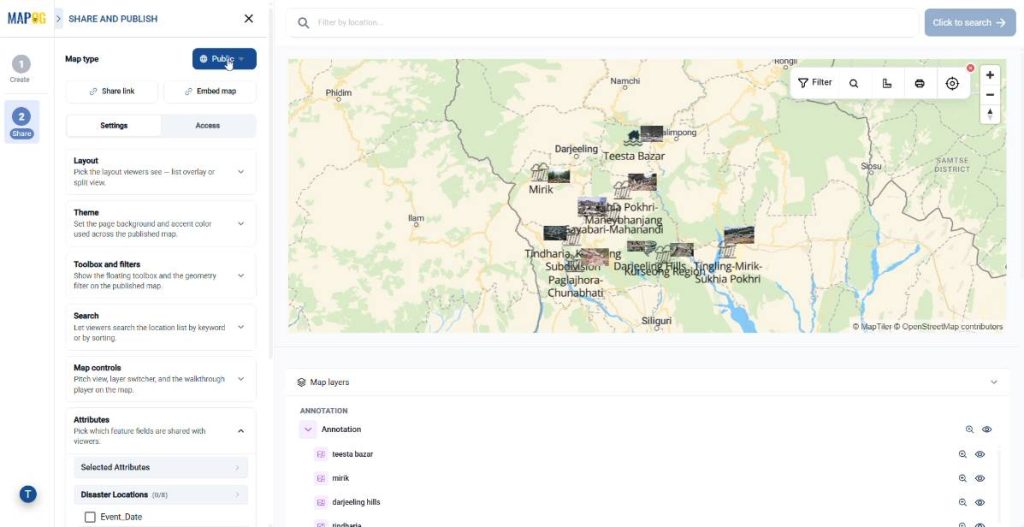
Consequently, saving the project as Public instantly unlocks the advanced sharing tools you need, specifically the share link and the embed link.
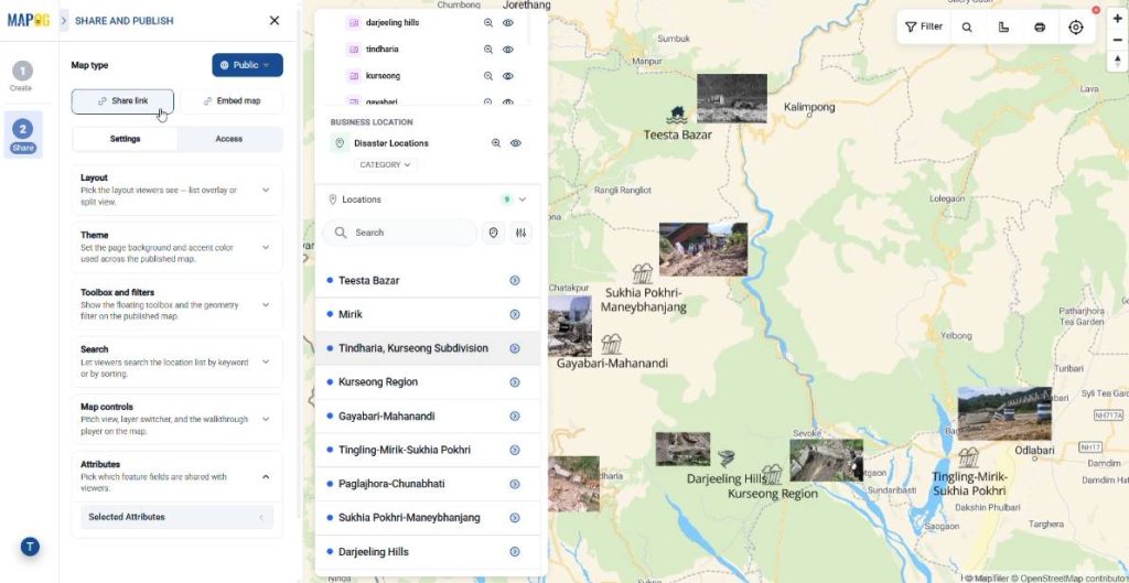
Step 2: Generating the MAPOG embed link
For embedding your map onto your website or portal, choose the embed map option from the sharing menu.
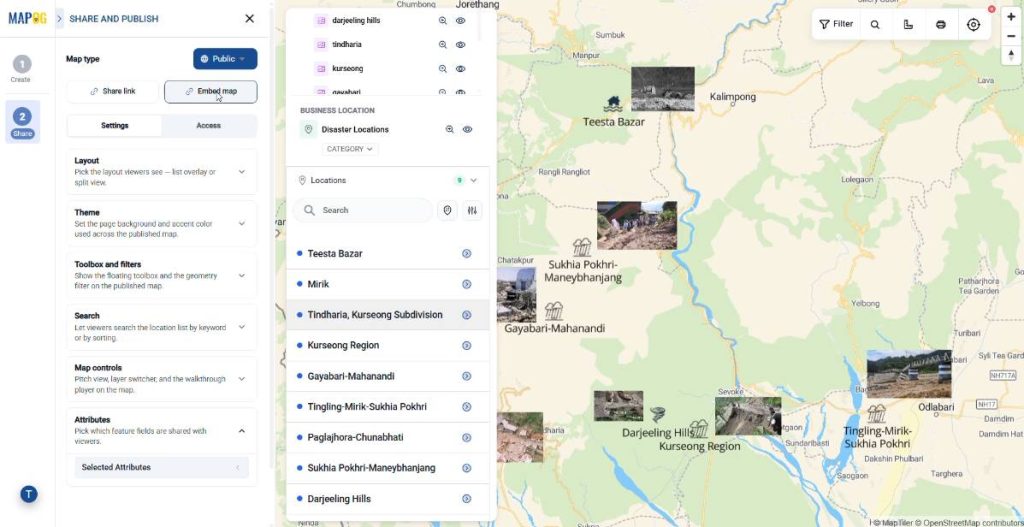
The MAPOG platform will automatically generate an HTML iframe snippet designed specifically for seamless web integration.
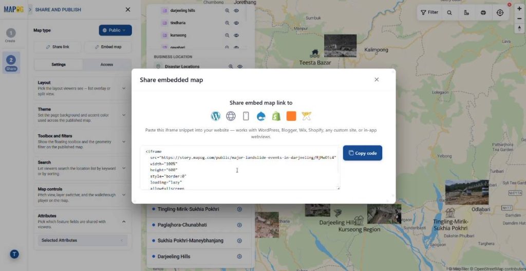
Accordingly, click the Copy button to save this block of code to your clipboard.
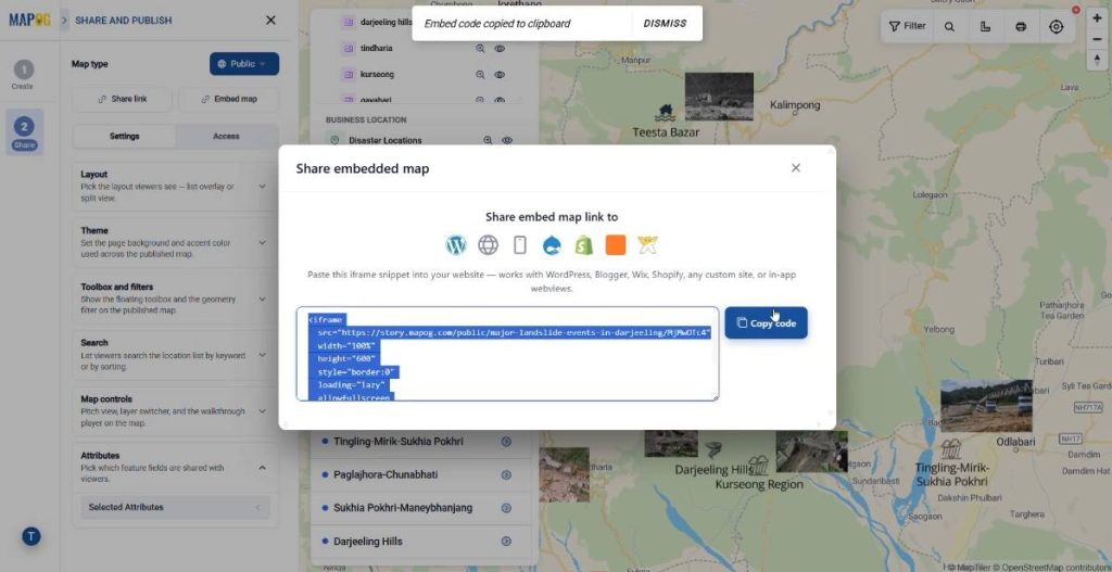
Step 3: Embedding the map link onto your website or portal
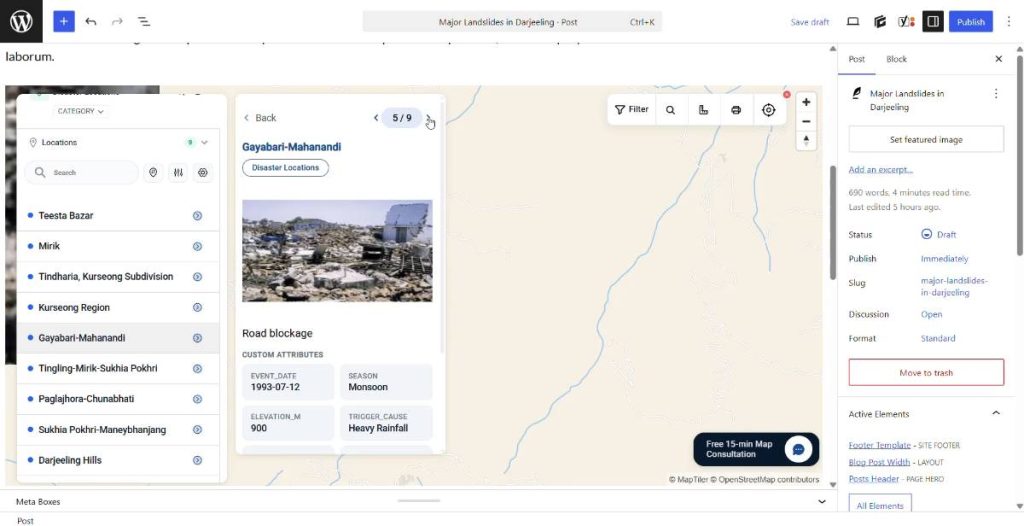
At this point, integrating the code into your content management system is a very straightforward process. For instance, if you are using Blogger, open the post editor,
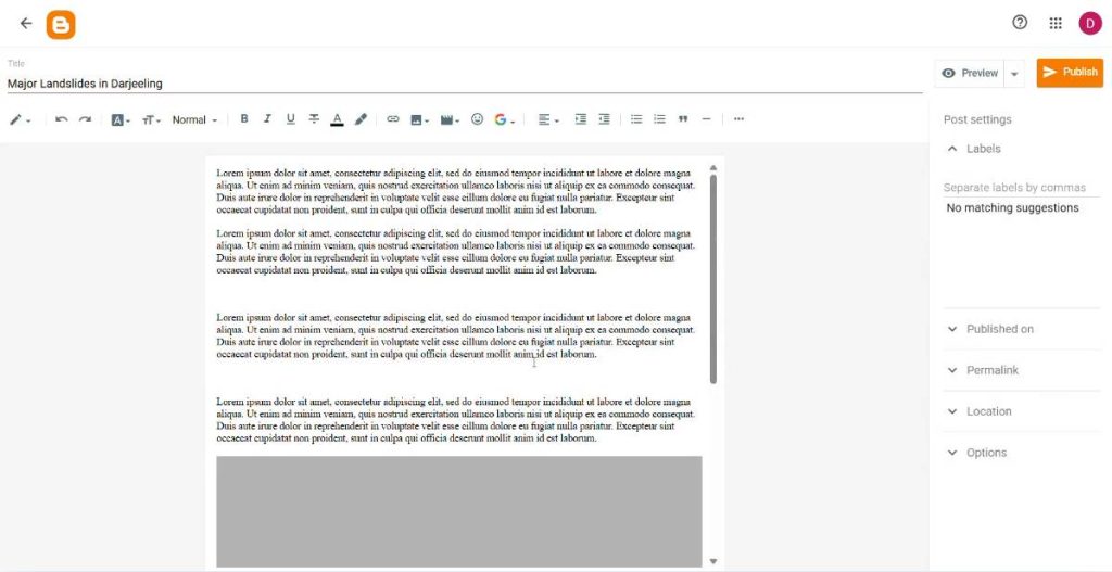
choose HTML view from the view toggle icon in the top-left corner,

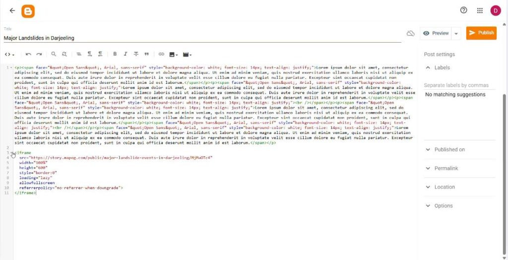
scroll to the exact section where the map should appear, and paste the MAPOG iframe code snippet.
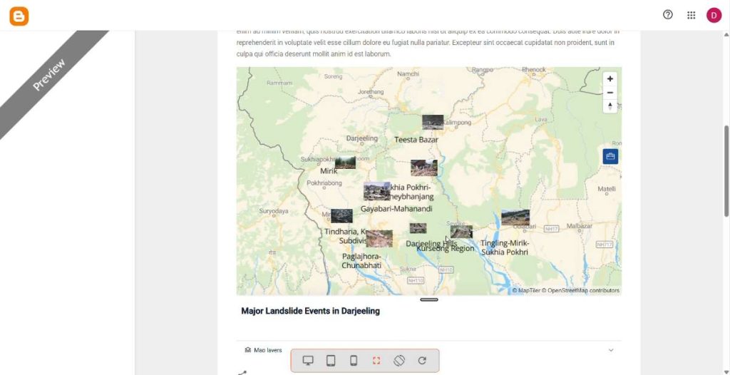
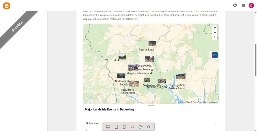
Finally, switch back to Compose view allows you to verify the embedded map placement before you click update.
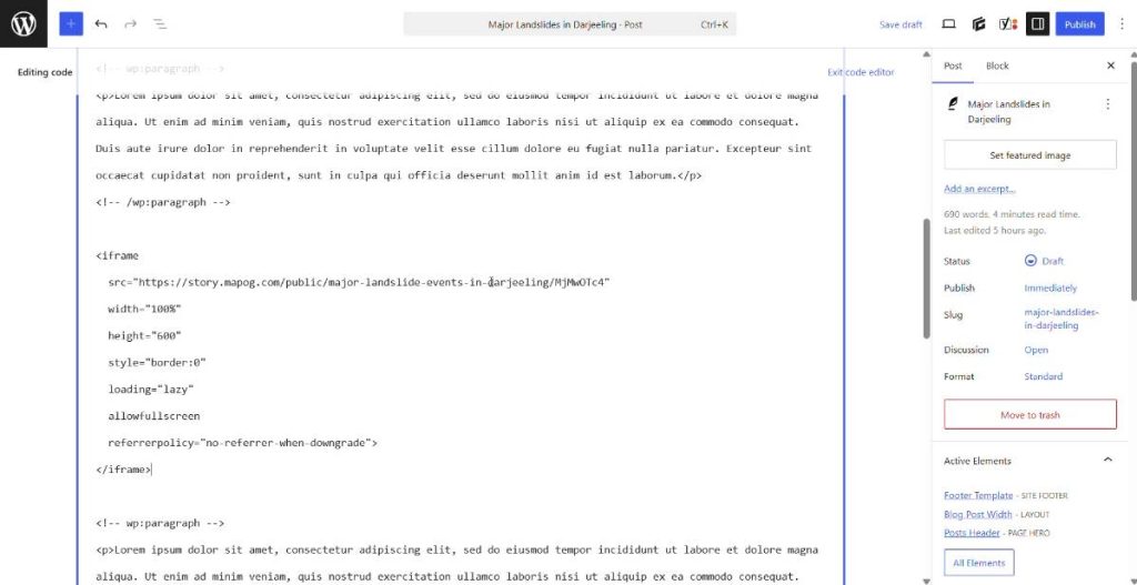
Moreover, you can add your MAPOG iframe embed code onto any other website, WordPress site, or custom portal by editing the underlying HTML code behind your visual composition and pasting the snippet in the desired container.
Applications across Sectors of Embedded Maps
The ability to embed such interactive and dynamic maps seamlessly has transformative applications across multiple sectors.
- Real Estate: Showcase property locations alongside interactive map markers for nearby amenities like schools, parks, and transit.
- Retail & Franchise: Power dynamic store locators allowing customers to find the nearest outlets, view hours, and see active promotions.
- Tourism & Hospitality: Build interactive itinerary maps and neighborhood guides highlighting local attractions, restaurants, and hotels.
- Public Administration: Foster civic engagement by sharing transparent community maps detailing infrastructure projects, zoning, and public resources.
Final Thoughts
The greatest advantage of this workflow on how to embed our interactive maps, is ultimately, the real-time synchronization. Any future data modifications or styling updates made within the MAPOG platform will automatically reflect on your embedded map, completely eliminating the tedious need to re-copy or re-upload HTML code every time your information changes. By leveraging these simple embedding tools, you can conversely transform complex spatial data into an engaging, accessible, and visually stunning asset that keeps your audience engaged and informed.