
Creating Cross-Country Routes by Distance and Bearing Angle
“Creating Cross-Country Routes by Distance and Bearing Angle” by MAPOG’s Route Compass simplifies cross-country route planning.
“Creating Cross-Country Routes by Distance and Bearing Angle” by MAPOG’s Route Compass simplifies cross-country route planning.
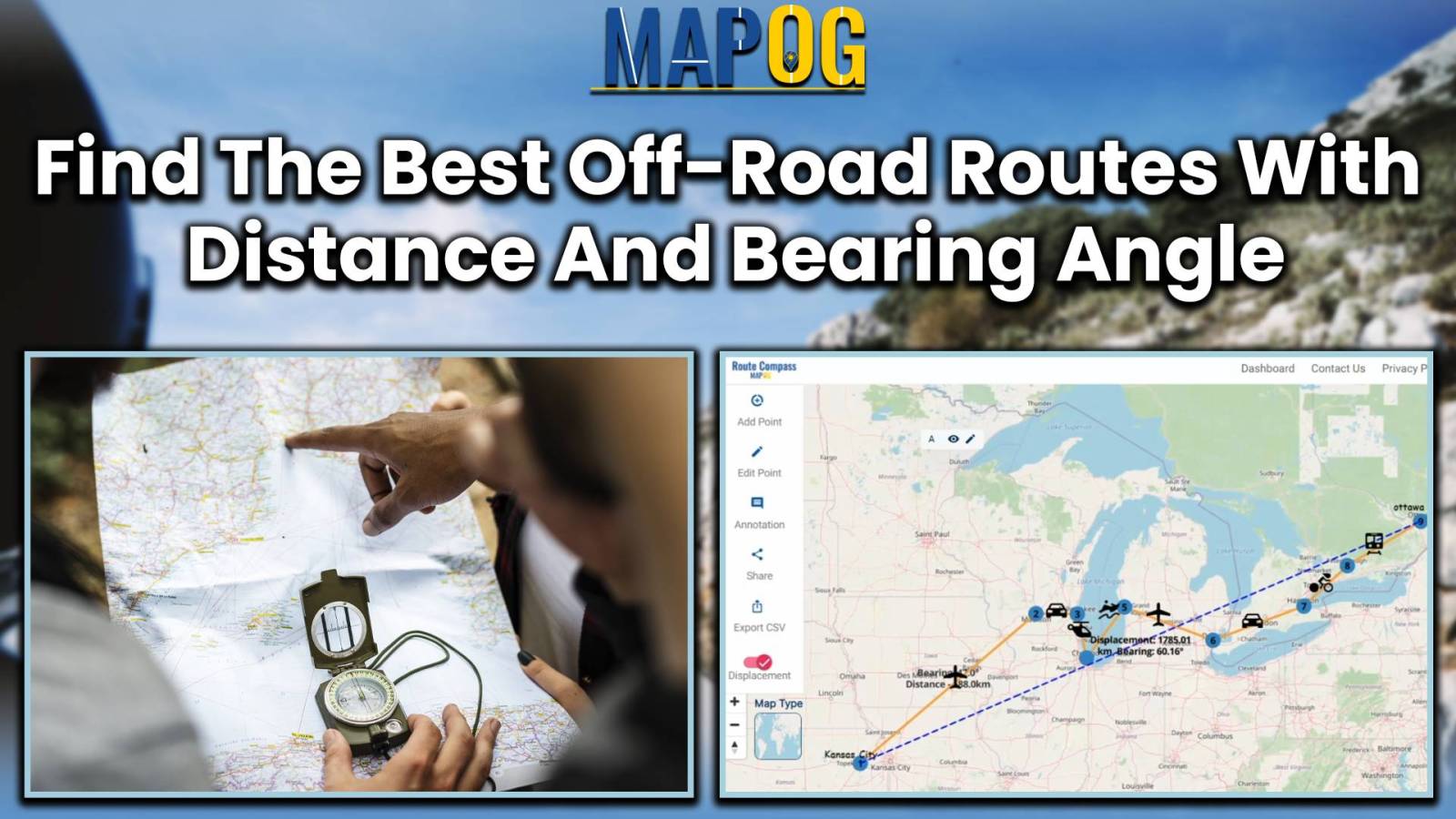
In the world of simple and smart journey planning, meet MAPOG Route Compass! It’s a tool for both engineers and adventure lovers, making route planning from Calgary to Vancouver Island. Key Concept: MAPOG Route Compass is like a friendly guide for your travels. It uses maps and numbers to make your journey easy and precise. … Read more
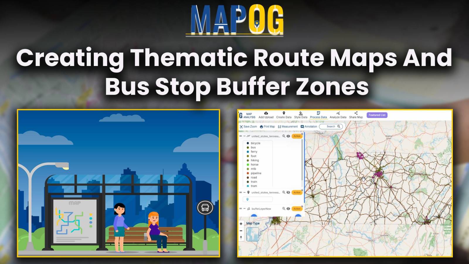
Explore the power of MAPOG in creating thematic route maps and bus stop buffer zones, offering key insights for urban planning, transportation optimization, real estate development, and emergency services.
Explore the intersection of cutting-edge technology and environmental responsibility in civil engineering. This article focuses on Environmental Impact Assessments (EIAs), emphasizing the role of the MAPOG Route Compass in precise spatial analysis. Discover how this innovative tool revolutionizes decision-making, shaping a future of conscientious engineering practices. Now we are on Google Play store also. Below … Read more
Unlock global trade with MAPOG’s Route Compass. Optimize world trade routes for strategic planning and seamless logistical operations
MAPOG Route Compass streamlines construction travel, offering precise route planning and efficient navigation for engineering professionals.
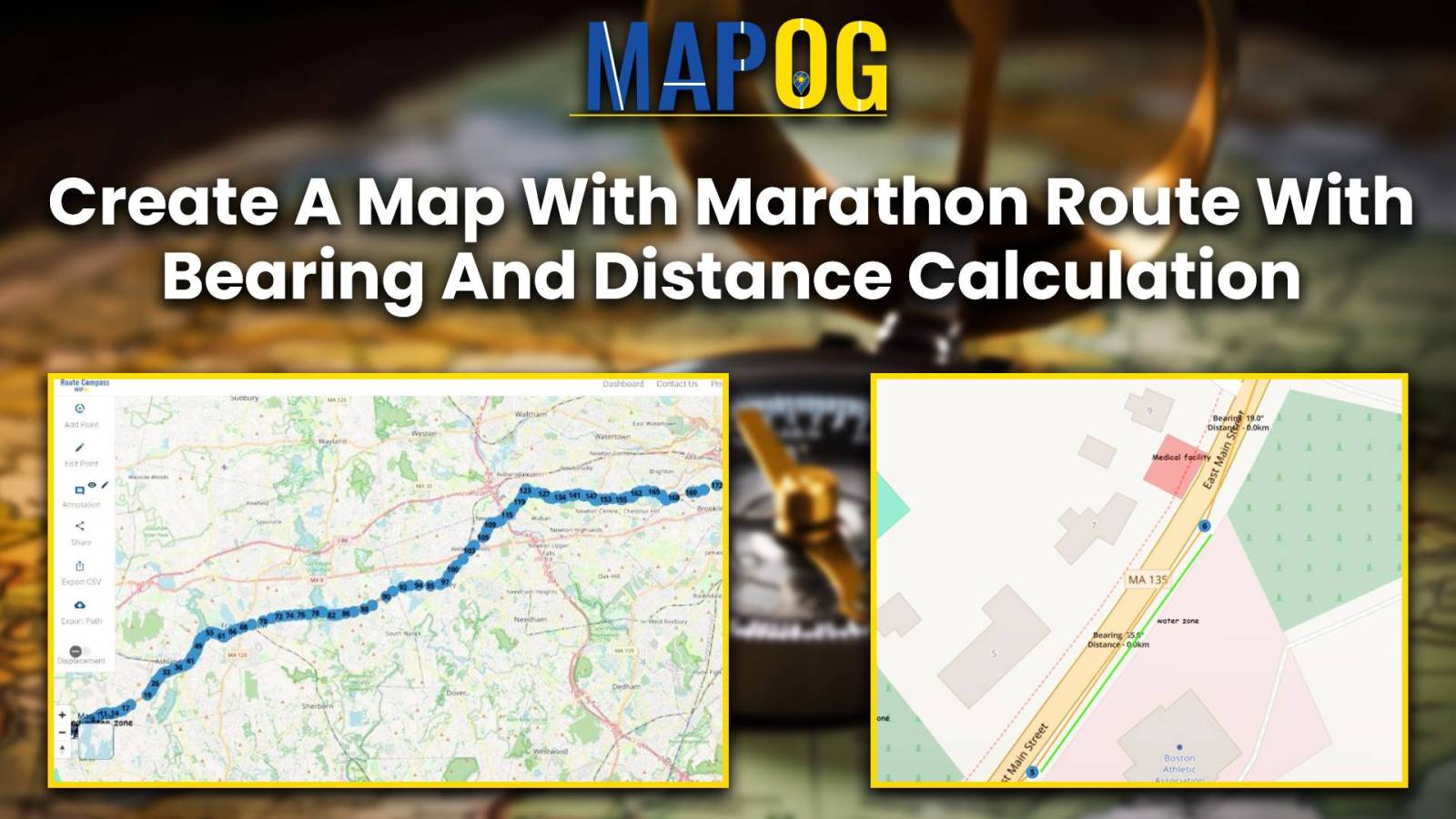
Craft your marathon route map with precision using Route Compass. Calculate bearing and distance for an optimized and strategic running.
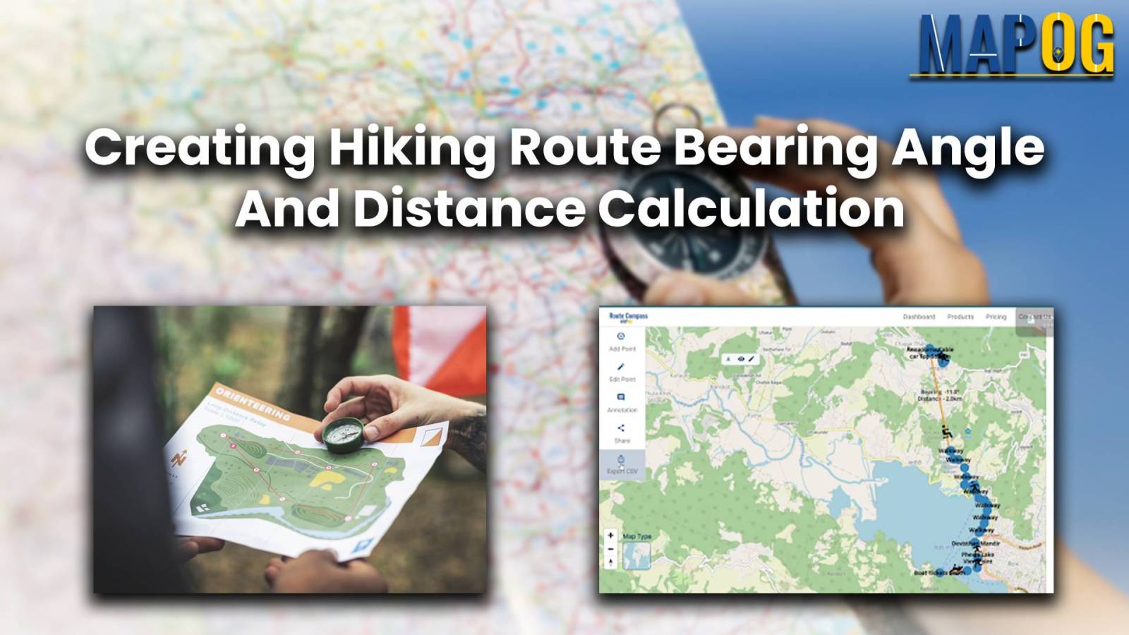
Take your hiking experience to new heights with MAPOG’s Route Compass Tool. Explore nature and navigate scenic trails effortlessly.
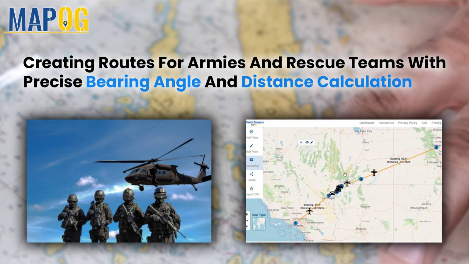
This analysis provides insights for armies and rescue teams, ensuring precise navigation through bearing angles and distance calculations.
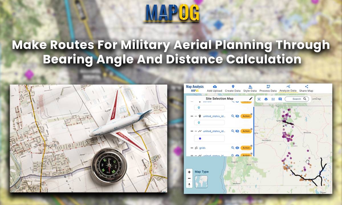
Introduction In this military aerial route planning analysis, we employ the MAPOG route compass to navigate the strategic journey from one Air Force Station to another Air Base. This tactical approach ensures efficient and effective planning for aerial movements in the specified region. Key Concept The key concept underlying this military aerial route planning analysis … Read more