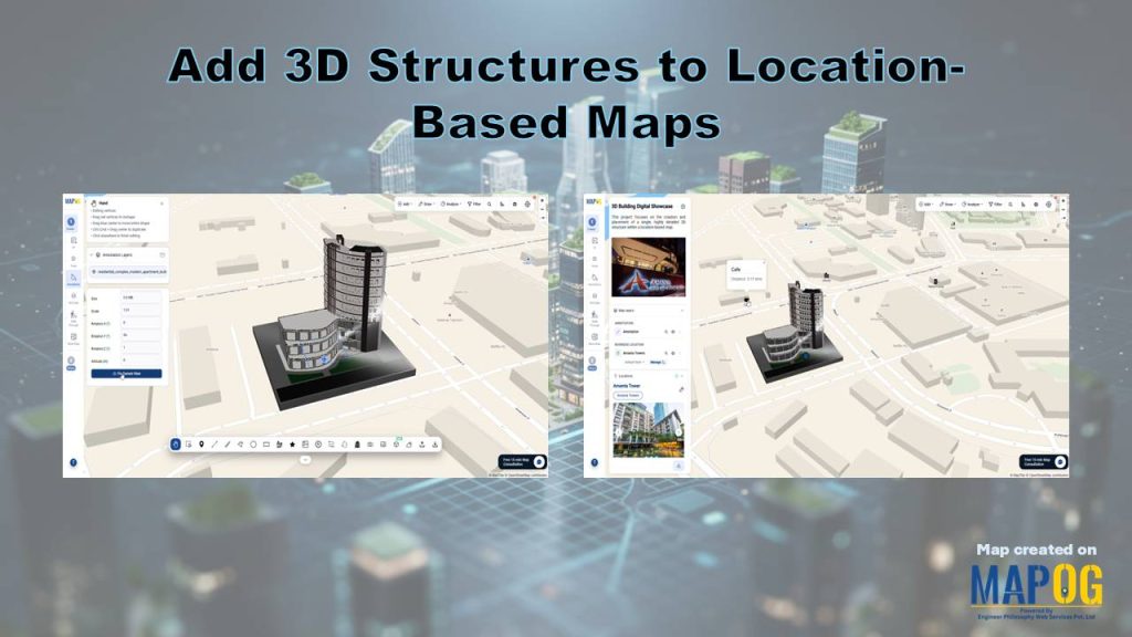
Showcasing a residential complex requires more than flat markers on a map. The best way to add 3D structures combines precise location data with realistic models. It presents both the property and nearby amenities with clear context. With MAPOG‘s annotation tools and 3D model upload capability, developers place detailed residential structures directly onto maps. This transforms static views into immersive, real-world visualizations.
Key Concept of Adding 3D Structures to Location-Based Maps
The best way to add 3D structures means placing accurate 3D building models directly onto real-world map locations instead of flat representations. This improves spatial understanding by clearly showing scale, orientation, and nearby amenities. As a result, maps become more effective for analysis and presentation.
Steps- by- Step Workflow to Add 3D Structures to Location-Based Maps
1. Map Setup and Initialization
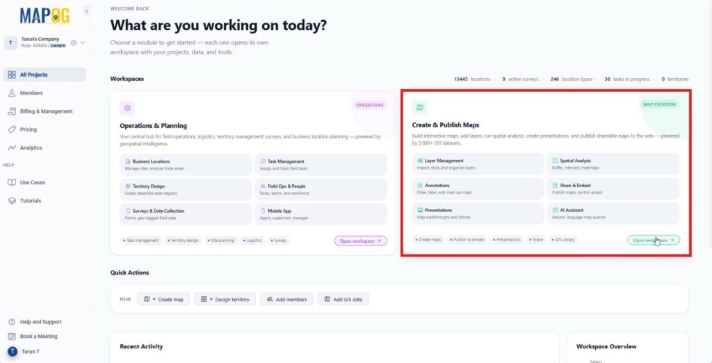
First, access MAPOG and open the create and publish map workspace to initiate a structured environment for creating and managing the project.
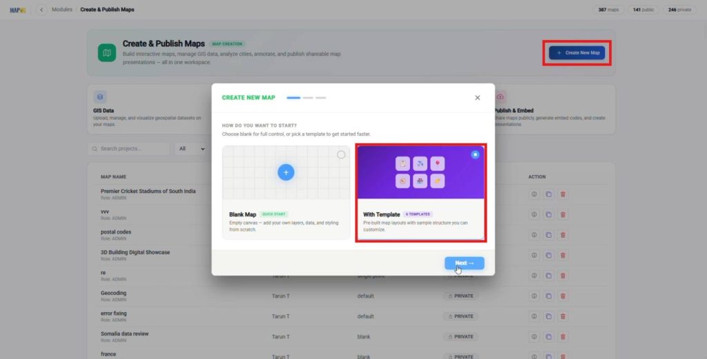
Next, click Create New Map, then move into the Template section and select a suitable template such as Single Location so the map remains focused on one site for clear and detailed visualization.
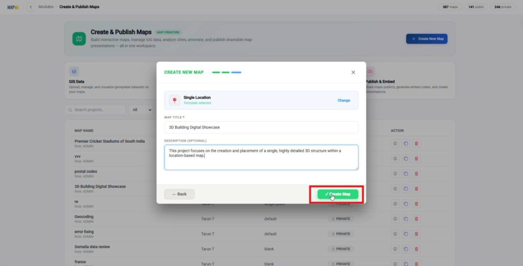
Add a title and description, and finally click Create Map and proceed to the map interface.
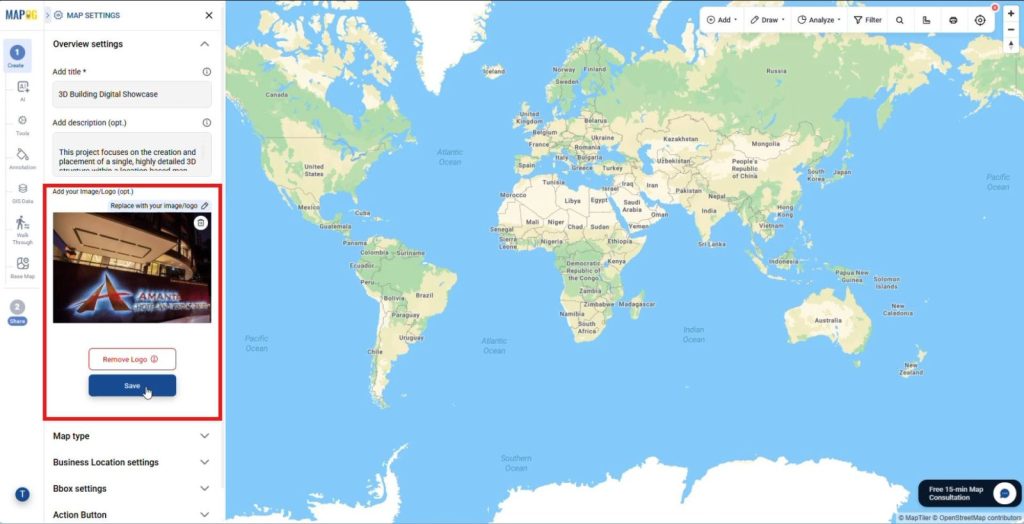
After that, open Map Settings and upload a map logo to add clear branding and a professional look.
2. Starting with the Annotation
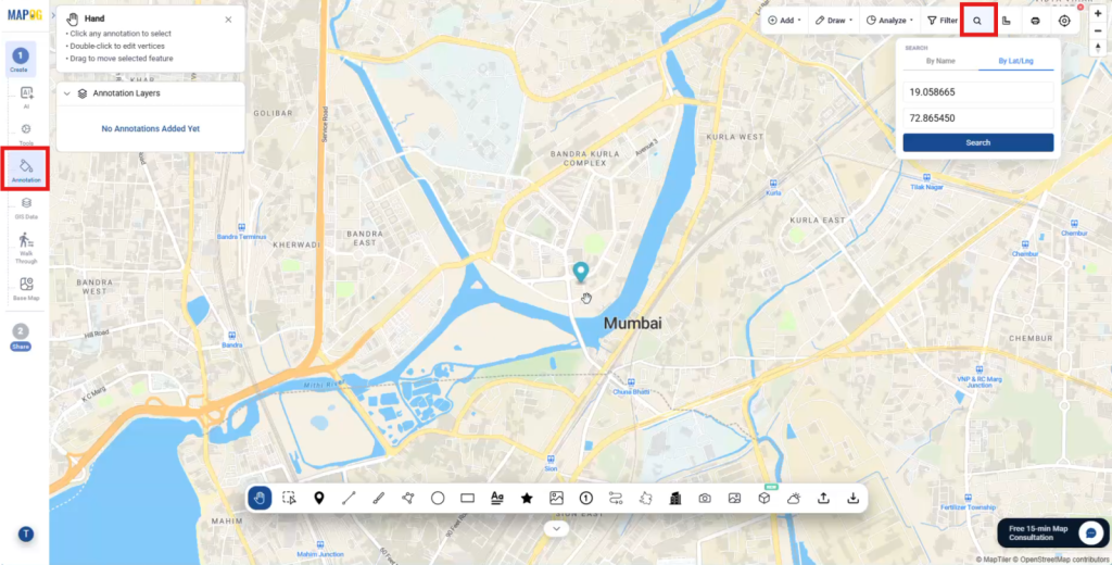
After that, navigate to the annotation section and search for the exact location using a place name or coordinates to anchor the map with geographic accuracy.
3. 3D Model Integration
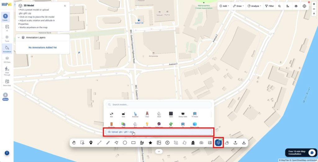
Subsequently, open the 3D model tool and upload the structure in GLB, GLTF, or ZIP format to integrate realistic building data into the map.
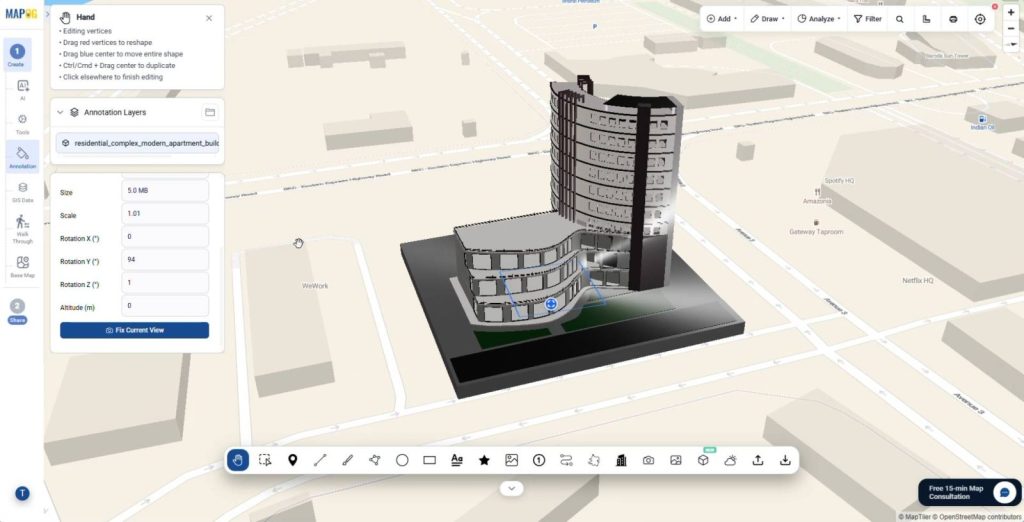
Once uploaded, place the model on the map and adjust scale, rotation, and position so it aligns correctly with real-world surroundings.
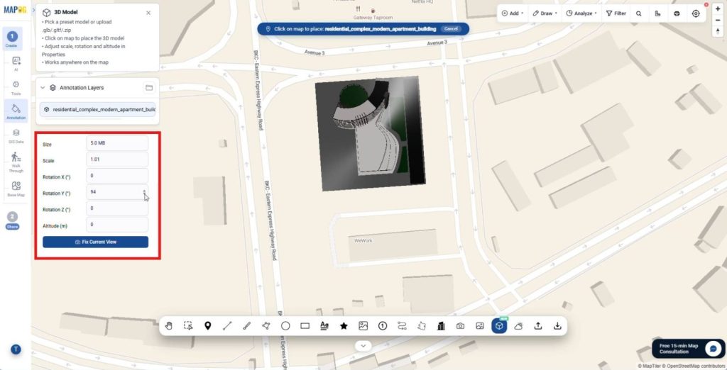
In addition, refine visual settings such as opacity and orientation to ensure the model blends naturally with nearby features and amenities.
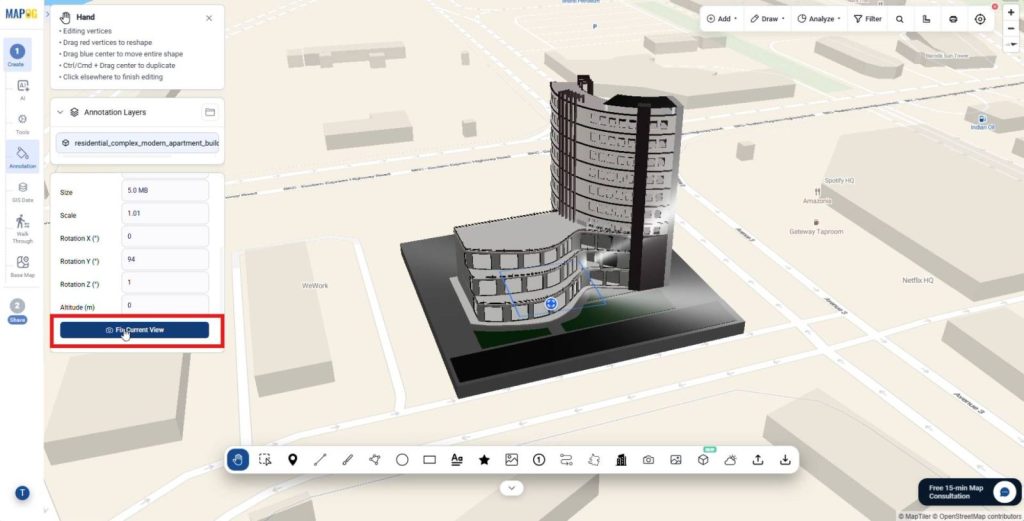
Finally, click fix the current view to lock the perspective, thereby ensuring a consistent and professional 3D map output ready for presentation or analysis.
Industries and Domains Benefitting
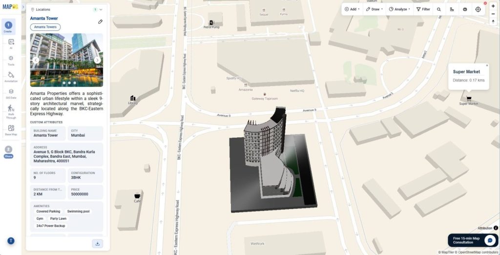
Real estate developers use this approach to showcase residential projects along with nearby amenities, improving buyer understanding. Urban planners rely on it to analyze building placement and surrounding infrastructure more effectively. Additionally, logistics teams benefit by visualizing facilities and optimizing movement within complex environments.
Conclusion
In conclusion, integrating 3D models transforms how location-based maps deliver value. MAPOG’s annotation and 3D model upload capability make this process efficient and accessible without complex workflows. By applying the best way to add 3D structures, professionals can create clear, interactive maps that support better planning, presentation, and decision-making.