In the world of navigation and surveying, bearing angle and distance measurements—from true north, clockwise in degrees, and along the ground—form the core of accurate mapping. Traditionally, these demanded manual calculations with compasses and trigonometric tables, risking errors in everything from land deeds to flight paths.
However, automation has transformed this process. MAPOG computes bearing angles and distances instantly from coordinates, taking terrain and curvature into account. Moreover, mobile apps bring this functionality to hikers and developers alike, enabling real-time route plotting, boundary delineation, and precise navigation.
Key Concepts
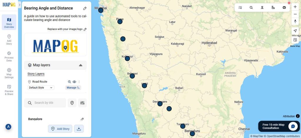
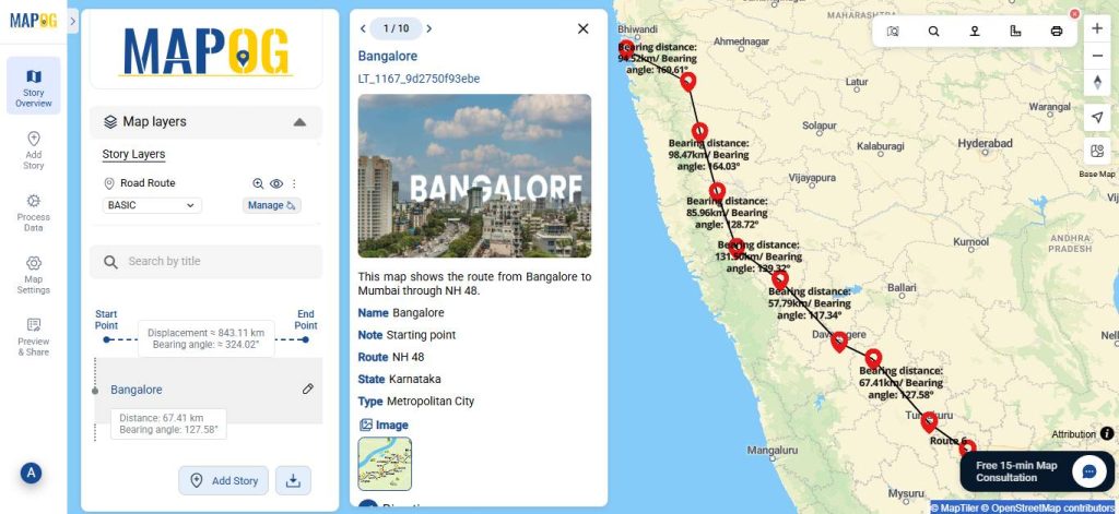
The core idea of applying bearing angles and distances to map a road route—such as India’s NH48 highway connecting Bengaluru (Bangalore) to Mumbai—is to represent the path as a traverse or polyline in a polar coordinate system. This breaks the winding, real-world road into manageable straight-line segments, each defined by:
- Bearing angle: The clockwise direction from true north (0°) to the segment’s endpoint, in degrees (0°–360°). It guides orientation.
- Distance: The ground length of the segment, typically in kilometers.
Furthermore, MAPOG can process multiple micro-segments automatically, generating digital layers for navigation, route optimization, toll calculations, or traffic analysis. By automating these computations, they save time, reduce errors, but also enable precise modeling of complex road networks.
Step by Step Guide on how to calculate bearing angle and distance
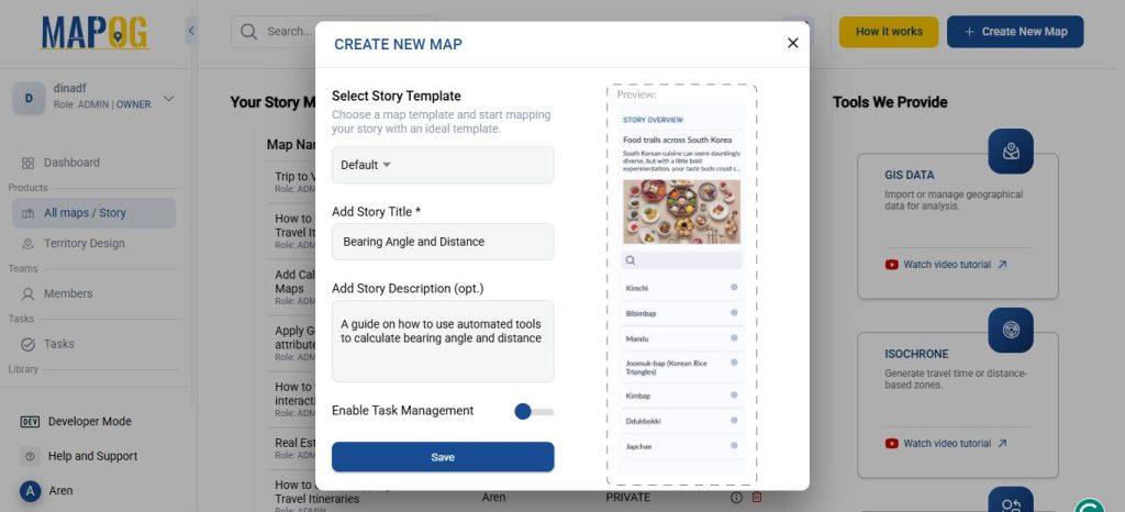
1. Start with a New Map
Open MAPOG and click on “Create New Map”. Give your project a title and brief description, then hit save.
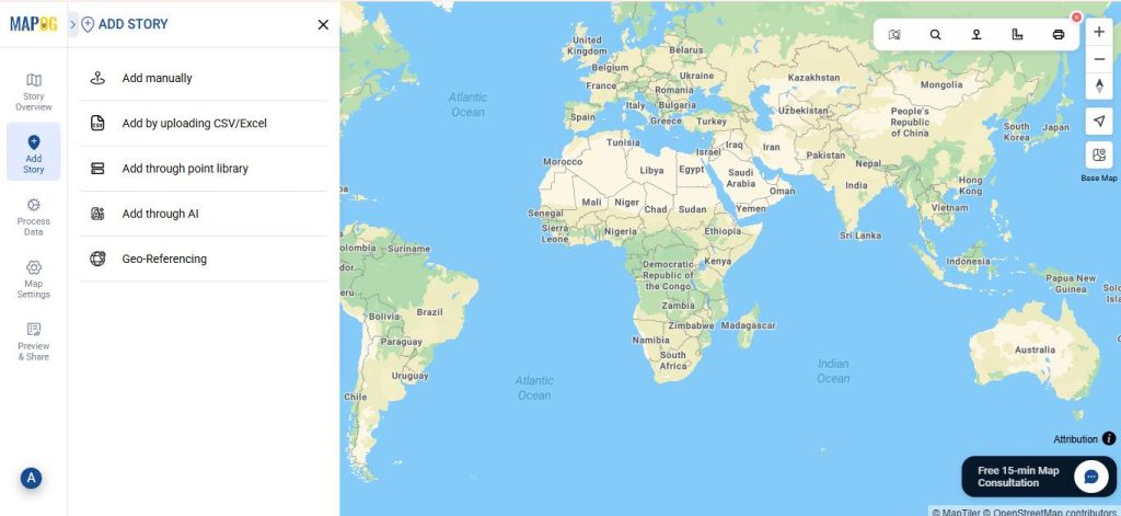
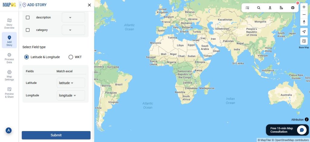
2. Add coordinates using a CSV file
Go to Add Story and then select “Add by uploading CSV/Excel”.
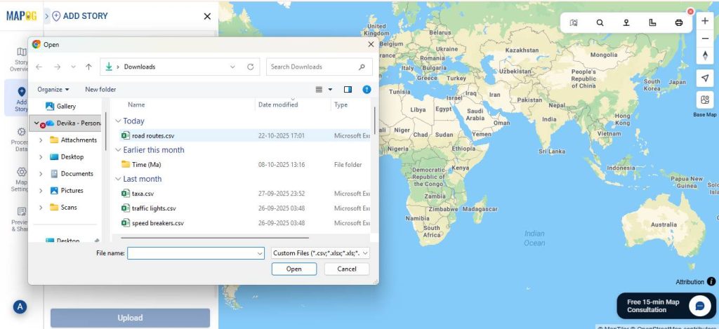
And then upload your desired CSV file.
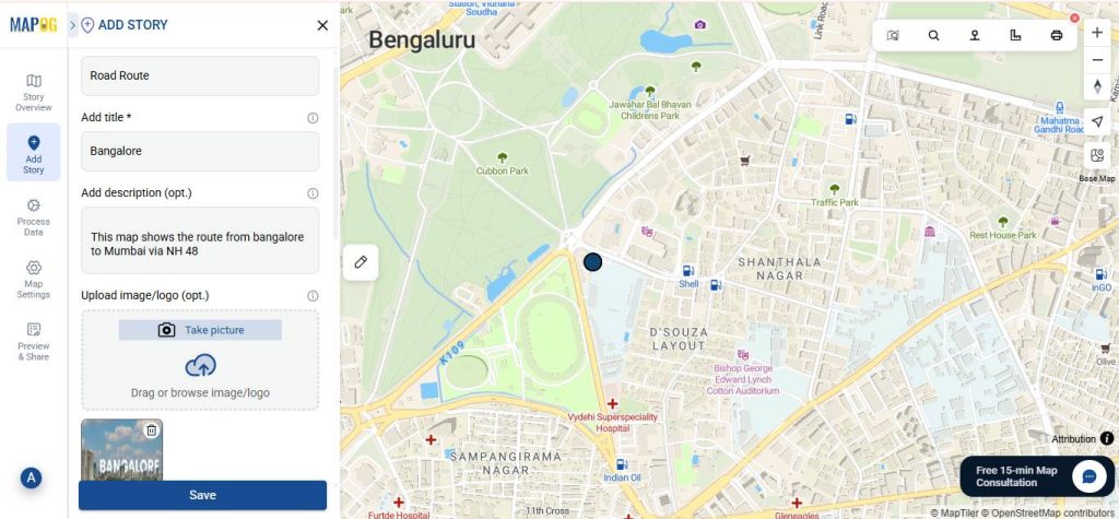
Subsequently, go to Select Point Type settings option, add Location Type such as Road Route. After that, input the necessary attributes such as the name, photographs, etc.
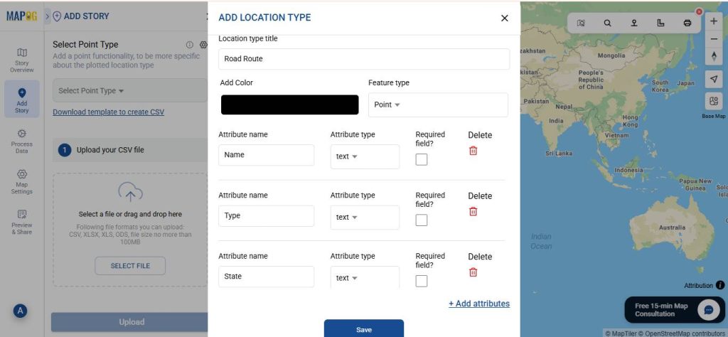
Then match your excel with attributes and hit submit.
3. Editing the points.
Go to Edit point details.
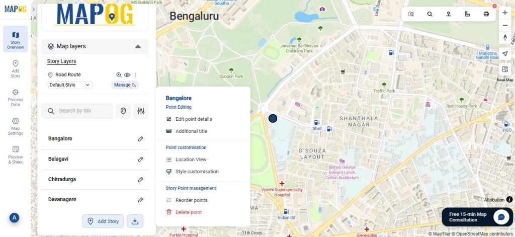
Next, add a relevant image for your point and complete the necessary attributes, then click Save.
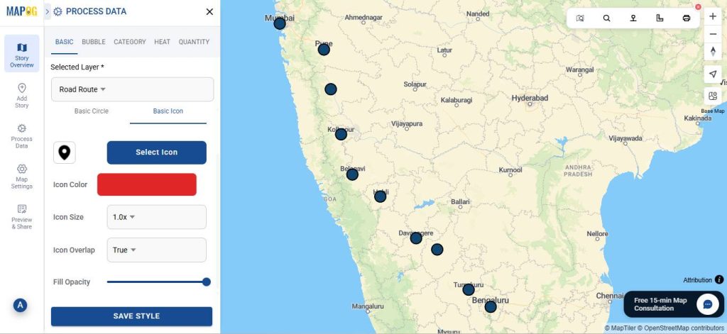
Additionally, you can personalize the point icons by applying a Style Layer. For that, go to the Style layer and select ‘Create New Style’.
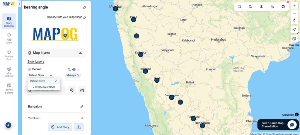
On the basic icon section, select your desired icon and customize the colour.
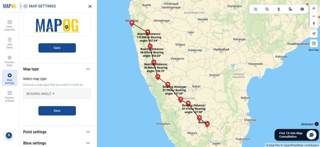
4. Calculating Bearing Angle and distance
Open Map Settings and switch the map type from “Default” to “Bearing Angle”. Consequently, the distances and bearing angles for all points will be automatically generated, thereby allowing you to easily view them within the map interface.
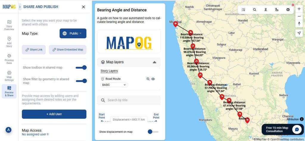
5. Share Your Map
Once your map is ready, click “Preview and Share”. You can set your map to public for wider visibility or share it using the Share Link option.
Who Uses Bearing Angles and Distances?
Bearing angles and distances, essential for precise navigation and positioning, are utilized by a diverse array of professionals and enthusiasts. For instance, land surveyors and civil engineers employ them to delineate property boundaries and align infrastructure like roads. Similarly, Pilots, mariners, and hikers rely on these metrics for plotting courses and orienteering. Geographers and GIS specialists use them in digital mapping and spatial analysis, while military and search-and-rescue teams apply them for tactical coordination. Moreover, urban planners leverage them for zoning and traffic simulation, and even hobbyists or app developers incorporate them into recreational tools like AR navigation apps, thus making the concepts accessible across technical and exploratory pursuits.
Conclusion
In conclusion, automated tools for calculating bearing angles and distances have revolutionized mapping, effectively transforming manual drudgery into seamless precision for surveyors, navigators, and planners alike. By harnessing GIS platforms, these innovations not only streamline route plotting, but also empower data-driven decisions in an increasingly connected world. For those seeking an accessible entry point, MAPOG stands out as a versatile GIS website, offering intuitive tools for data visualization, analysis, and interactive storytelling that make bearing and distance computations effortless and insightful, paving the way for broader adoption across industries.