In a data-driven landscape, controlling access to your interactive maps is crucial for collaborative projects and client solutions. Unlike static images, interactive maps offer real-time information sharing. MAPOG facilitates this by allowing users to view or edit your Map & provide permissions through its Preview & Share and add user features, ensuring secure and efficient collaboration.
Key Concept: View or Edit Your Map
The concept of controlling who can view & edit your map is essential for various purposes. Public maps facilitate sharing of open data, while private maps cater to sensitive information and internal planning. Team-based access allows collaboration among stakeholders, enhancing productivity and communication, particularly in fields like real estate, urban planning, and logistics.
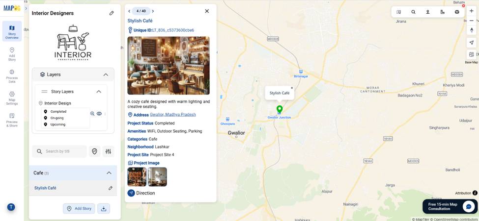
Real Estate Property Listings: A Practical Use Case
Consider a real estate company enhances its marketing by creating an interactive property map instead of traditional brochures. This map visually showcases available listings with detailed attributes like floor plans and neighborhood highlights. Clients with view link can explore properties dynamically, increasing engagement and satisfaction. The company can easily share the map via link, facilitating collaboration among team members and clients, which leads to more inquiries.
Add User Feature: View or Edit Your Map
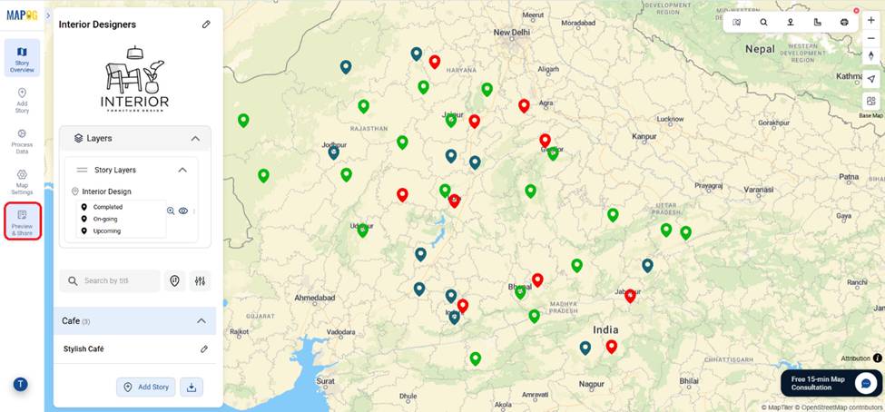
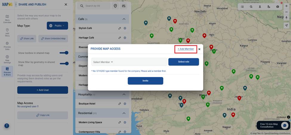
Now, let’s see how this works in practice. After creating a live interactive map in MAPOG, you simply go to the Preview and Share section.
Here, you can set the map visibility as private for limited viewing or public for wide sharing.
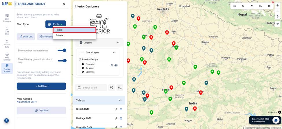
After that come to the Add User section. This feature ensures that your interactive project remains secure while still being collaborative. Then, Clients, partners, or colleagues can view or contribute to the project based on the permissions you set — all managed directly from one platform.
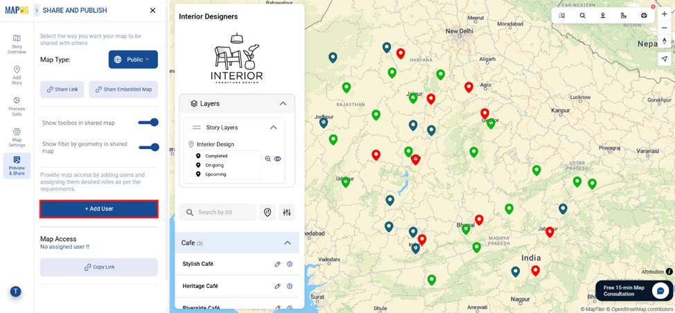
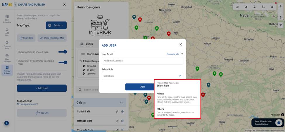
With the Add Member option, you can invite team members or clients by entering their email addresses and assigning them roles,
Such as
- Admin: Company & Property owners can get full access to edit, delete, and manage map layers, as well as add new users.
- Others: Teammates or clients can only edit or view the map and its data After adding user email & selecting role, click on add to add the specific member in that specific role.
After adding user email & assigning their roles click on add to add the member to that specific role.
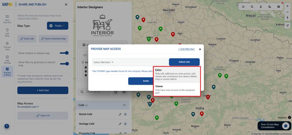
Next come to provide map access again and there you can select the members through email address from the drop down & assign them map access such as
- Editor: only edit, add/remove story points, add viewer and contributor but cannot delete map or create admin.
- Viewer: Only have view access to the assigned part.
After selecting member & providing them map access click invite to provide members map link to view or edit the map.
Industry Benefits of Controlling Map Access
The ability to control who can view or edit your map has significant industry-wide benefits. In real estate, it ensures clients view updated listings without altering any data. In logistics, team members can update routes while clients track deliveries. Urban planners can collaborate on zoning data without exposing sensitive details to the public. Moreover, because embedded maps can be placed directly into websites or reports, stakeholders always have access to the latest information without switching platforms.
Conclusion
Interactive maps are more than just visuals — they’re dynamic tools for collaboration, decision-making, and storytelling. By learning how to control who can view or edit your map, you protect sensitive information, streamline teamwork, and create more engaging user experiences.
Whether it’s real estate, logistics, or research, MAPOG makes this process simple and secure. With its Preview & Share options, embedded maps, and easy role assignments, you can confidently share the right data with the right people — every time.
Do you want to see the step-by-step process to create such beautiful live interactive property map?
Have you tried embedding interactive maps in your own projects? Share your thoughts in the comments!