Measuring distance and area is a fundamental tool with a wide range of applications like calculating land parcels, determining the lengths of roads and rivers. Leveraging MAPOG one can measure distance and area enabling to analyze and manage geospatial data for more informed and efficient decision making.
Key concept and importance
The key concept of measuring distance and area is to calculate the size of real-life geographic features like land parcels, roads and rivers on a map using MAPOG, without doing it manually.
This process goes beyond providing simple numbers; it’s about leveraging that data to reveal insights and solve real world problems. For example, while designing a park, city planners use measurement of distance and area to layout features like logging tracks, estimate space for new facilities, and calculate maintenance costs.
Step-By-Step Process of how to Measure Distance & Area on a Map
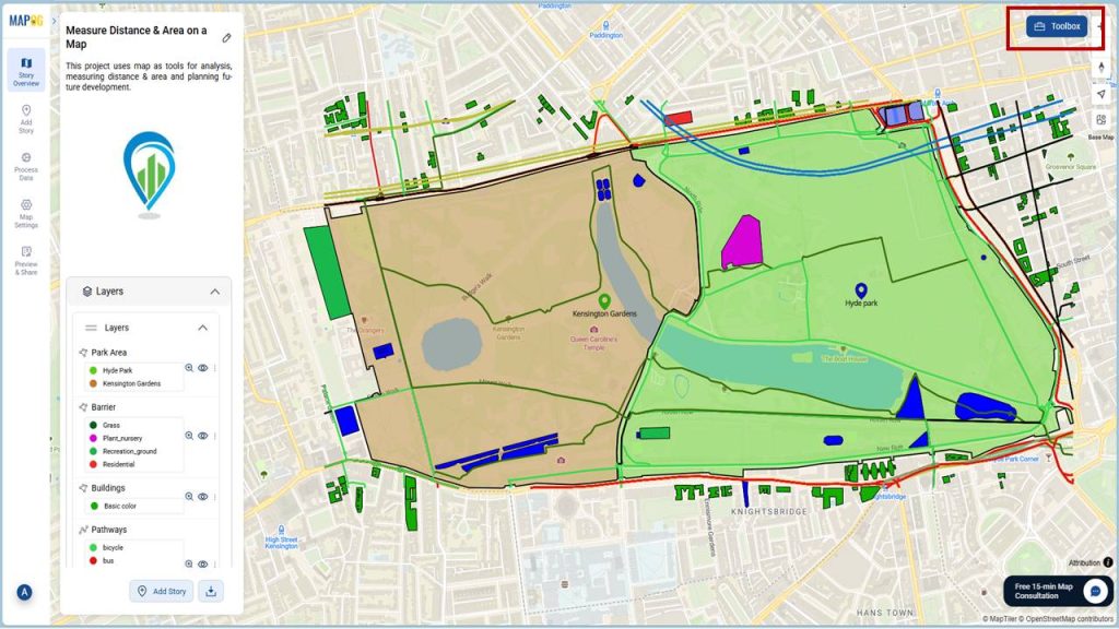
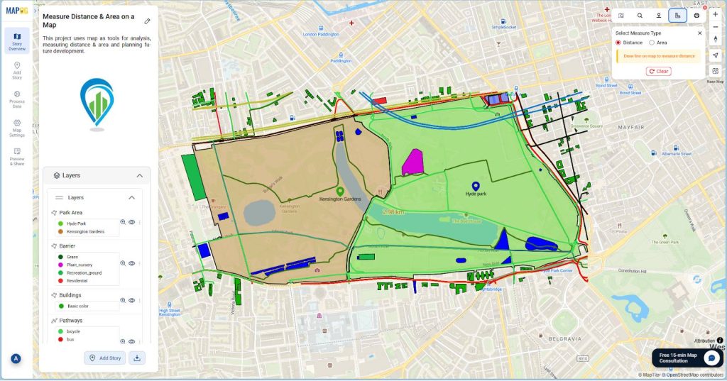
- After creating the map, To measure Distance and Area go to the Toolbox available at the top right corner.
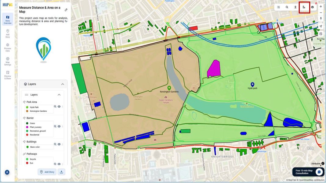
- After that, Click on Measure distance or area option.
- Then, to measure distance, select measure type as Distance.
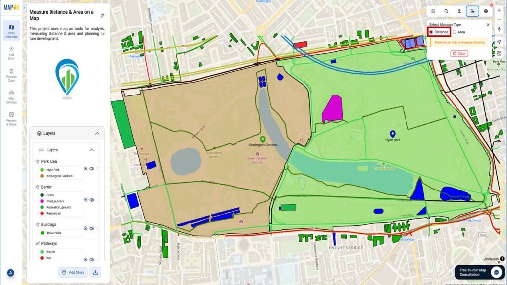
- Now precisely trace to draw a line over the feature you want to measure.
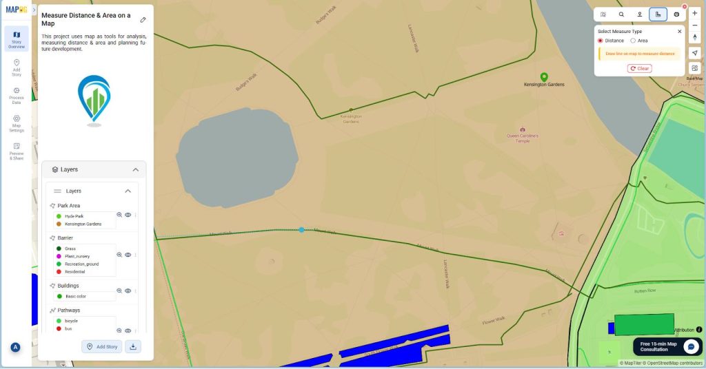
- Finally, It will show the distance on the map.
- Similarly, to measure Area select measure type as Area.
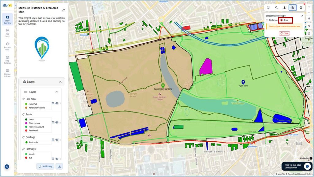
- Then draw a polygon over the feature to measure its area.
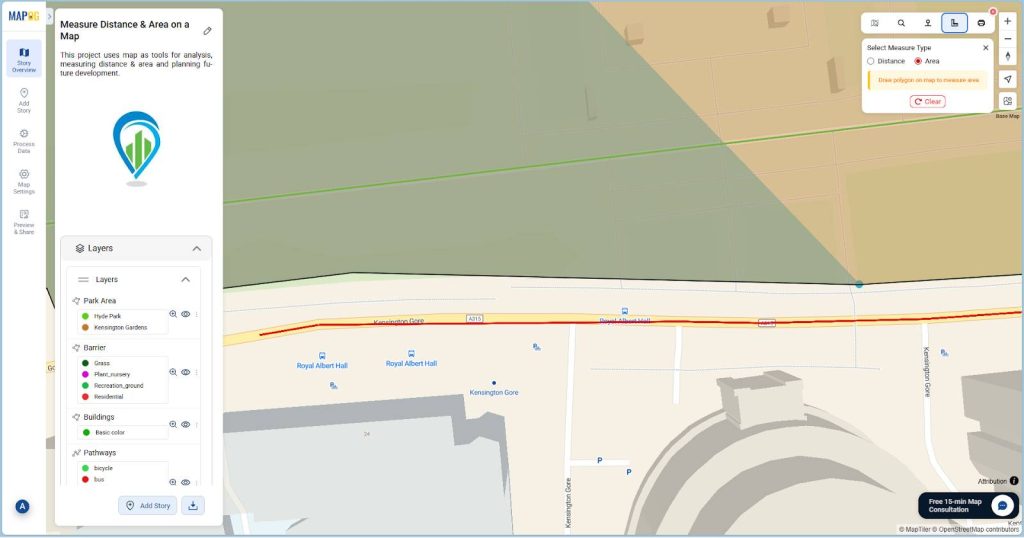
- At the end complete the polygon using double click.
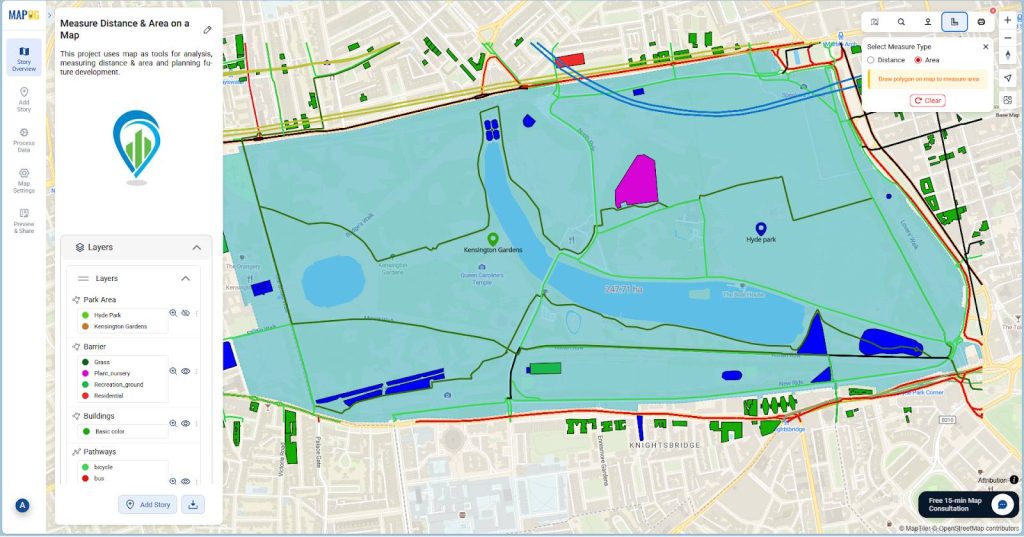
- It will show the area of the feature inside the polygon.
Industries and domains that uses Measurement of Distance and Area
Numbers of industries and domains use measurement of distance and area for tasks like analysis, planning and decision making. These includes:
- Urban planning: In planning, measurement of distance and area is used for zoning, infrastructure development, planning layout of new roads etc.
- Transportation and Logistics: Transportation and logistics heavily relies on measurement of distance and area and overall GIS for tasks like route optimization, network analysis, etc.
- Environment Management: Environmental scientists also use measurement of area of features like forest covers, wetlands to monitor changes over time.
- Construction and Engineering: Planners calculate the area of a site to estimate budgets and materials needed. Similarly, distance measurement is a fundamental requirement for accurately laying out powerlines, pipelines, and critical infrastructure.
Conclusion
To conclude, measuring distance and area is an essential aspect of GIS that enables data driven planning and decision making across a wide range of industries. MAPOG provides tools to measure distance and area accurately, using which city planners can make planning and future development rapid and efficient.
Here are some other blogs you might be interested in
- GIS in Land use and Zoning analysis for better city planning
- Mastering Farmland Boundaries with Maps: Accurate Perimeter Measurement Made Easy
- Creating Point Data for Urban Planning: Digitizing Settlement Features & Infrastructure Mapping
- Land Parcel Mapping with GIS: Create Accurate Polygon Maps for Urban Planning & Real Estate