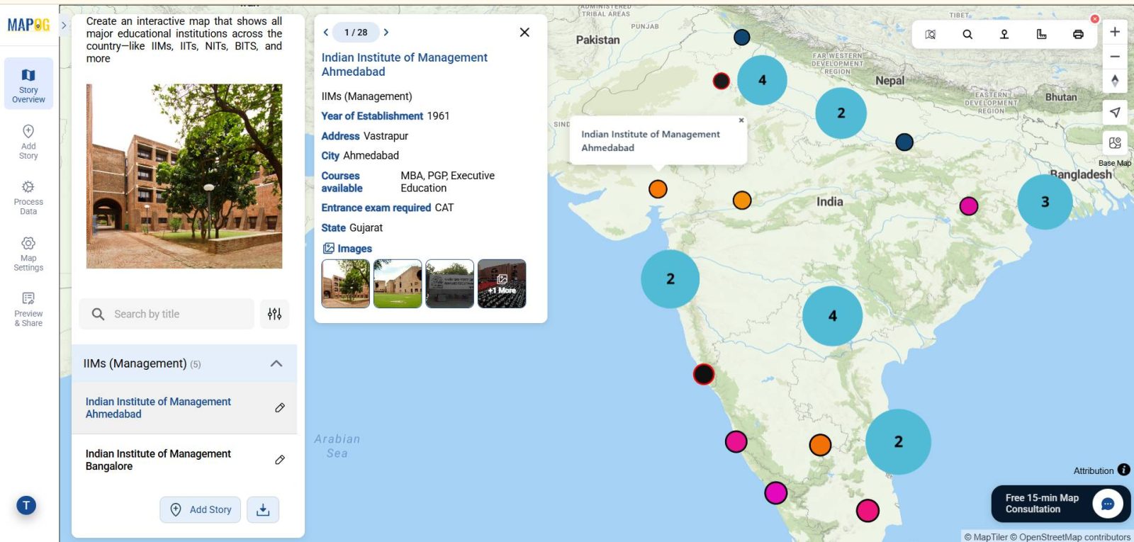
Education shapes futures, and therefore knowing where the best institutions are located is essential for students, parents, and policymakers. Moreover, Interactive Map of Top Colleges and Universities for Students is not only exciting but also visually engaging. In addition, they help at the same time, to find nearby facilities such as electric vehicle stations. Furthermore, interactive maps make it easier to explore academic strengths in context. As a result, decision-making becomes more informed and less overwhelming. By integrating MAPOG with institution data, tourism and education exploration become dynamic, immersive, and efficient. Consequently, this approach bridges the gap and ultimately, it supports educational planning.
Key Concept: Interactive Map of Top Colleges and Universities for Students Matters :
Interactive Map of Top Colleges and Universities for Students not only shows where they are located but also highlights what makes each stand out. Moreover, such maps provide valuable insights for students like learning history seeking the right place to study, businesses looking to partner with universities. As a result, interactive maps become powerful tools that connect education, planning, and opportunity.
Importance of Interactive Map of Top Colleges and Universities for Students
- Student Decision-Making – To begin with, students can visualize university and college options by location, and as a result, they can easily shortlist based on facilities.
- Policy & Planning – In addition, governments and education boards can analyze the distribution of institutions. Consequently, they can identify gaps in access and improve resource allocation more effectively.
- Tourism & Local Economy – Moreover, cities with top universities often attract cultural and educational tourism. Therefore, local businesses benefit from increased visitors, and academic events.
- Parent & Guest Experience – At the same time, interactive maps allow families to explore institutions with ease. Furthermore, they provide directions , amenities for added convenience.
Methodology: Creating an Educational Institution Map Story Using GIS
1: Prepare Your Data
- Create an Excel file listing all the institutions you want to map.
- Include columns such as:
- Institution Name
- Category (IIT, IIM, NIT, Private University, Central University)
- Location (City/State)
- Latitude & Longitude
- Year Established
- Programs / Courses
- Entrance Exam
- Description
- Institution Name
2: Create a New Story
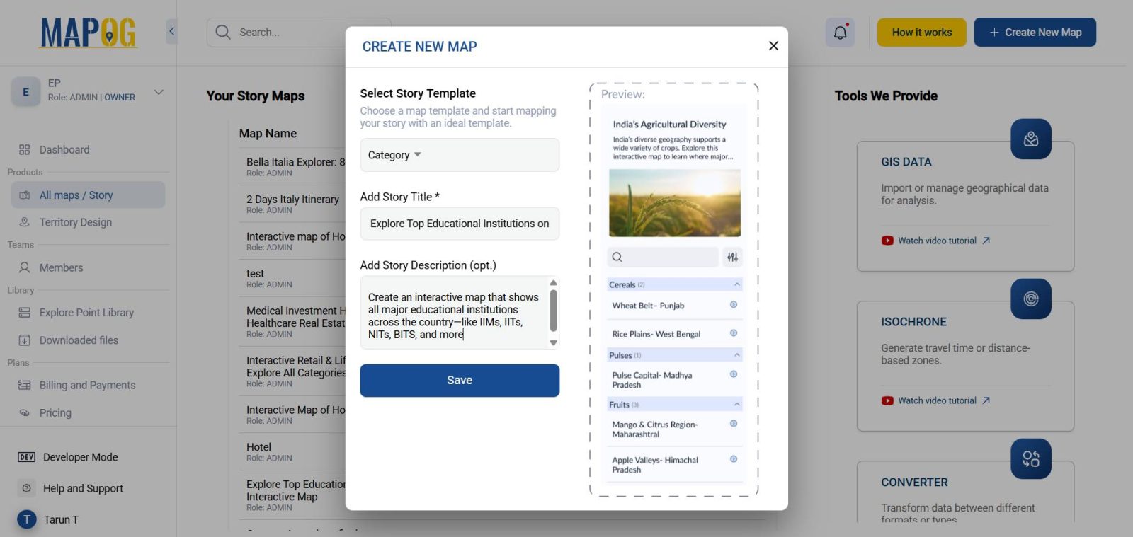
On the MAPOG platform, click “Create New Map” to begin your map story. Select category map as the story template then add Title and a description .
3- Upload as CSV
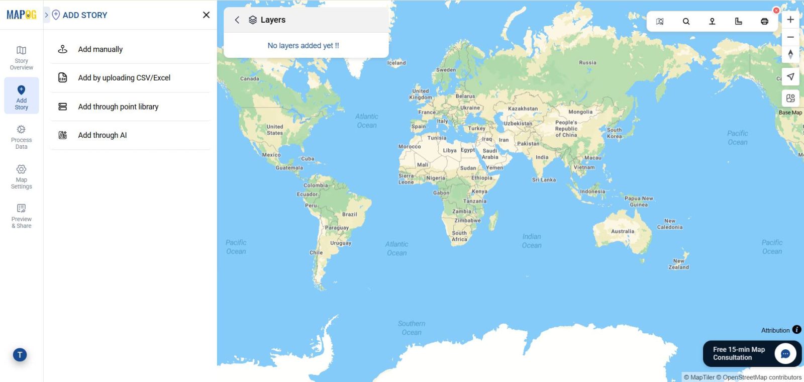
Click on “Add Story” > “Add By Uploading CSV/Excel.”
- Upload your Csv file
4- Create Attributes
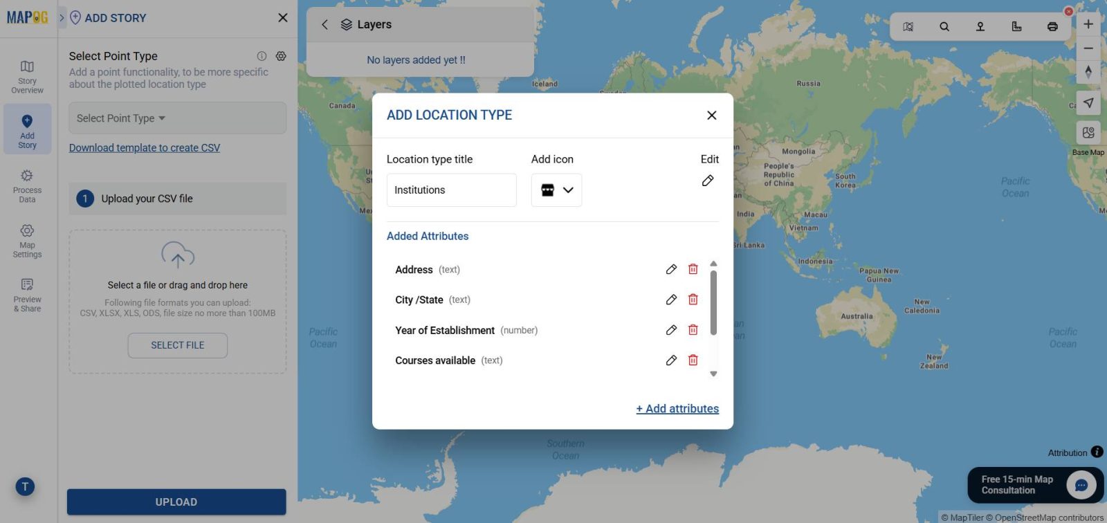
- select point type settings option then “Location Type Management”, create a new type called Educational Institution.
- Add attributes such as:
- Institution Name
- Year Established
- Programs / Courses
- Category (IIT, IIM, etc.)
- Image & Description
- Institution Name
- Match the Latitude and Longitude columns
Complete the upload
5 – Match Data with Locations
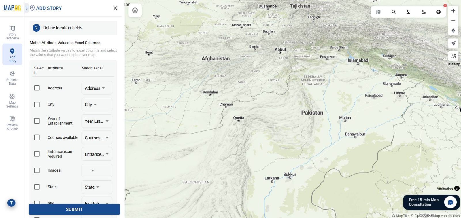
After uploading the CSV, match attributes with the correct columns (Institution Name, Location, Latitude, Longitude, etc.).
Ensure all locations appear correctly on the map.
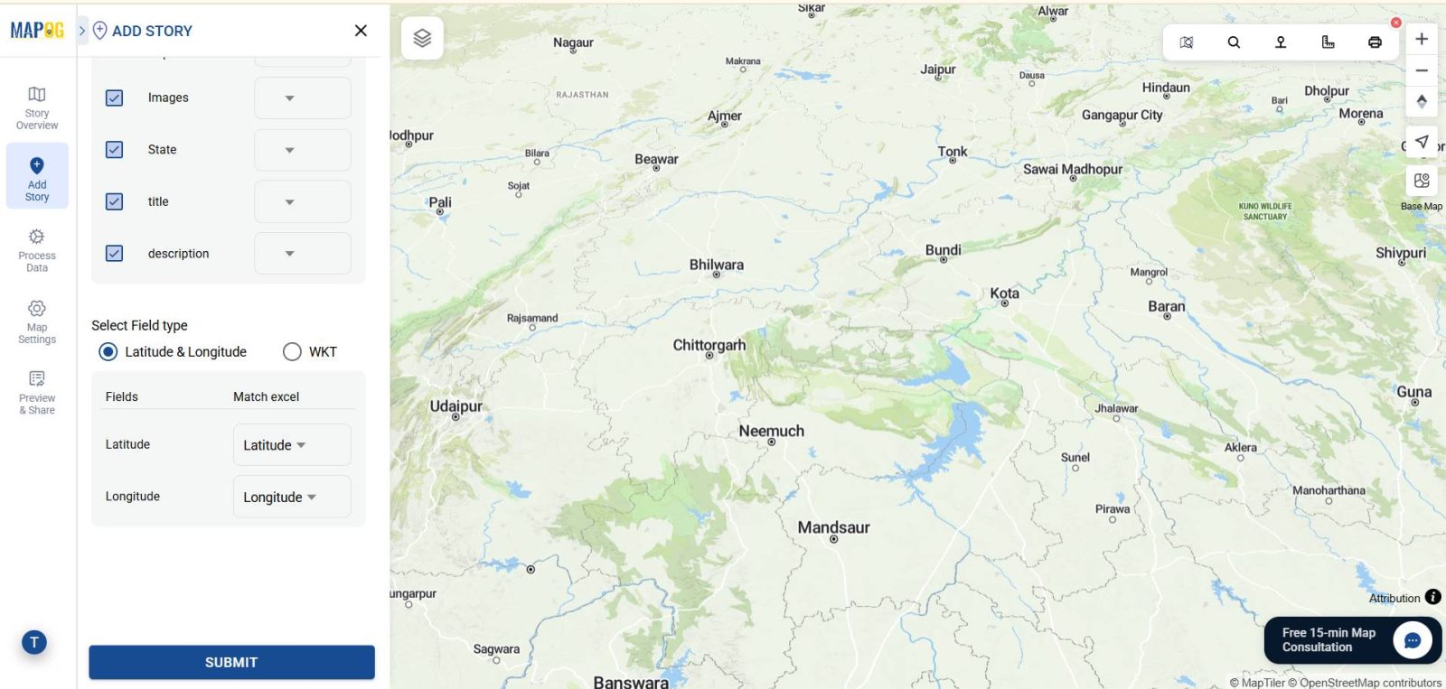
After submitting all points will automatically appear in the map with all information attached to it.
6 – Categorize
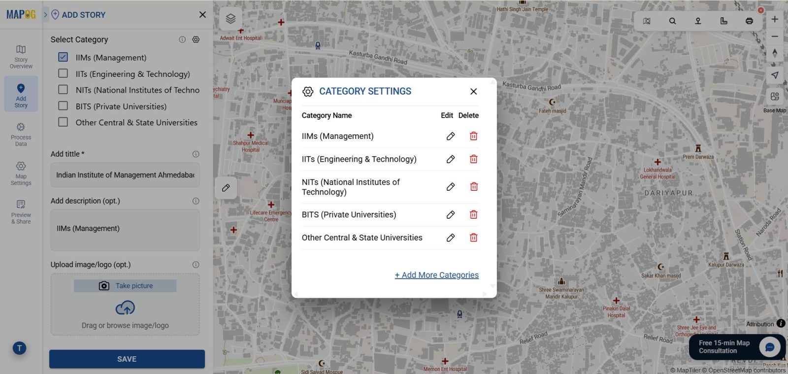
- Go to edit points details of any point then category setting and make category attributes (e.g., IITs, IIMs, NITs, Central Universities).
- In each point enter category
- Upload institution images . Lastly save the points after filling up all the information.
7 – Styling and Visual Enhancements
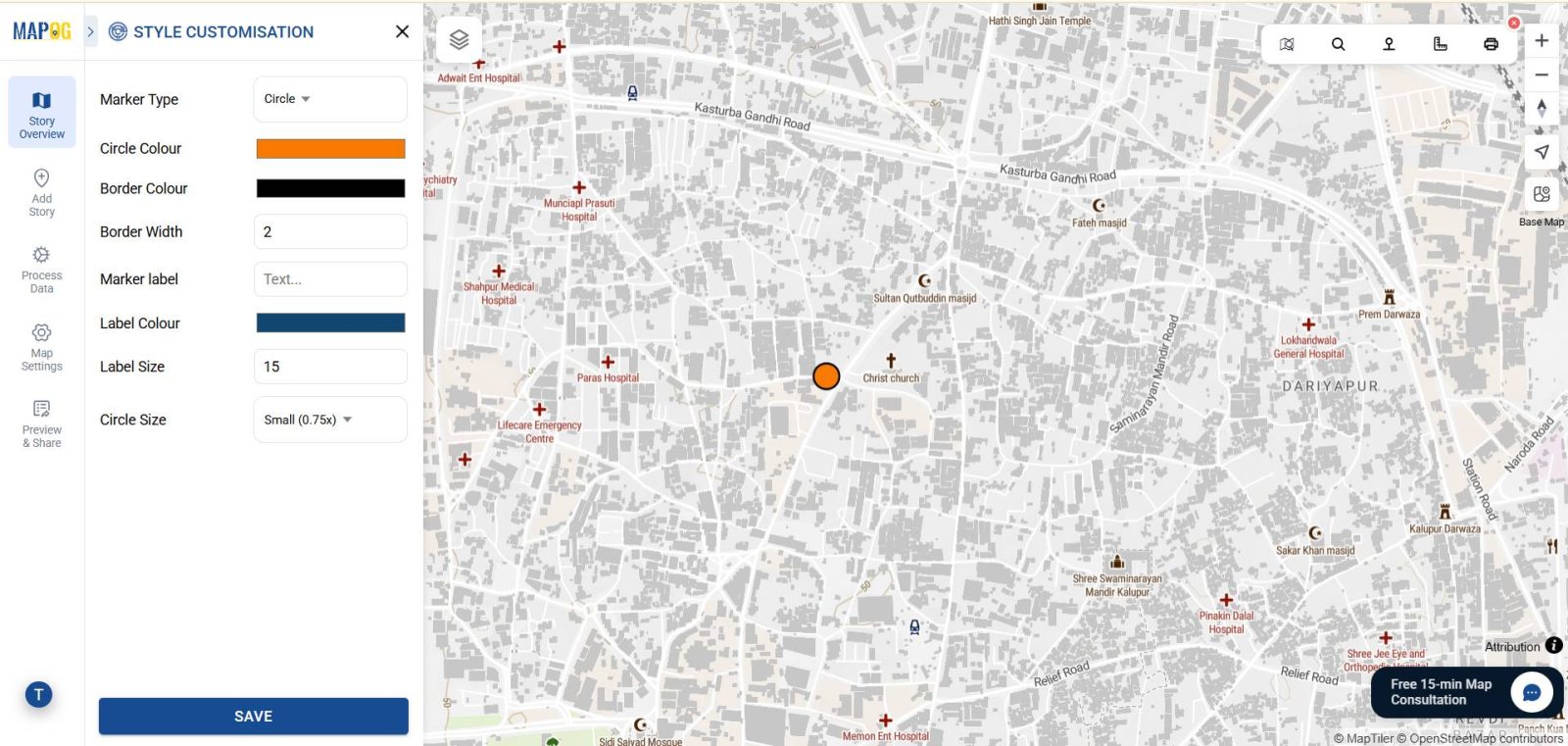
- Customize your map using the Point customization options:
- Use different icons or colors based on themes to differentiate venue styles.
8 – Publish and Share
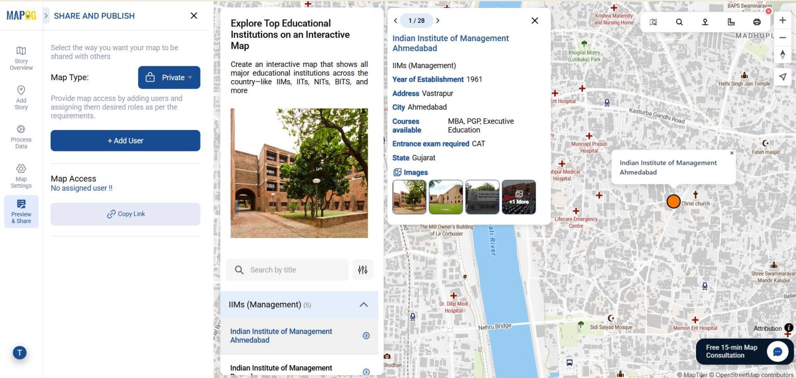
- Once satisfied, click “Share & Publish.”
- Make the story public or private.
Industry and Domain
The work operates at the intersection of education, policy planning, student services, and tourism, with a strong focus on higher education, student guidance, digital marketing, and academic research. At the same time, it integrates structured guidance, evidence-based research, and digital outreach to promote institutions, improve visibility, and support student success in both academic and career pathways.
Conclusion
Mapping educational institutions with GIS transform into a visual and interactive journey with MAPOG, students, parents, and planners can compare institutions, explore facilities, and understand their surroundings better. This makes the decision-making process inspiring, structured, and efficient.
Exploring Our Previous Blogs
- Role of GIS In Irrigation Planning and Water Resource Management
- How GIS and Smart Mapping Reduce Urban Heat Islands
- GIS in Infrastructure Development and Road Network Analysis
- Flood Risk Mapping with Interactive Web Maps: SaaS Approach
- Optimizing Warehouse Location Selection with GIS for Supply Chain Efficiency