Spatial Analysis

Cover Image

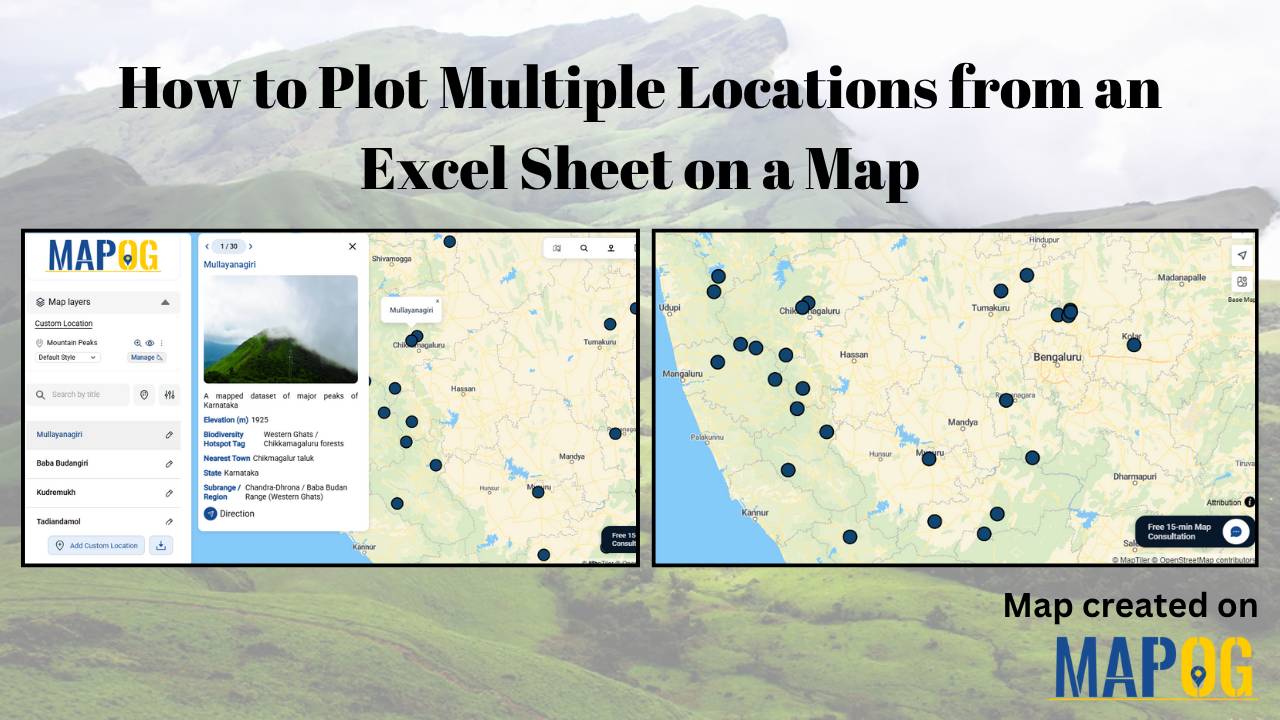
How to Plot Multiple Locations from an Excel Sheet on a Map

If you have ever managed an extensive list of locations in an Excel sheet — such as customer addresses, store locations, survey sites, or well coordinates — and wanted to represent them spatially, you are not alone. Visualizing location-based data on a map enables you to clearly understand the spatial distribution, relationships, and patterns that … Read more

Featured image how to use geospatial filters to your Map

Using Geospatial Filters to Simplify Your Map

If your map feels crowded or confusing, you’re not alone. Many GIS projects start out clear but quickly become overwhelming as more layers and data are added. That’s where using geospatial filters to simplify your map can make all the difference. With MAPOG, which offers advanced filtering tools, this process becomes simple and accessible. Key … Read more