online gis analysis

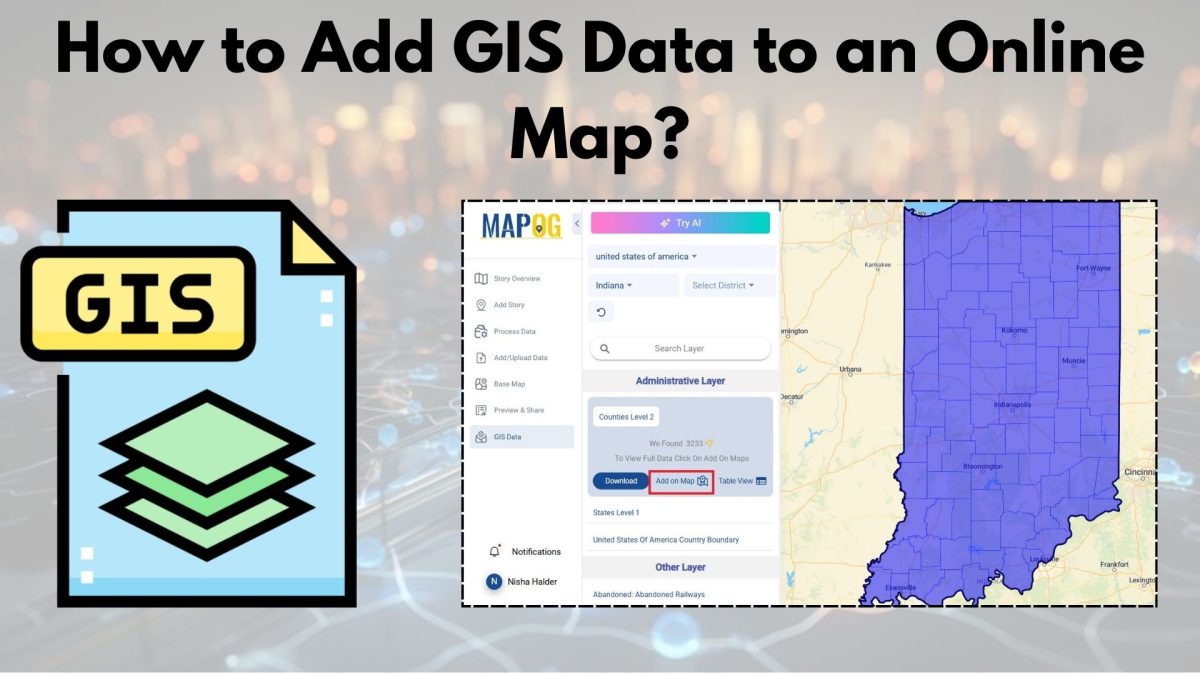
A Beginner’s Guide to Mapping GIS Data Online

With the advancements in today’s digital world, GIS data is a necessary element for any professional or enthusiast in urban planning, environmental monitoring, or simply the creation of a visual story. The integration of GIS data with an online map is, thus, an indispensable skill. In the following pages, we shall describe how to incorporate … Read more

Create a Map to Extract Forest Areas Using Filter Tool

In the realm of environmental analysis and land management, extracting specific geographic features from larger datasets is essential for informed decision-making. In this use case, we explore the extraction of forest areas from a larger dataset using the Filter Tool in MAPOG Map Analysis. By uploading a shapefile of the region and a forest area … Read more