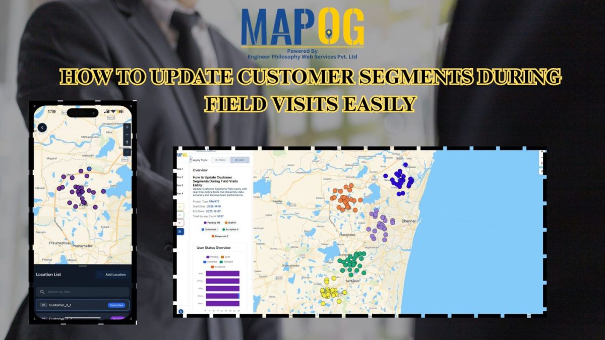
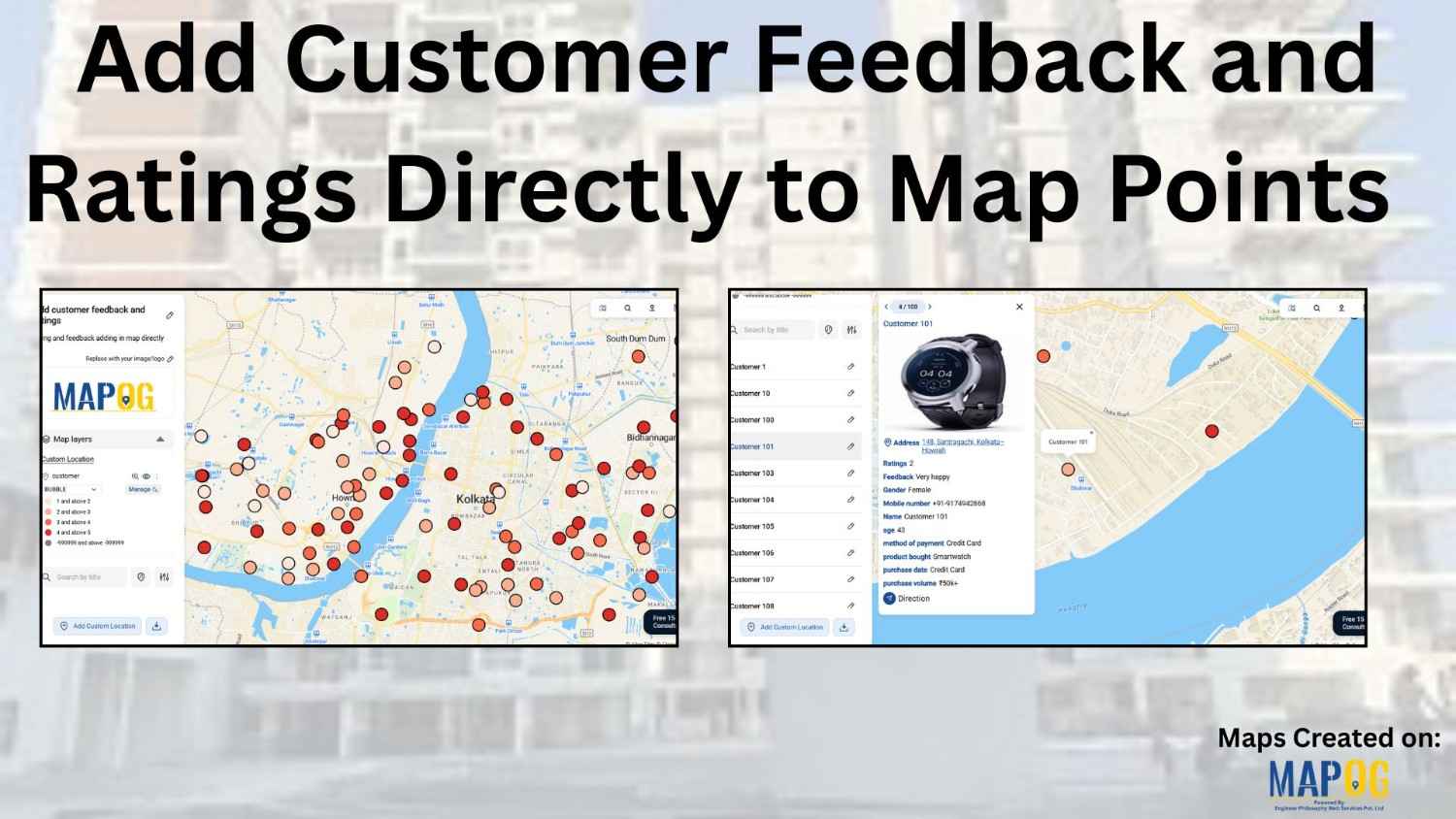
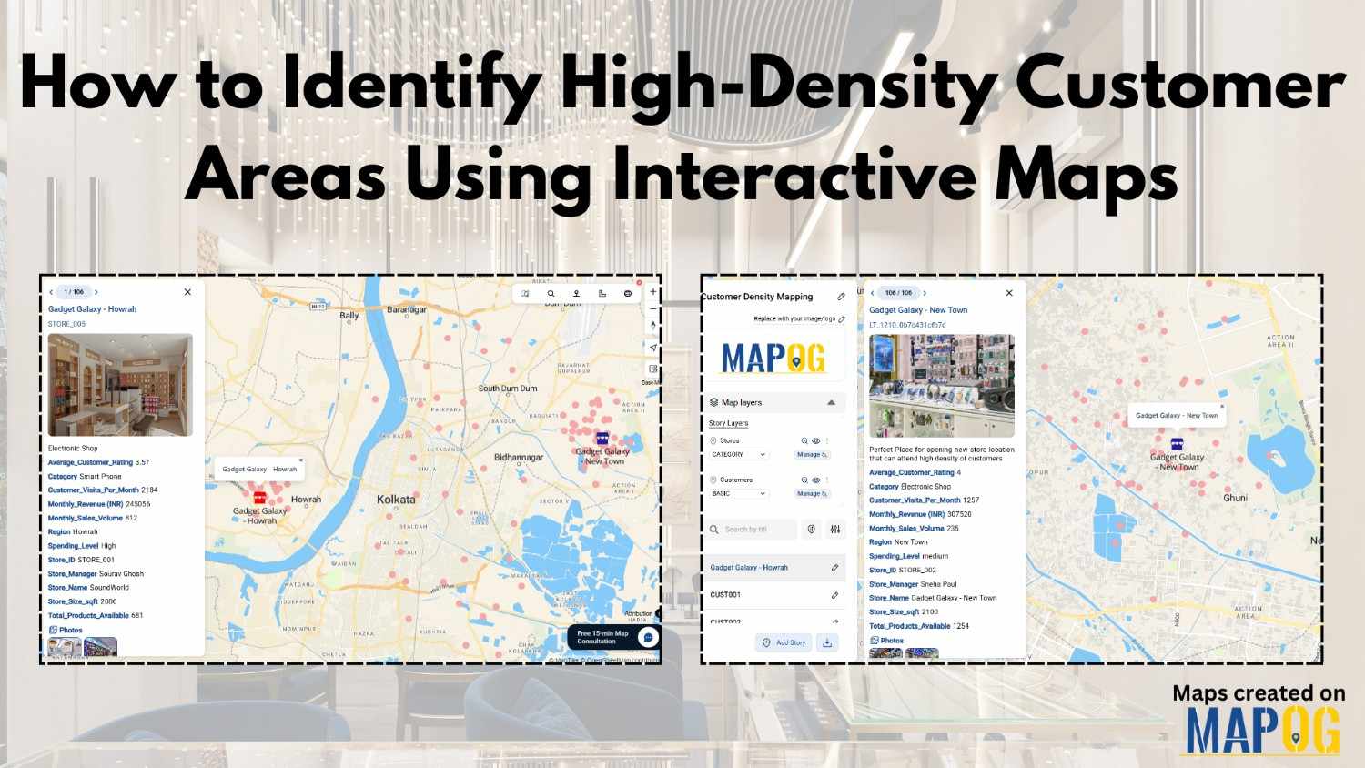
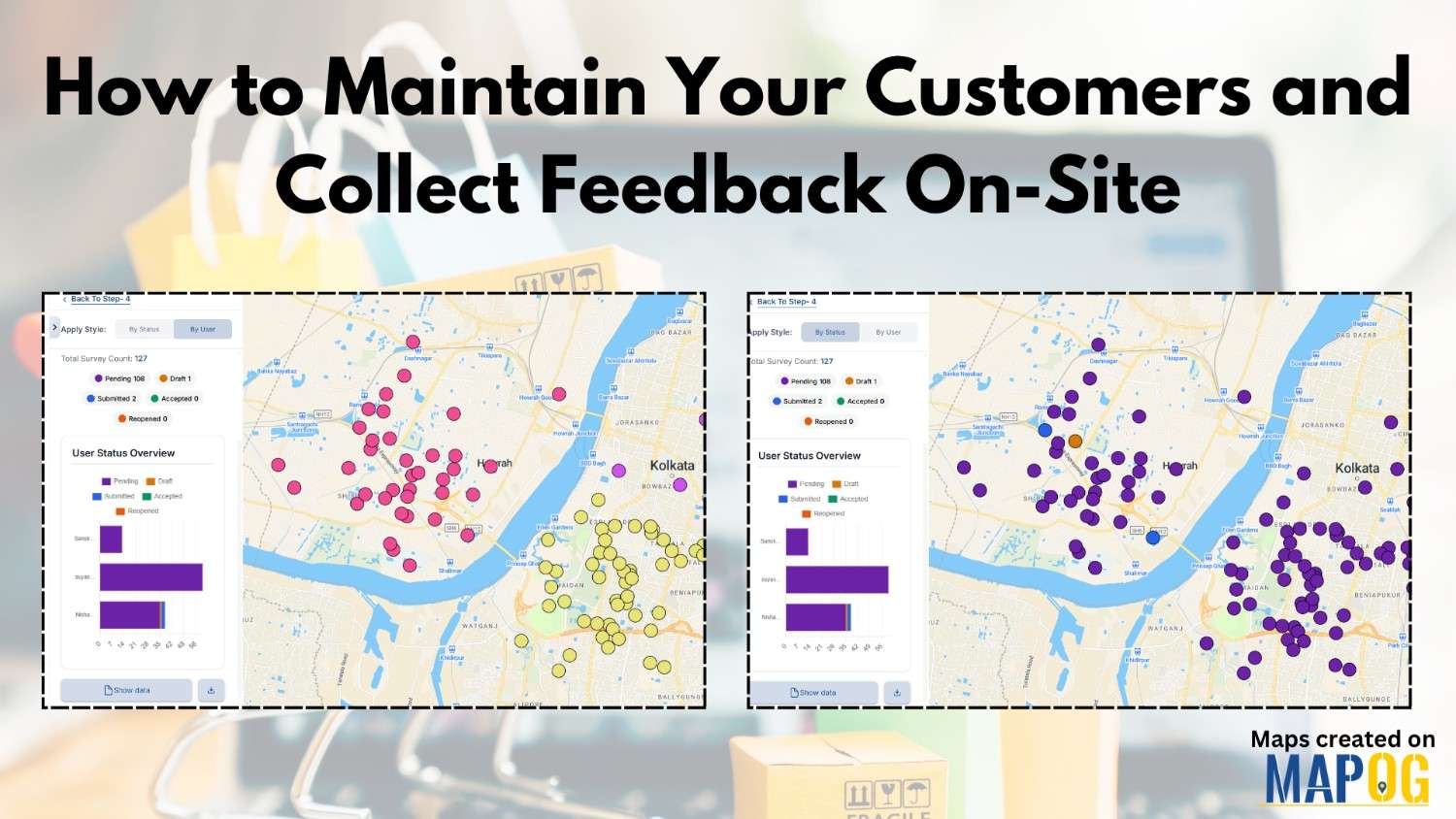
#mapog

Learn how to build mobile-friendly web maps quickly and easily using MAPOG for responsive, interactive mapping.

How to Build Mobile Web Maps Quickly and Easily

In the era of smartphones, build mobile web maps has become essential for real-time navigation, planning, and communication. Traditional GIS software can be complex and desktop-oriented, but MAPOG makes it simple to build fully responsive, mobile-friendly interactive maps without coding. From visualizing city infrastructure to projects like “Showcase Your Hotel with an Interactive Property Map for … Read more

Interactive Maps for Better Engagement

Why Businesses Are Switching to Interactive Maps for Better Engagement

Businesses today are moving beyond static visuals and lengthy reports — they’re using interactive maps for better engagement to turn raw data into visual stories. From real estate firms displaying project portfolios to tourism companies mapping destinations, and logistics brands tracking operations, interactive mapping platforms like MAPOG are helping businesses communicate more effectively and engage … Read more

Easy Mapping Tools

Easy Mapping Tools Are Revolutionizing Real Estate Project Planning

Creating detailed maps for real estate projects or buildings once required technical GIS knowledge or expensive software. For developers, planners, easy mapping tools for real estate projects often meant relying on specialists just to visualize property layouts or land parcels. However, the rise of easy, no-code mapping tools has completely changed that. MAPOG now make … Read more

georefrencing the image

How Can I Georeference a Base Map Image and Digitize the Data?

Adding georeferenced image overlays—such as PNGs or GeoTIFFs—to a map can be challenging. Especially when working with , georeference a base map image or custom visuals. The main difficulty lies in aligning the image with real-world locations so that landmarks and features appear at the correct scale and position. While many GIS platforms support raster … Read more

How to Sort Map Locations by Distance from Your Current Location

In today’s fast-paced, location-driven world, knowing exactly where things are in relation to you is essential. Whether it’s finding the nearest hospital during an emergency, locating a petrol pump while traveling, or discovering nearby restaurants and stores, thus being able to sort map locations by distance from your current location can save significant time and … Read more

5 Essential Features Every Interactive Map Should Have

Interactive maps for tourism planning transforms raw data into dynamic visuals, helping manage tourism efficiently. Additionally, the 5 essential features every interactive map should have are Real-World Updates, Custom Icons & Labels, Heatmaps, Pop-Ups and Collaboration. Key Concept: interactive maps for tourism planning Interactive maps highlight attractions, heritage sites, hotels, and amenities while integrating layers like … Read more

Color-Code Map Points by Category (Online, No-Code)

To begin with, Color-Code Map Points is a simple yet powerful way to transform raw data into clear, visual insights. Moreover, this approach enables governments, planners, and communities to classify projects, services, or assets into instantly understandable categories on a single interactive map. As a result, we can instantly track and visualize metro stations in … Read more

Monitor & Maintain CCTV Installations with Interactive Maps

Monitor & Maintain CCTV Installations with Interactive Maps

Running a CCTV Installation Map helps businesses manage hundreds of camera sites, clients, and service requests efficiently. Traditionally, companies relied on Excel sheets, WhatsApp chats, or handwritten registers, which made tracking installations confusing. But managing installations, clients, and service records in scattered places quickly becomes confusing. That’s where an interactive map comes in — a … Read more

Change Map Icons & Sizes Based on Your Data Values

Often, when faced with a large set of data, it is very difficult to visualize it together. We need the help of data visualization tool in digital maps. Suppose you are a businessperson, who owns several retail chain stores across the city and need to see the performance of your stores in an effective manner. … Read more

Share an Interactive Map with Teammates (View or Edit Access)

Best Way to Share Interactive Maps Online with View and Edit Access

Today, readers and team members expect more than just static information when exploring content or managing data online. Whether it’s tracking locations, updating details, or monitoring progress, interactive maps make collaboration simple and engaging. With MAPOG, you can easily share an Interactive Map with teammates, assigning view or edit access to ensure the right people … Read more