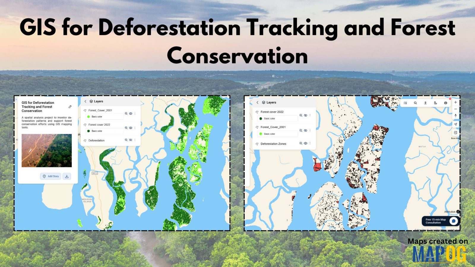
How to Use GIS for Deforestation Tracking and Forest Loss Analysis
Using GIS for deforestation tracking has become a powerful approach in environmental research. Every year, massive tree cover disappears. Therefore, tracking these changes accurately becomes essential for timely forest conservation efforts. GIS helps researchers and conservationists visualize forest loss clearly and over time. Consequently, it enables faster and smarter decision-making. One of the simplest tools … Read more