Create Story Maps for Education: A Visual Way to Teach History, Geography, and More
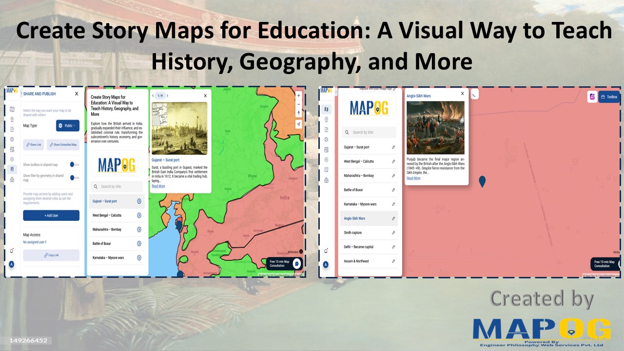
Visual storytelling through maps offers a dynamic way to teach history, making abstract timelines and political shifts more tangible. When learners can Create Story Maps for Education, they visualize how historical events unfolded across space, leading to deeper understanding. For example, using a British India interactive map, educators can illustrate how the British Empire expanded—from … Read more