Mapping Top National Parks play a vital role in conserving biodiversity and protecting natural landscapes while offering recreational opportunities that connect people with the environment. Additionally, these protected areas serve as sanctuaries for endangered species, geological wonders, and cultural heritage. From towering mountain ranges to vast desert expanses, national parks also support sustainable tourism, scientific research, and environmental education. Moreover, they foster a strong sense of stewardship for future generations.https://youtu.be/xl5TD22IhwU?si=YvOLgRJRWcwwCYvJ
Key Concept: Why Mapping Top National Parks Matter
National parks serve to safeguard ecological integrity and promote public enjoyment of pristine natural areas. Additionally, they help combat habitat loss, preserve scenic beauty, and provide essential refuge for wildlife. As climate change and urbanization increasingly threaten natural systems, national parks, therefore, offer controlled environments to monitor environmental shifts and test innovative conservation strategies. Moreover, they support eco-friendly economies by attracting sustainable tourism and enabling community-based conservation efforts.
Importance and Uses of Mapping Top National Parks
Mapping Top National Parks fulfill multiple roles in environmental conservation, education, and public engagement, including:
- Biodiversity Conservation – Protect ecosystems, endangered species, and genetic diversity.
- Climate Change Research – Serve as natural laboratories to study ecological responses to climate shifts.
- Recreation and Tourism – Offer outdoor activities that promote physical and mental well-being.
- Cultural Heritage Preservation – Safeguard historical landmarks and indigenous knowledge systems.
- Environmental Education – Provide platforms for learning about ecosystems, sustainability, and climate action.
- Community Development – Create jobs, support local businesses, and encourage sustainable livelihoods.
Methodology: Mapping Top National Parks Using GIS
This methodology outlines the process of creating geospatial points to represent the mapping Top National Parks globally using Geographic Information Systems (GIS). It involves the integration of diverse data sources to create accurate, comprehensive, and user-friendly maps to facilitate park management, research, and public awareness.
1. Selection of National Parks
- Researchers compile a list of significant mapping Top National Parks by applying criteria such as biodiversity, ecological value, conservation importance, historical significance, and global recognition.
- Furthermore, they often select these parks for their unique natural features, which include rare species, endemic flora, and vital ecosystems.
2. Collection of Geographic Coordinates
- The central geographic coordinates (latitude and longitude) for mapping top national parks come from reliable and authoritative data sources, such as global environmental databases and official park records.
- Moreover, ensuring the accuracy of these coordinates is crucial. It guarantees correct park positioning on the map and enables precise spatial analysis.

- When creating the new story, be sure to select the travel option.
- Then, assign a relevant title, specify the number of travel days, and provide a detailed description of the map in MAPOG.
- Additionally, make sure the story accurately reflects the journey and highlights key locations along the way.
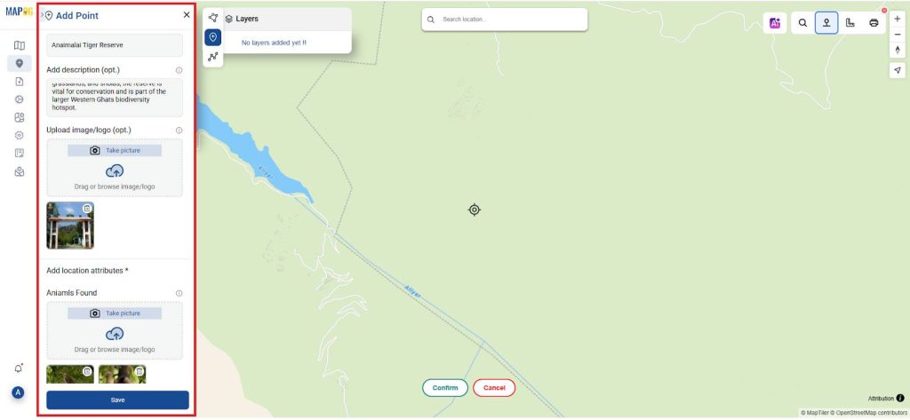
3. Creation of Point Features
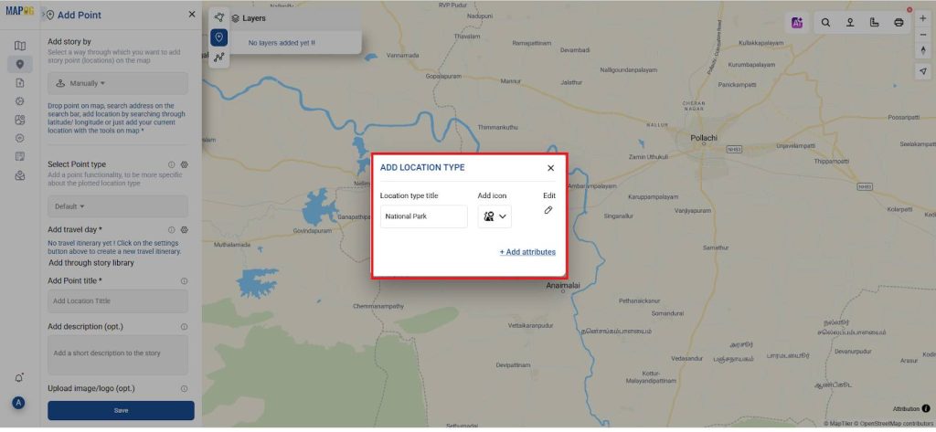
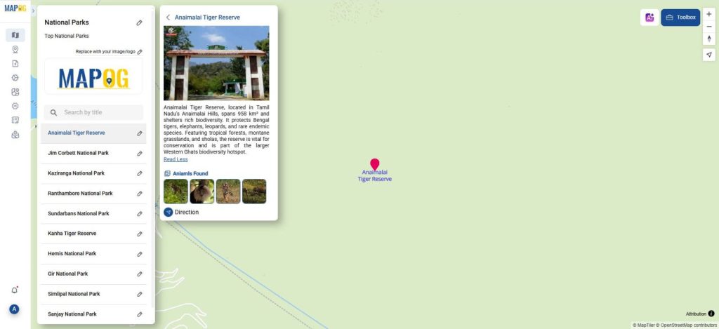
- A point feature is created for each national park using GIS in Add story, marking the exact location of mapping top national parks on a digital map.
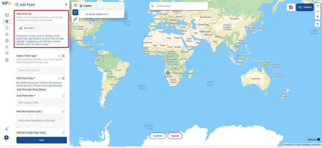
- In add story select the add point by manually and in point type move to the settings of location type management add more location types as national park and add attributes as animals found and save it.
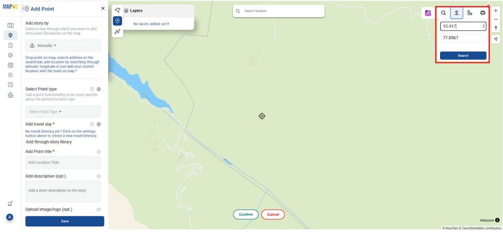
- In the top right corner select the toolbox icon in which the latitude and longitude give the exact locations of the national parks the points and press conform then the points be created.
- Next, select the point type as “National Parks.”
- Then, assign the point title to the name of the national park.
- After that, provide a detailed description and attach an image related to the point.
- Finally, save the information to complete the process.
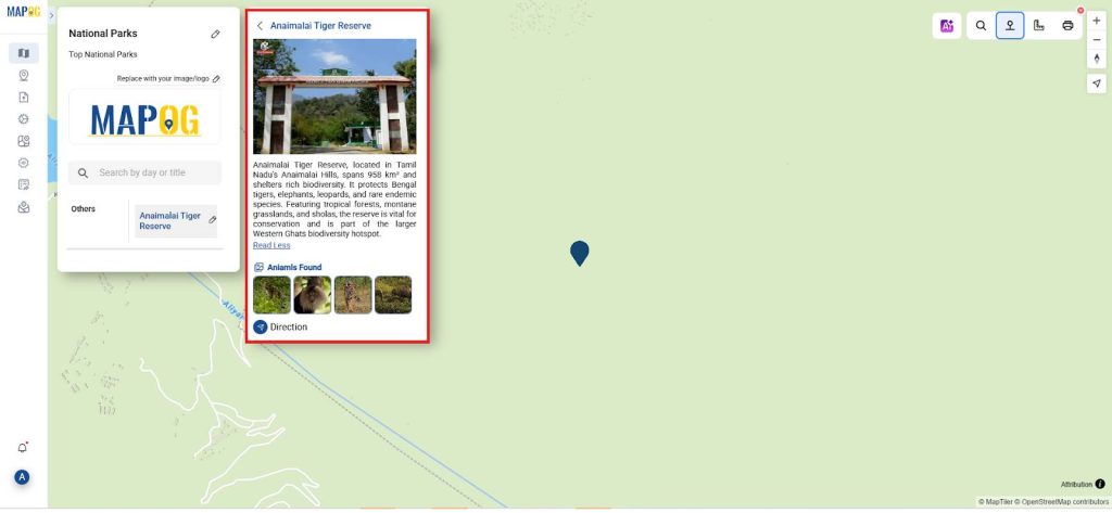
- Similarly, add the points for all the national parks.
- For each park, select the point type as “National Parks,” assign the point title using the park’s name, and include a description along with a related image.
- Once all the details are added, save the information for each national park.
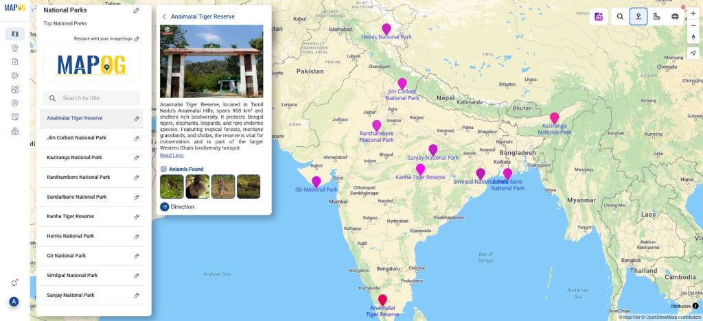
4. Visualization and Styling
- Point customization to distinguish between parks based on factors such as ecosystem type, conservation status, and size.
- The map uses various color schemes and symbols to make the data visually appealing and easily understandable.
- Labels are added to display essential details about each park when selected, enhancing the user experience.
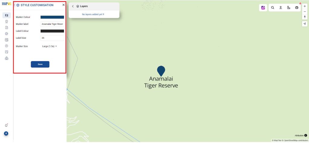
- These visual elements allow users to quickly compare parks based on location, and other attributes, making it easier to analyze the spatial distribution of natural reserves globally.
5. Presentation and Sharing
- The map is designed to be accessible and easily interpreted by various stakeholders, including researchers, park managers, tourists, policymakers, and the general public.
- The final product is shared using the publish & share option, providing a tool for environmental education, conservation planning, and tourism development.
- Interactive maps can be used in online platforms, reports, or presentations to highlight national parks’ contributions to biodiversity conservation and their role in sustainable tourism.
- By offering an engaging and user-friendly interface, the map increases awareness and encourages responsible park usage.
Principal Results in Mapping Top National Parks
The principal results of the Mapping Top National Parks Using GIS project include the creation of an interactive, cloud-enabled GIS platform that showcases significant natural reserves across the globe. This user-friendly system allows exploration of national park locations, ecological features, visitor accessibility, and conservation status. MAPOG platform integrates park boundaries, biodiversity data, and infrastructure layers to enhance understanding of protected areas and their ecological importance.
Industry and Domain
- Industry: Geospatial Technology, Eco-Tourism, Environmental Conservation. The system leverages GIS tools and environmental datasets to map park boundaries, monitor ecosystem health, and support nature-based tourism.
- Domain: Protected Area Management, Biodiversity Conservation, Environmental Education. The GIS solution aids in assessing ecological value, managing natural resources, and promoting awareness of heritage landscapes.
Conclusion
The GIS-based platform greatly enhances the mapping and understanding of national parks by providing layered, interactive visuals that clearly highlight ecological zones, showcase tourism opportunities, and emphasize conservation needs. Moreover, it offers a valuable resource to park authorities, researchers, and eco-tourists alike, empowering them to make informed decisions that support sustainable park management and the preservation of natural heritage.
An Online Map-Making Tool: MAPOG
The Mapping Top National Parks initiative gains added strength through the use of the open-source platform like MAPOG. With interactive features in layered map design and spatial analysis. This platform enables users to explore parks from multiple perspectives, assess conservation challenges more effectively, and responsibly plan visitor experiences. Furthermore, its application in this context promotes collaborative environmental protection, supports data-driven tourism strategies, and fosters deeper engagement with global natural treasures.
Several of the studies mentioned here actively employed the MAPOG platform.
Role of GIS In Irrigation Planning and Water Resource Management
How GIS and Smart Mapping Reduce Urban Heat Islands
GIS in Infrastructure Development and Road Network Analysis
Flood Risk Mapping with Interactive Web Maps: SaaS Approach
Optimizing Warehouse Location Selection with GIS for Supply Chain Efficiency