Mapping Coastline Marathon organizing a marathon along coastline requires accurate GIS mapping . By plotting hydration points, medical tents, and key milestones, planner, smooth logistics, and a great runner experience without complex crowd-flow simulations, using interactive maps with coastline and checkpoint data.
Key Concept: Mapping Coastline Marathon
- Map start/finish lines, mile markers, and facilities along coastline for accurate route planning.
- Moreover, geotag race points and support stations to streamline logistics, guide runners, and manage spectators.
Identifies:
- Key race milestones with facilities nearby.
- Hydration, medical, and info stations at strategic points.
- Safe spectator zones and volunteer positioning.
Uses of Mapping Coastline Marathon
- Strengthens event-planning skills for students, GIS learners, and organizers using route-based mapping.
- Supports runner safety, emergency response, crowd management and large event.
Methodology: Mapping Coastline Marathon
Project Focus: Creating an interactive route map for the Coastline Marathon with all mile markers and amenities using MAPOG’s mapping tools.
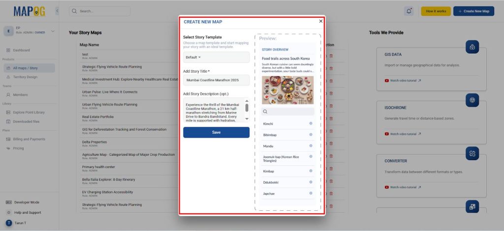
1. Start a New Project and Add a Title
- Go to the MAPOG website and click “Create New Map.”
- Assign a project name (e.g., Coastline Marathon – Route Map) and add a short description.
2. Adding Points Using Add story
- Now go to Add story and select Add manually.
- Then go to the settings in select feature type in which select the add more locations type.
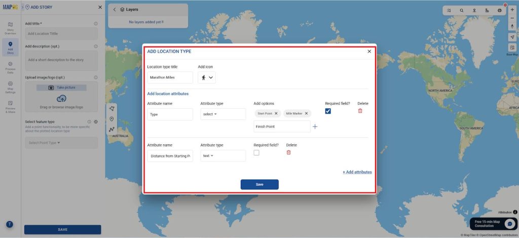
- Addition, give the Location type title as “Marathon Miles” give it an icon and add location attributes like
- Attribute name – Type and Attribute type – select and add options like Start Point, Mile Marker and Finish Point and tick the required field.
- Attribute name – Distance from Starting Point and Attribute type – text.
- Attribute name – Expected Start Time and Attribute type – text.
- Attribute name – Medal and Refreshment and Attribute type – select and add options as Available and tick the required field.
- Attribute name – Mile and Attribute type – text.
- Then, give it a title as Starting point and a short description and add related images and add all the details.
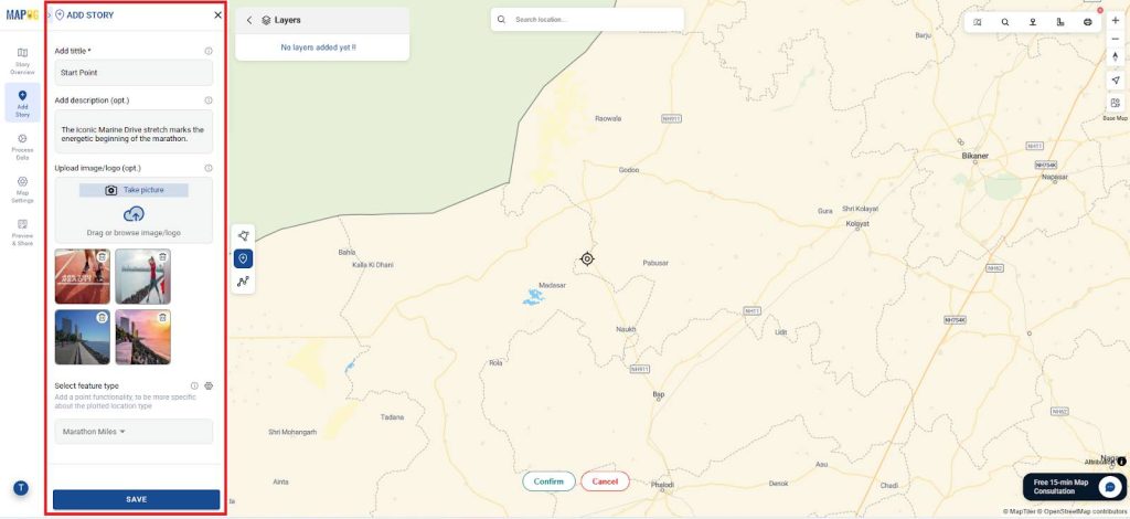
- Then , locate the location manually using the latitude and longitude in the toolbox and conform it and save it.
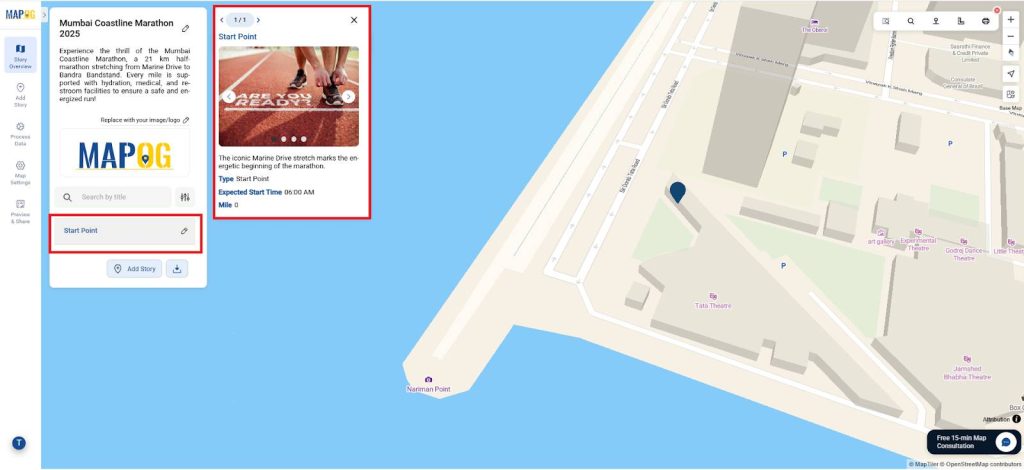
- Similarly, Create for all the other locations and give all the details.
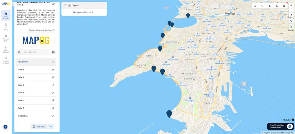
3. Add nearby details
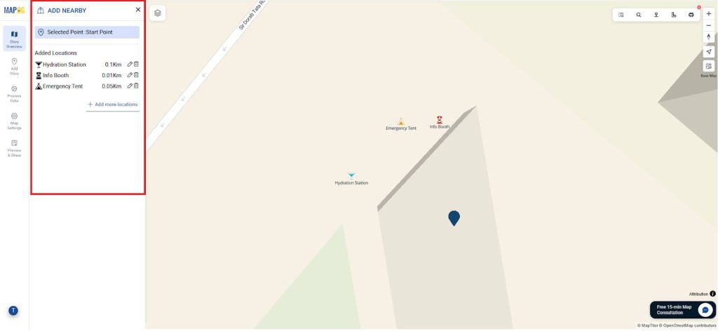
- Now go to the edit icon in each point and select add Near by point and give the details and style it using changing the color and icon.
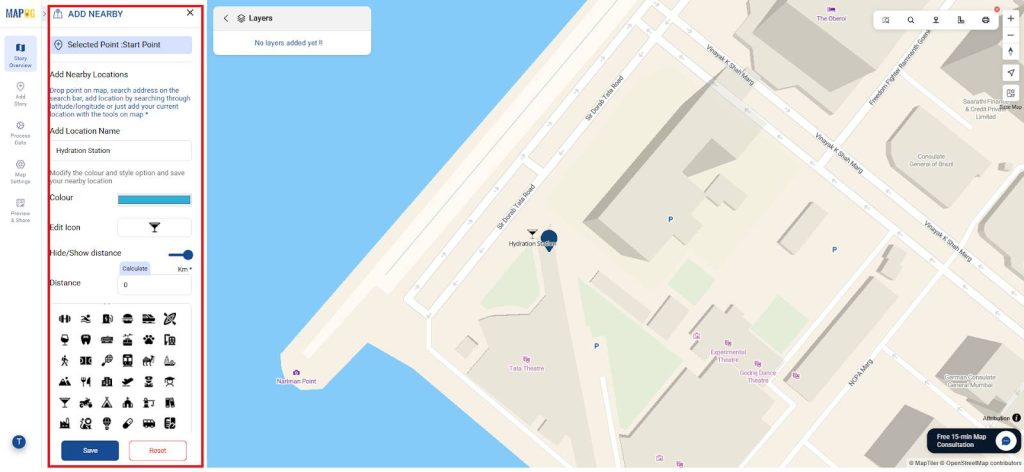
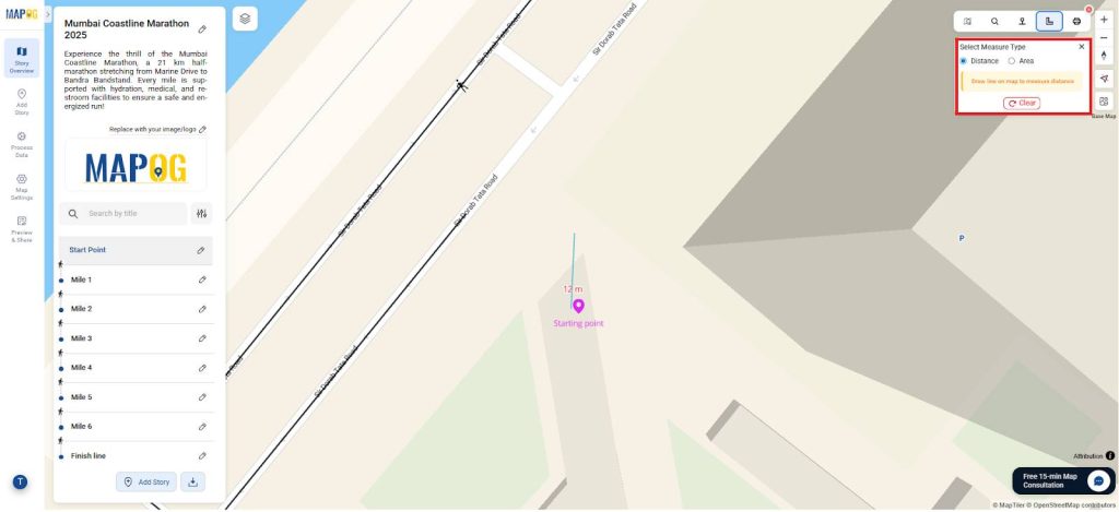
- Then, similarly you can add as many as nearby locations distance by using distance measurement in the toolbox and switch on show distance for all locations and add for all the locations.
4. Location connection
- Additionaly, now go to the edit icon in each point and select location connection in which select the road line and an icon for it and save it.
- For location connections start with the mile 1 to the finishing point since the starting point is the origin (i.e.., starting point of marathon).
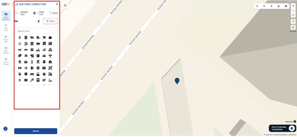
- Then, similarly do it for all the points.
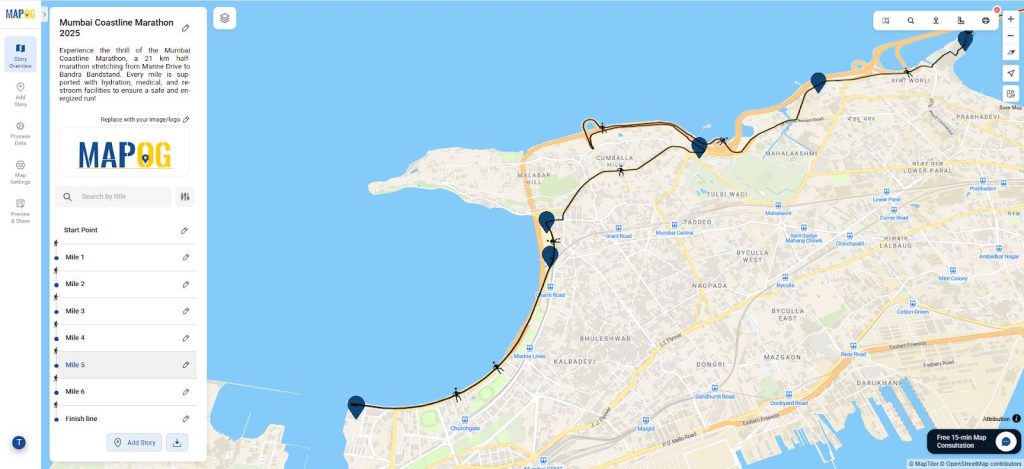
5. Style the Icon and Label it
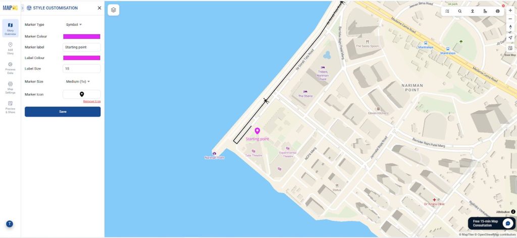
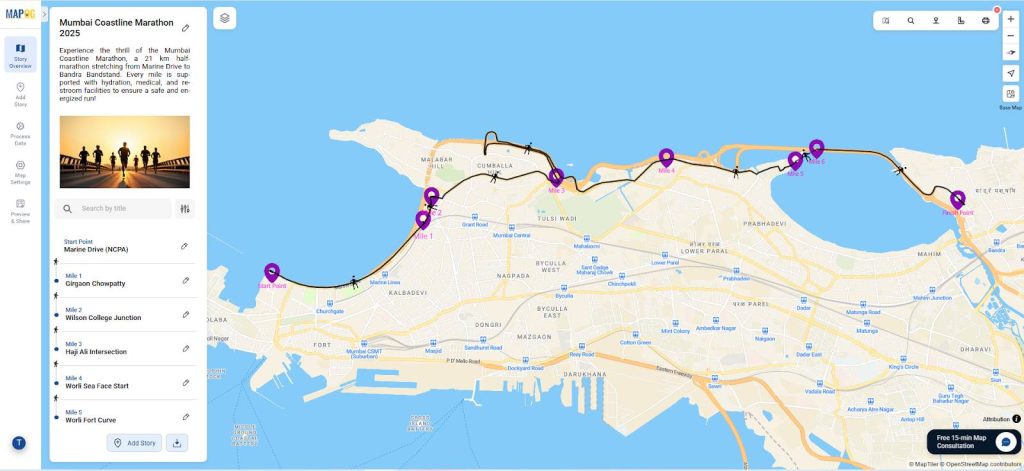
- Moreover, now go to the point customization using the edit icon and give it an icon and change color and label it as shown.
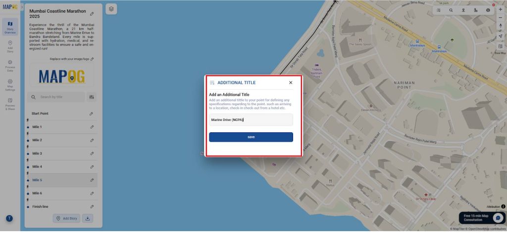
- Then select Additional title and give an additional heading to all the points.
6. Publish and Share the Map
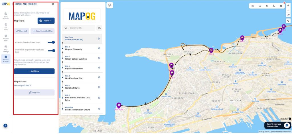
- Also, use MAPOG’s Publish & Share feature to generate a live link or embed code .
- Accordingly, distribute the link to runners, volunteers, and the public for race-day guidance.
Insights and Applications
Consequently , this marathon route analysis helps:
- In fact it ensure safety for runners and spectators.
- Improve resource placement along the route.
Relevance Across Disciplines
- Event Management
- Then, Public Safety and Risk Management
- Sports Geography
In any event, So it also promotes collaboration between planners, volunteers, and authorities.
Conclusion
As a result, GIS-based route mapping in MAPOG empowers marathon organizers with precise planning tools. So, by combining road network data, amenity locations, and spatial filtering, this method ensures a safe, efficient, and enjoyable.
So above all, similar GIS workflows have successfully supported international marathons and large-scale public events.