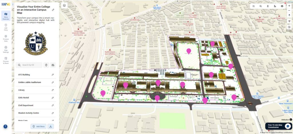
Visualize Your Entire College into a smart, navigable, and interactive digital hub with GIS-powered campus mapping. This modern solution allows colleges and universities to showcase their entire infrastructure—academic buildings, hostels, sports arenas, cultural centers, and even upcoming event venues—on a single interactive map. In this case students, faculty, visitors, and alumni gain instant access to accurate, location-based information, improving campus navigation and overall engagement.
Key Concept: Visualize Your Entire College
- Map academic buildings, hostels, sports facilities, and key amenities in one platform.
- Add navigation layers for classrooms, labs, parking, cafeterias, and administrative blocks.
- Integrate event locations, transport routes, and safety zones for an enhanced campus experience.
Identifies: Visualize Your Entire College
- Academic zones and department clusters.
- Moreover, Residential facilities for students and staff.
- Cafeterias, sports arenas, libraries, and event spaces.
Why Use an Interactive Campus Map?
- Improves Orientation: Helps new students and visitors find their way around easily.
- Streamlines Events: Allocate spaces for workshops, seminars, and cultural activities.
- Enhances Accessibility: Displays wheelchair-friendly routes and accessible entrances.
Uses of Visualize Your Entire College with GIS
- Simplifies campus tours for admissions and open house events.
- Helps facility managers plan expansions, maintenance, and infrastructure upgrades.
- Provides students with a mobile-friendly campus guide for daily navigation.
Methodology: Visualize Your Entire College with GIS
Project Focus: Building an interactive map of the entire college campus using MAPOG’s mapping tools.
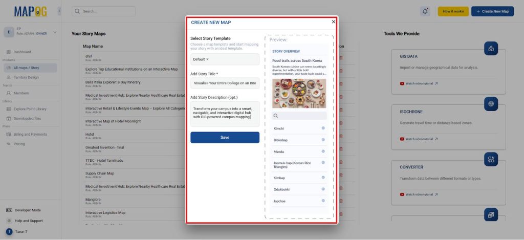
1. Start a New Project
- But open the MAPOG platform and click “Create New Map.”
- Although, name your project and add a brief description.
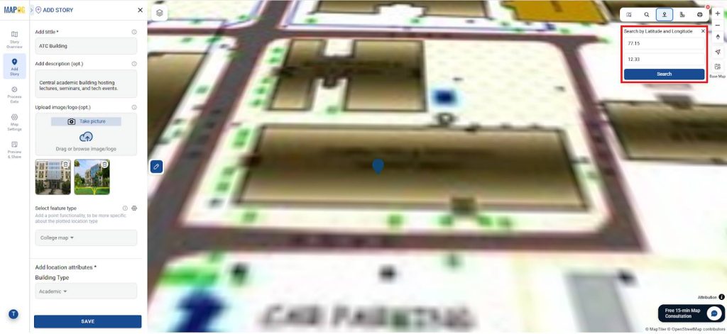
2. Geo Referencing
- Go to process data and select Geo referencing tool and select Geo-referencing.
- Furthermore, upload the image and move to the selected area and move to the toolbox and search the location manually.
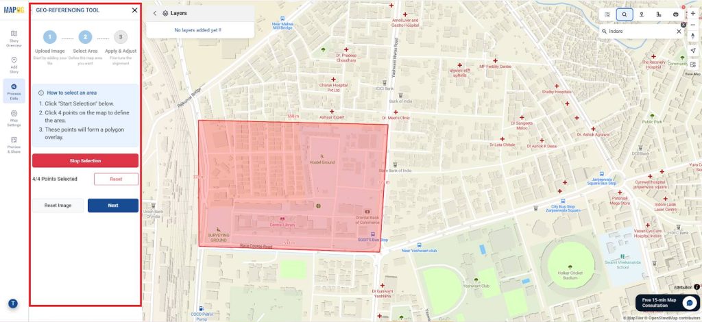
- So select the 4 points to geo reference within it and move to the next step to adjust and fit the image.
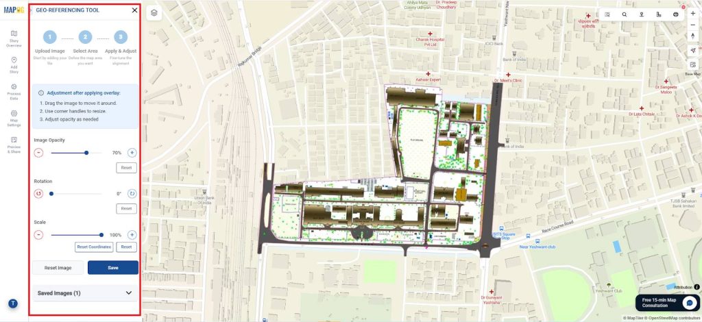
- Correspondingly, once you are perfectly georeferenced it, save it.
3. Add Campus Locations
- Besides, go to Add Story → and select Add Manually.
- Additionally, in Select feature type settings, select Add More Locations type.
- In fact, set location types such as:
- Building Type – Select (Academic, Administrative, Hostel, Sports, Utility, or Mixed-use)
- Primary Use – Select (classrooms, labs, cafeteria, offices, etc.).
- Capacity – text
- Opening Hours – text
- Accessibility Features – Wheelchair access, ramps, elevators, or Braille signage.
- Parking Availability – Type and number of spaces (car, bike, disabled).
- Restrooms & Amenities – Male, female, unisex, or accessible restrooms nearby.
- WiFi Coverage – Availability and strength of campus network in the area.
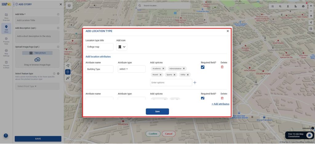
- Similarly, add titles and descriptions for each building or facility and upload images or floor plans for better visualization.
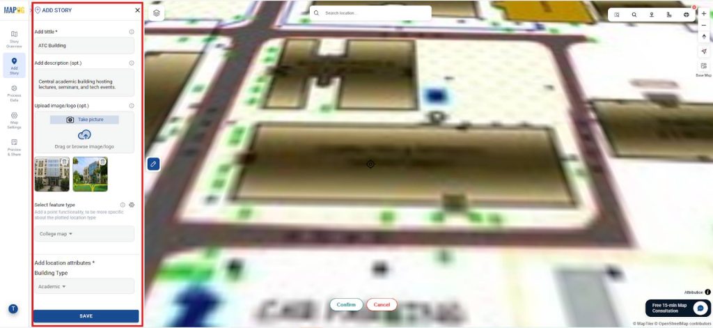
- Additionally, plot each location precisely using latitude and longitude.
- Finally save it and repeat for all the points.
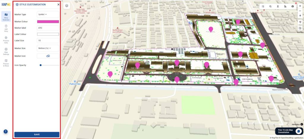
4. Style Icons and Labels
- Then, use point customization to customize icons for dorms, and common areas.
- So, use color coding to distinguish between open access, restricted zones, and event venues.
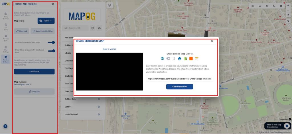
5. Publish and Share
- But, Use MAPOG’s Publish & Share tool to generate a live interactive map link or embed it on the college website.
- And share with students, parents, faculty, and visitors via email or QR codes during orientation.
Insights and Applications
Therefore, this digital campus map can:
- At the same time, Enhance student onboarding during admissions and the first weeks of classes.
- Furthermore, support campus safety by displaying evacuation points and first-aid locations.
- Above all, Act as a central hub for location-based event updates and academic scheduling.
Relevant For:
- College Administration & Planning Teams
- Although, Students and Visitors
- Event Coordinators & Campus Security Teams
Benefits of Campus Mapping
- Boosts Campus Experience: Makes navigation effortless and engaging.
- Facilitates Planning: Supports future infrastructure development and resource allocation.
- Eco-Friendly Solution: Reduces the need for printed maps and guides.
- Community Engagement: Offers a virtual gateway for alumni, guests, and prospective students.
Conclusion
Finally, Interactive campus mapping with MAPOG provides an efficient, scalable, and visually engaging way to explore and manage your college facilities. By integrating academic blocks, residences, while safety zones, and event venues, you can create a dynamic digital companion for your campus community. Similar approaches have guided here.