Fire station mapping is an important step as fires spread fast, and when communities lack nearby fire stations, hydrants, or safety infrastructure, the risk of damage rises dramatically. That’s why mapping fire safety infrastructure has become an essential tool for city planners, emergency responders, and local authorities. furthermore using GIS-based interactive tools like MAPOG to map fire stations, hydrants, and high-risk areas can help decision-makers strengthen disaster preparedness and reduce losses.
Why Use a Fire Station Map?
Moreover, traditional records of fire stations or hydrants are often scattered across documents or outdated plans. However, fire station mapping brings everything into one place, offering a clear view of emergency resources and gaps in coverage. Whether you’re a city official planning new hydrant installations or a safety officer assessing risk zones, a fire safety map makes it easier to act quickly and strategically.
Key benefits include:
- Smarter Risk Planning: Identify areas that lack adequate coverage, highlight underserved neighbourhoods, and plan new fire stations accordingly.
- Faster Emergency Response: Visualise hydrant networks, fire truck accessibility, and shortest routes to high-risk zones.
- Real-Time Updates: Add or update new stations, hydrants, and moreover blocked access points instantly.
- Community Safety Insights: Additionally, mapping helps local communities understand available fire safety resources and risks in their neighbourhoods
How to Map Fire Stations
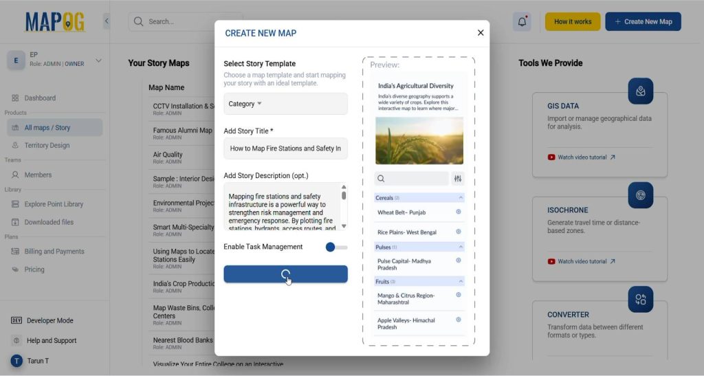
Create a New Map
- Click “Create New Map” on MAPOG.
- Select Map Type as “Category.”
- Add a title and description.
- Save your map.
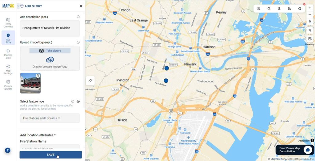
Add Fire Safety Data
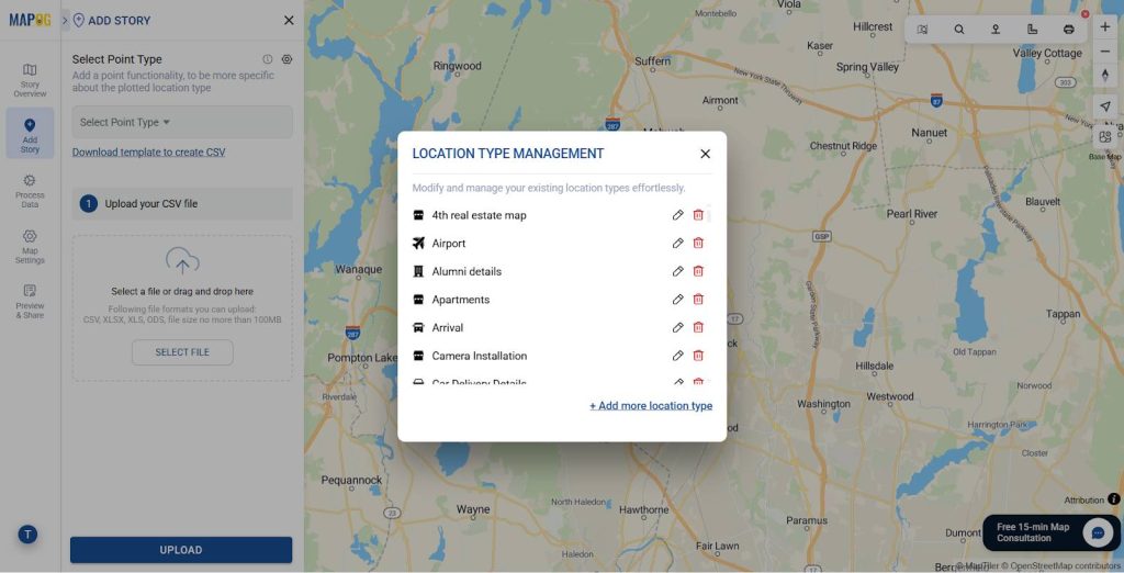
- Add the Point data using Add Story
- Upload the data using Add by uploading Excel/CSV feature.
- Click on select point type and add the location type.
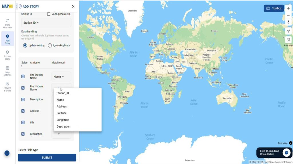
- After adding the location type Add the attributes like Fire Station Name, Address, description etc.
- Match the Attribute Values to Excel Columns such as Fire Station Name, Address, description etc.
- Add the latitude and longitude of the points from the table and click Save.
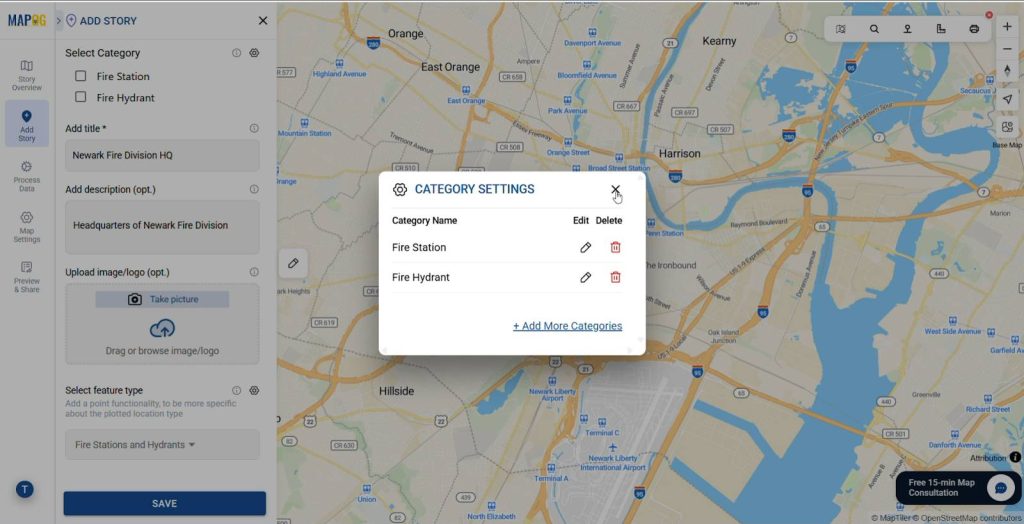
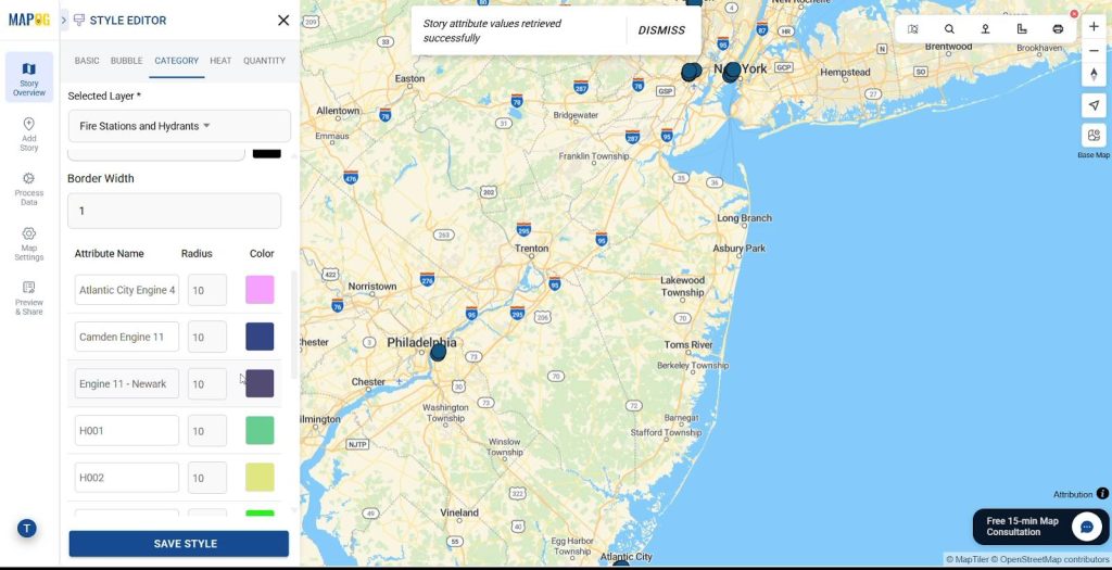
Add Categories
- Go to edit point details & Categorize points as Fire Stations and Hydrants simultaneously.
- Upload images or graphics if needed for easier identification.
Customize Markers
- Click on the Style layer and style the Fire Station and Hydrants layer.
- Use Category Styling and distinct icons or colours for each category and type consequently.
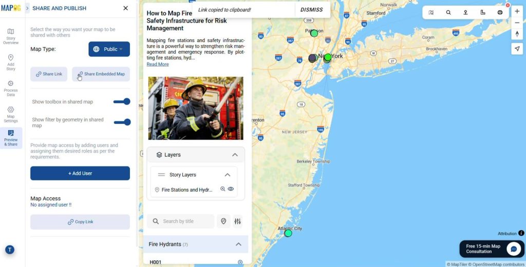
Preview & Share
Finally use the Preview and share option to review your map. Thus share it with local authorities, fire departments, or community groups to enhance preparedness.
Industry Applications & Benefits of Fire Station Map
- Fire Departments
Helps crews locate hydrants, plan routes, and respond faster during emergencies. - Urban Planners
Identifies gaps in coverage to guide placement of new fire stations or hydrants. - Local Governments
Supports disaster management policies and ensures equitable emergency access evidently. - Insurance Companies
Improves risk assessment and helps set fairer premiums based on fire safety coverage.
Conclusion
A Fire Safety Map is more than just a visualization—it’s a life-saving decision-making tool. By mapping stations, hydrants, and high-risk areas together, communities can strengthen resilience, reduce response times, and minimize losses. For residents, it builds awareness; for authorities, it unlocks insights to plan smarter infrastructure.
As cities continue to grow, mapping fire safety infrastructure will play a critical role in protecting lives and property.
Have you seen or used fire safety maps in your area? Share your thoughts and experiences in the comments!
More from MAPOG:
- Protecting Wetlands: Guide to Create GIS Map for Nature
- Fast Emergency Response: Using GIS and Isochrone Maps for 10-Minute Ambulance Arrival
- Make Routes for Military Aerial Planning- Through Bearing angle and Distance calculation – Online Route Compass
- GIS Analysis in Urban Planning: Reshaping Transportation Future Insights of state/city