How to map Destination weddings venues. It combine travel, culture, and celebration into one unforgettable experience, finding facilities like hospitals, and even explore different styles. In addition, this approach promotes better decision-making, while simultaneously inspiring new ideas and allowing for interactive exploration of venues. Moreover, by integrating GIS tools like MAPOG with venue data, wedding planning becomes more dynamic, immersive, and efficient—thus How to map destination wedding venues bridge the gap between location scouting and storytelling.
Key Concept: How to map destination Wedding Venues Matters
Furthermore How to map destination wedding venues shows not only where a venue is located but also what makes it special. As a result, venue maps are powerful tools for wedding planners, travel agencies, tourism boards, and event management professionals, and they can be used both for client presentations and for promotional purposes.
Methodology: Mapping Destination Wedding Venue Map Story Using GIS
1. Create a New Story
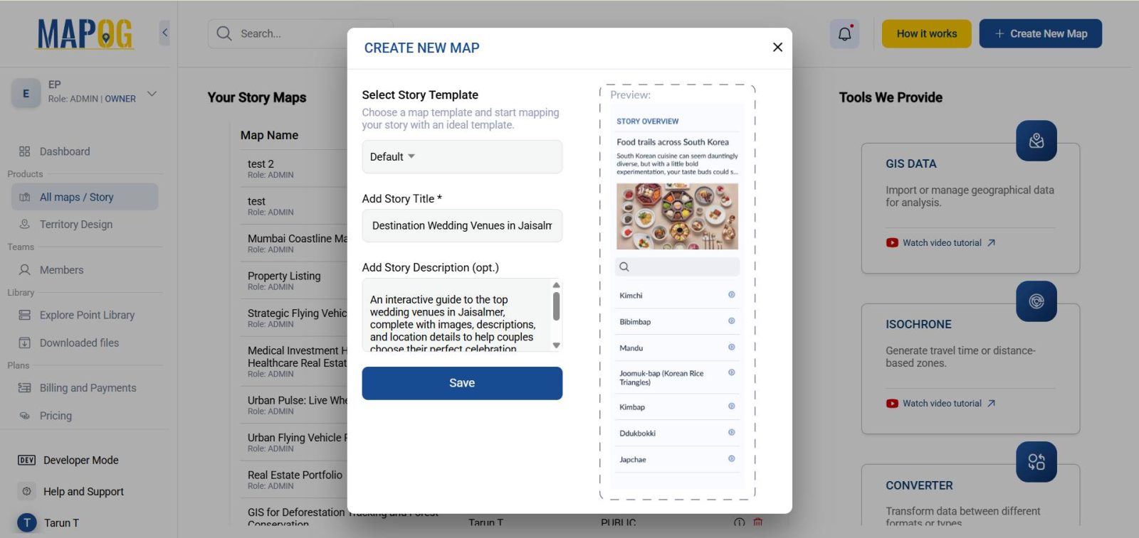
In the beginning On the MAPOG platform, click “Create New” to begin your map story. Title it, for example:
“ Destination Wedding Venues ”
Therefore Add a description, save the project.
2. Adding Points Manually
- Firstly Use the “Add Story” option and add manually, place points on each venue location.
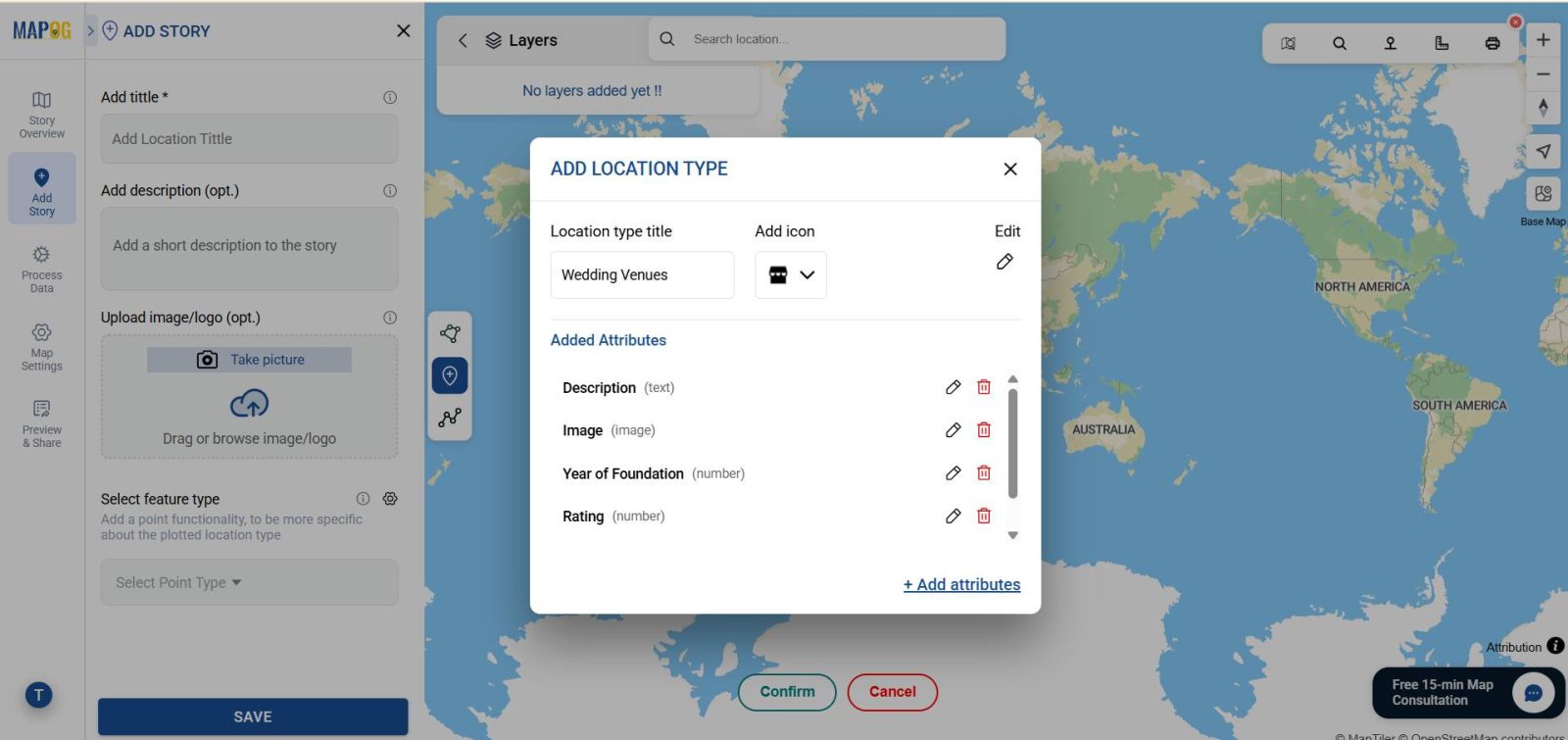
- Secondly click on settings option of select feature type then Under “Location Type Management”, create a new type such as “Wedding Venue”.
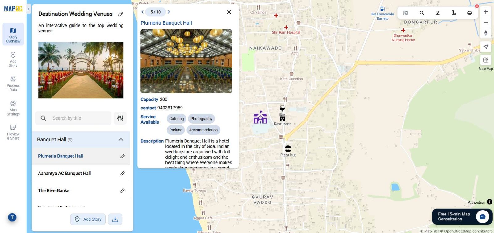
- Add custom attributes like Venue Name, Capacity, Theme, Description, Price Range, Image Link, and Contact Info.
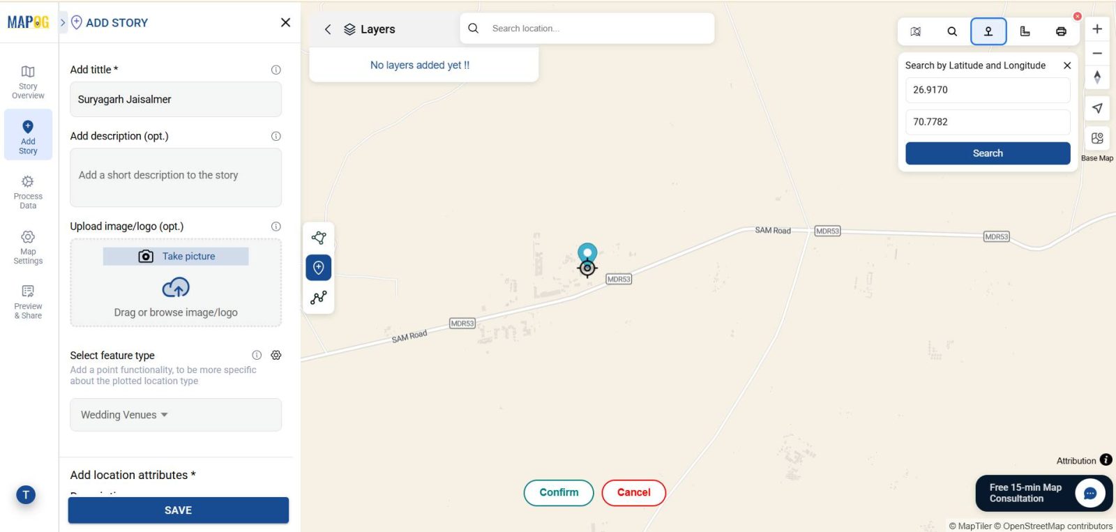
Manually enter the latitude and longitude in search by coordinate option in the toolbox, and confirm the place for precision.
For each point:
- Label it with the venue name
- Upload a high-quality photo
- Include a detailed but concise description of features and facilities
At last Fill in all attribute information and click Save
3. Styling and Visual Enhancements
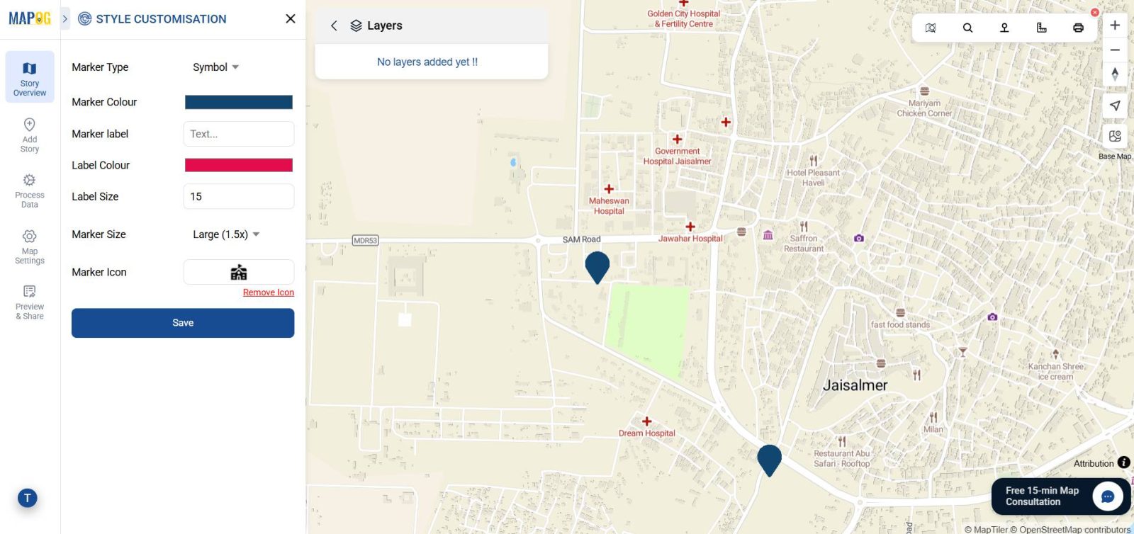
- Customize your map using the point customization options, and in doing so, make it more visually appealing and easier to understand.
4. Add Nearby Places
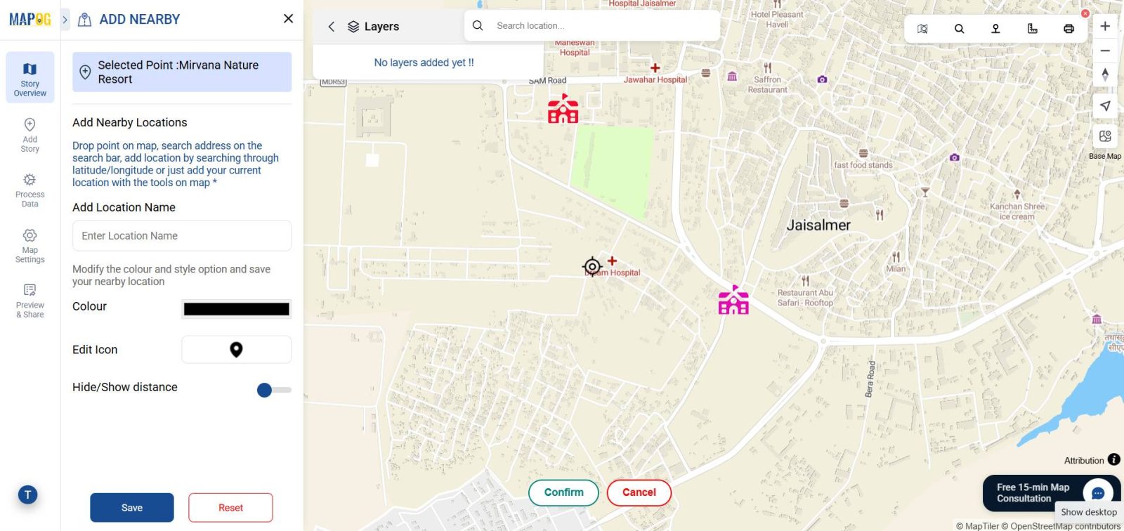
First, go to the Map Settings within the settings menu and turn on the Nearby Locations feature.
Then, click on Add Nearby Location, for each point you create, mark the nearby places you want to highlight. Select the place on the map, and confirm your choice. In addition, you can measure the distance from the venue to that location by using the distance measuring tool located in the top-right corner of the map.
Finally, repeat the process to mark as many nearby places as you wish, ensuring that your map provides a complete view of the venue’s surroundings.
5. Publishing and Sharing
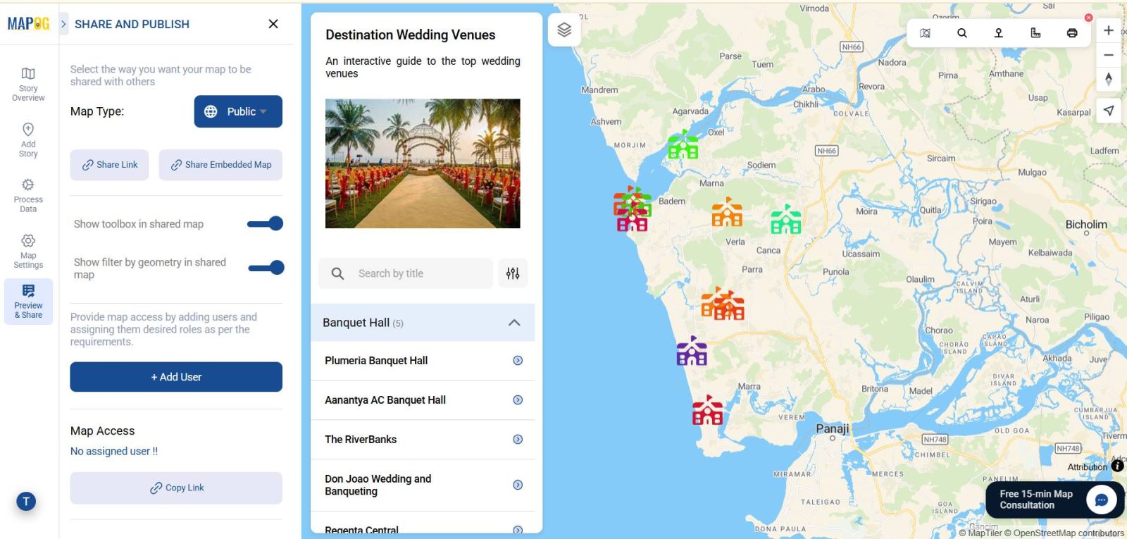
Once you are fully satisfied with your Mapping Destination Wedding Venues , simply use the “Share & Publish” option to set it as either private or public.
Industry and Domain
- Industry: Event planning, hospitality, tourism, and wedding services all benefit greatly from venue mapping, as it supports wedding planners, hotels, resorts, and destination marketing organizations in showcasing locations more effectively
- Domain: Event management, travel planning, digital marketing, and hospitality services can all benefit from venue maps, as these tools are highly effective for planning, showcasing, and promoting wedding destinations to a wide audience.
Conclusion
Mapping destination wedding venues with GIS transforms the planning process from simple guesswork into a captivating visual journey. With MAPOG, both planners and couples can explore venues interactively, while also comparing styles, capacities, and surroundings.
Exploring Our Previous Blogs
- Role of GIS In Irrigation Planning and Water Resource Management
- How GIS and Smart Mapping Reduce Urban Heat Islands
- GIS in Infrastructure Development and Road Network Analysis
- Flood Risk Mapping with Interactive Web Maps: SaaS Approach
- Optimizing Warehouse Location Selection with GIS for Supply Chain Efficiency