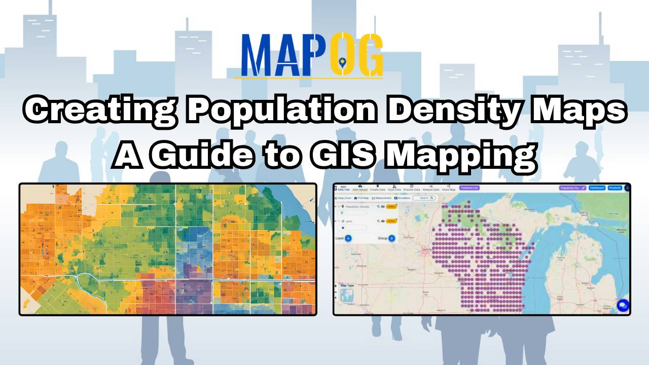
Creating Population Density Maps: A Guide to GIS Mapping
MAPOG’s population density map illuminates spatial patterns, guiding urban planning, healthcare, and policy decisions.
MAPOG’s population density map illuminates spatial patterns, guiding urban planning, healthcare, and policy decisions.
Explore interactive poverty rate heat maps to visualize and analyze socioeconomic disparities. Gain insights for targeted policy-making and community support.
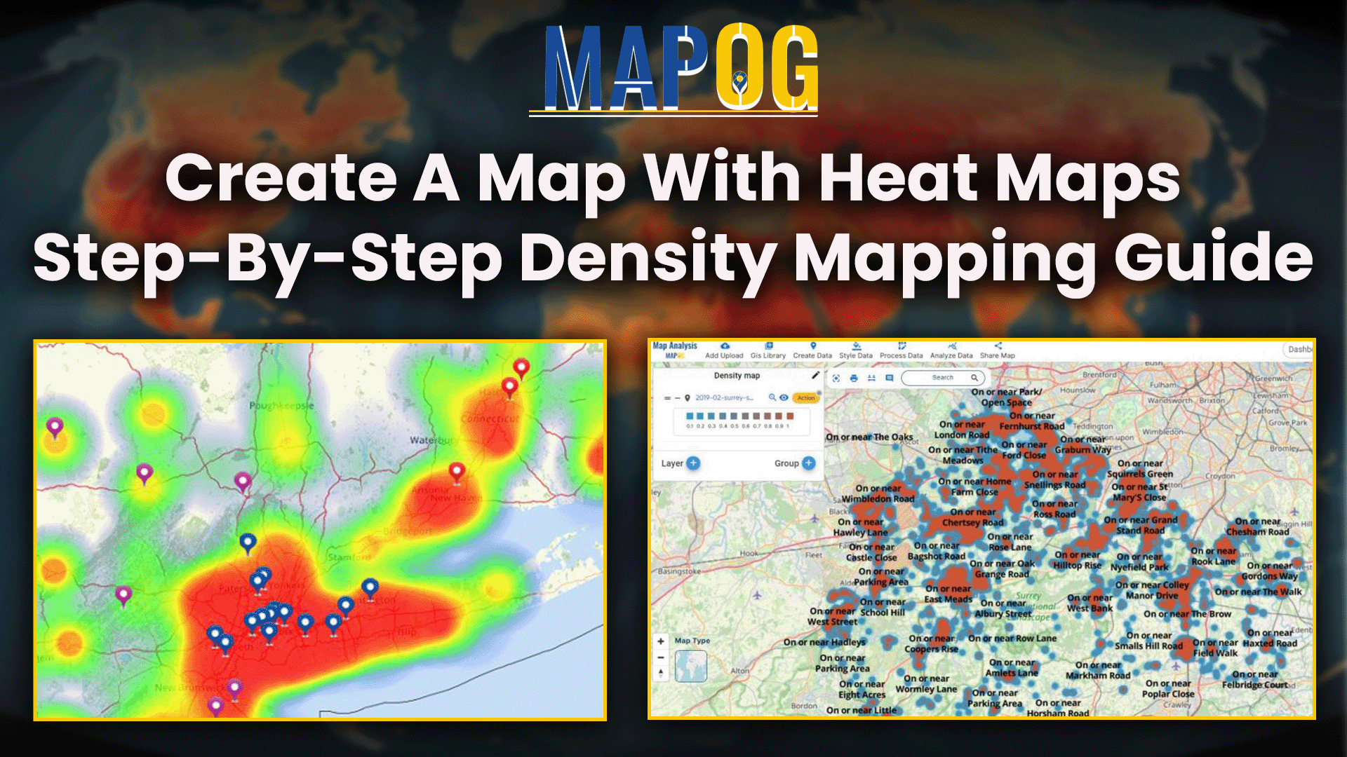
Visualize and analyze spatial data with density mapping using heatmaps. Identify patterns and trends for informed decision-making and planning.
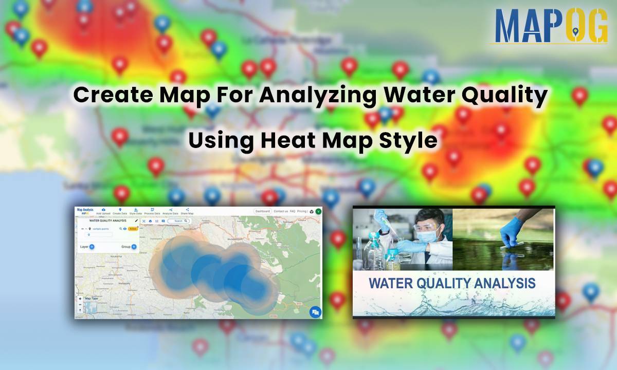
Water, the elixir of life, sustains ecosystems, nourishes communities, and fuels economies worldwide. However, in the face of increasing demands and environmental pressures, the assurance of water quality rises as a critical priority. In this context, MAPOG offers a powerful tool for create map for analyzing water quality using heat map style. This aids in … Read more