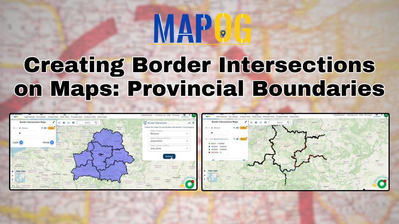
Creating Border Intersections on Maps: Provincial Boundaries
Learn how to map provincial boundaries using MAPOG. Understand border intersections for urban planning, environmental management, and political geography.
Learn how to map provincial boundaries using MAPOG. Understand border intersections for urban planning, environmental management, and political geography.
“Land Use Compliance using Border Intersection in MAPOG” enables urban planners to quickly identify and address non-compliant land use by analyzing the intersections of property boundaries with zoning attributes. Key Concepts Identifying these non-compliance areas quickly and accurately is crucial for effective urban management and enforcement. Steps to create Land Use Compliance using Border Intersection … Read more
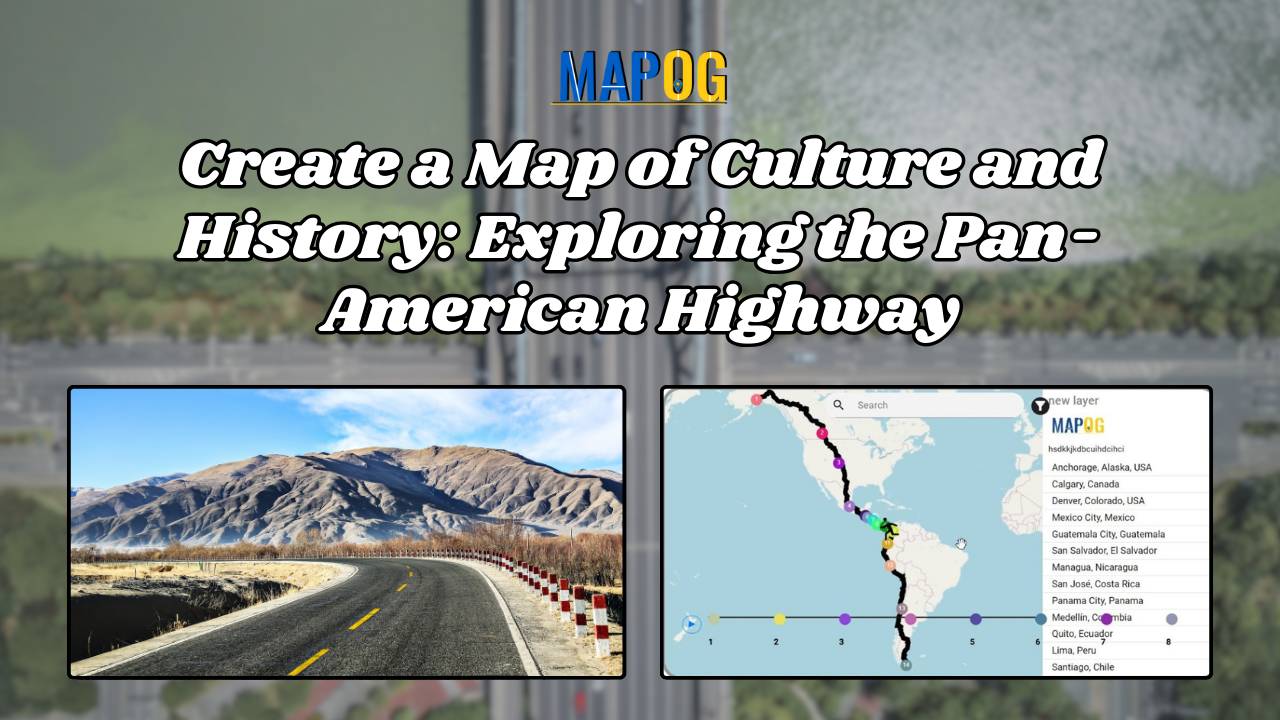
The Pan-American Highway, spanning from Alaska to Argentina, is the world’s longest road, linking 14 countries and numerous cities across North, Central, and South America. Mapping Culture and Historical Perspectives along the Pan-American Highway, This iconic route is not just a transportation corridor but a cultural and historical tapestry that weaves through the diverse landscapes … Read more
GIS analysis reveals where pharmacies should be located near hospitals, ensuring timely access to medicine and enhancing public health outcomes.
Understanding and analyzing sports activities in various areas is crucial for making informed decisions about community health, engagement, and infrastructure investments. Mapping Sports Activity: Using Levels for Analysis, By using the level feature and category style in GIS, we can visualize and categorize sports activities on a map effectively. Key Concept of Create Sports Maps … Read more
Banks strive to ensure that their branches and ATMs are conveniently located for their customers. Mapping Bank and ATM Locations Using Near by Neighbour Analysis, To achieve this, they use a sophisticated technique called ‘Near by Neighbour’ analysis. This method helps banks determine the optimal placement of ATMs and branches, ensuring customers have easy access … Read more
Large lakes present challenges in consistent and comprehensive environmental monitoring due to their vast size and varied conditions. “Lakes Monitoring Using Split Polygon and Split Line segmentation in MAPOG” is a systematic approach to segmenting the lake is necessary for efficient monitoring and effective management of environmental health. Key Concepts By utilizing the Split Polygon … Read more
GIS analysis identifies coverage gaps, places new infrastructure strategically, and optimizes resource allocation for telecom improvements
Proximity analysis reveals spatial relationships, aiding resource management decisions by identifying patterns, risks, and opportunities efficiently.
The task of creating a “Enhancing Hotel Experiences with Mobile Data Collection Survey App” falls to MAPOG. MAPOG information gathering makes it simple to obtain traveler acquisition details. Hotel operators may thus better cater to local tastes, enhance their offerings, and provide a more enjoyable stay for their patrons. Visitors will think it’s a great … Read more