Creating Connectivity: A Spatial Analysis of Urban Accessibility
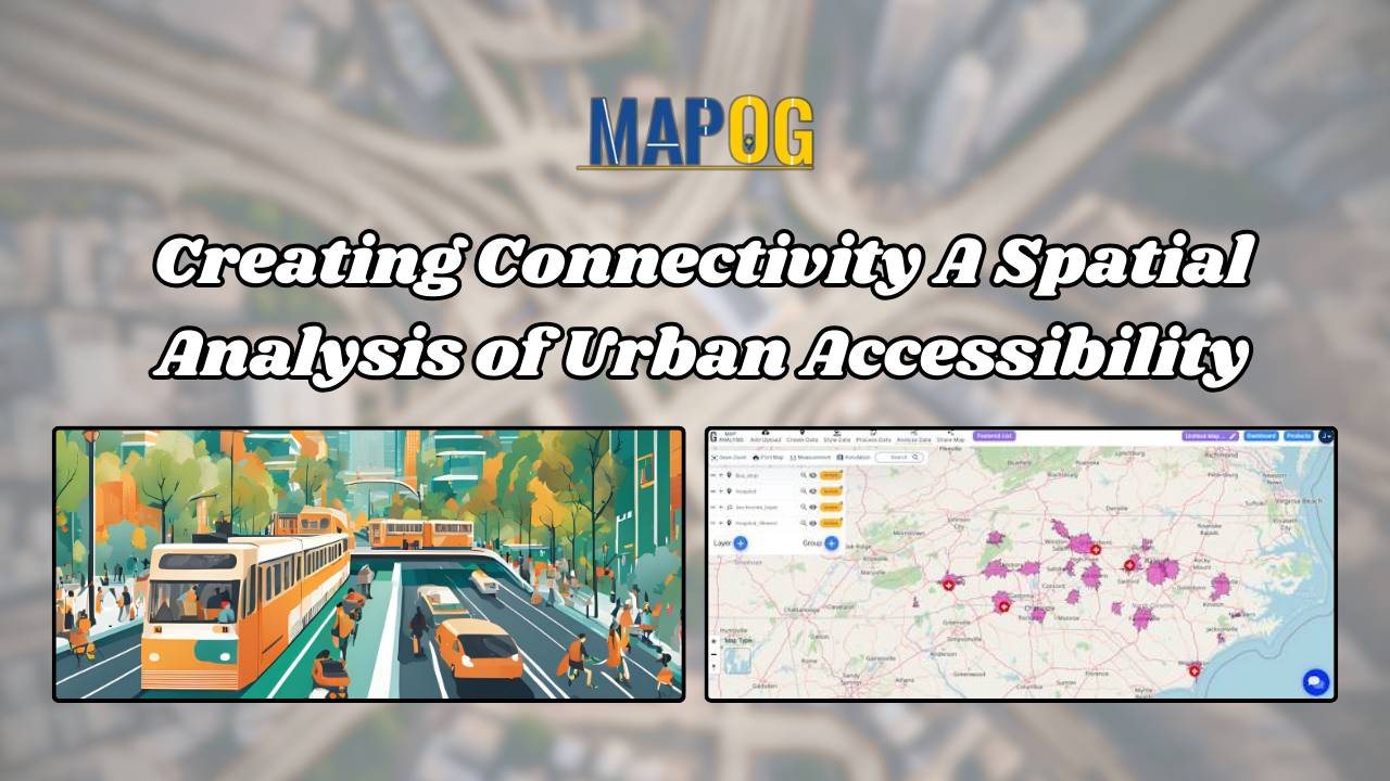
Creating Connectivity: A Spatial Analysis of Urban Accessibility links bus stops and healthcare, revealing areas and strategic real estate opportunities within 20 minutes.
Creating Connectivity: A Spatial Analysis of Urban Accessibility links bus stops and healthcare, revealing areas and strategic real estate opportunities within 20 minutes.
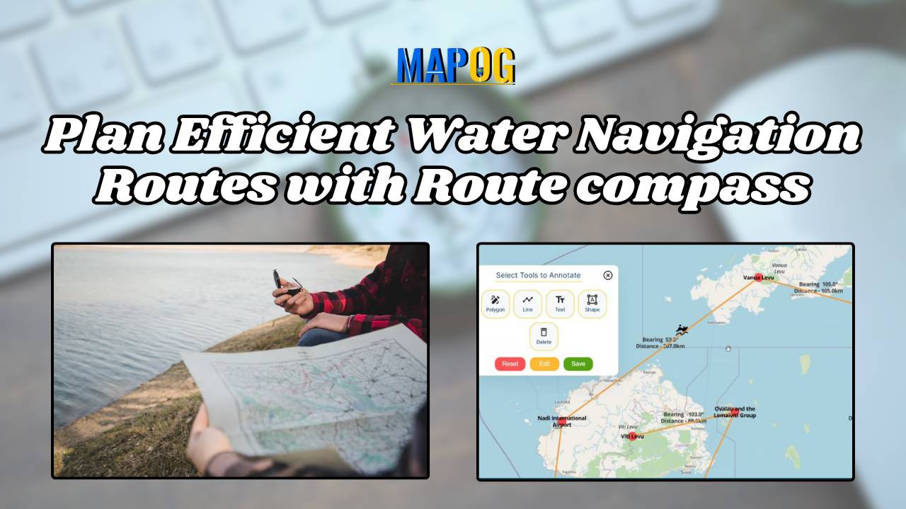
“Plan Efficient Water Navigation Routes with Route compass” will help water route creators to prime their planning process, make easy transitioning between locations and create schedule for guide speaking on related events. MAPOG Compass tool Voyage planner aids in creating itineraries for tour guides and plane navigation for expeditions hopping islands across various routes. Get … Read more
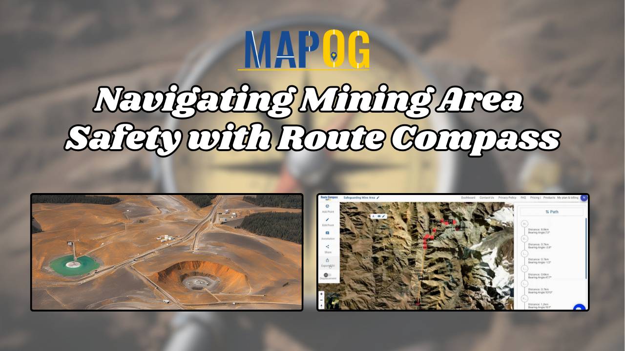
MAPOG‘S Navigating Mining Area Safety with Route Compass utilizes virtual reality technology to ensure site safety in traditional mining operations areas. This innovative technology creates an artificial environment, safeguarding people and equipment, and facilitating regulation observance. Immerse yourself in the dynamic landscapes of urban planning through “GIS Analysis in Urban Planning: Reshaping Transportation Future Insights … Read more
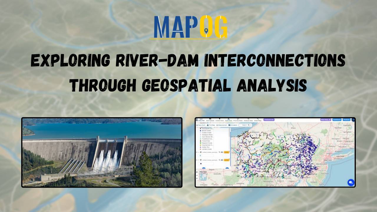
Creating Maps: River-Dam Relationships MAPOG geospatial analysis, aiding hydroelectric power, agriculture, and urban planning.
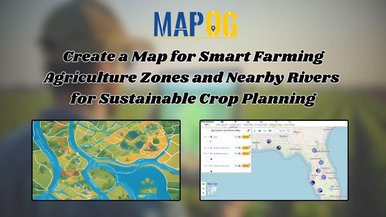
Create Map for Smart Farming. MAPOG’s innovative map creation process integrates agriculture and river data, offering actionable insights for smart farming.
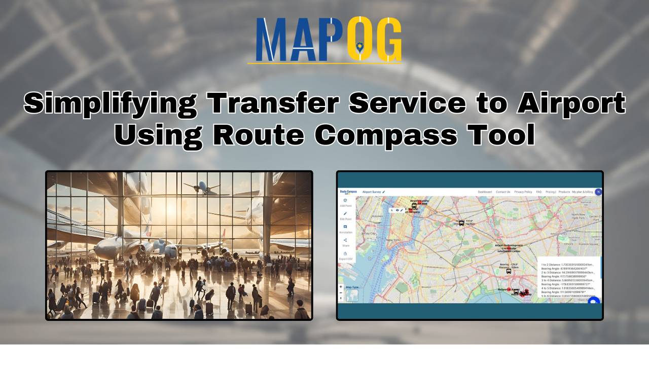
In order to successfully plan and carry out development at this bustling aviation hub, “Simplifying Transfer Service to Airport: Using Route Compass Tool” improves accuracy and efficiency in the surveying process. Users and experts use MAPOG‘s Route Compass map for precise surveying at an International Airport, optimizing topographic assessments and safety considerations in the intricate … Read more
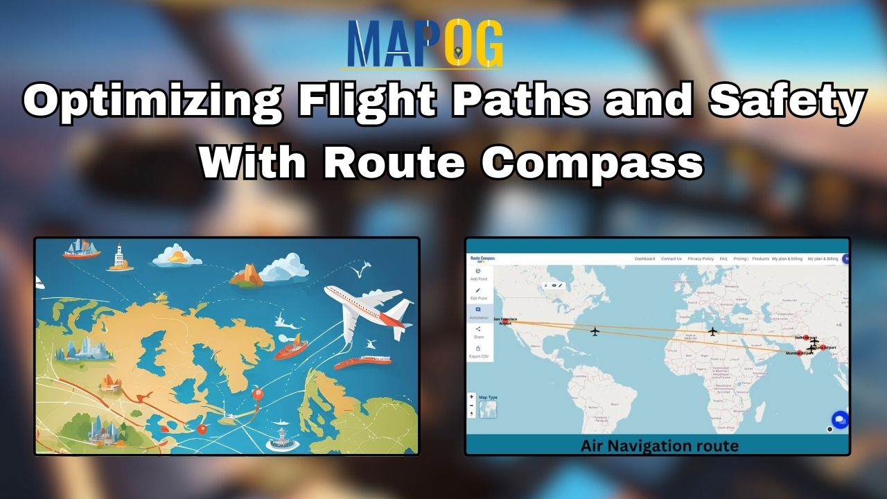
Through the integration of airspace, and topography data, “Optimizing Flight Paths and Safety with Route Compass” improves route planning. In air navigation from one Airport to another Airport using MAPOG, pilots leverage cutting-edge Geographic Information System (GIS) technology. The route compass, part of the MAPOG system, facilitates precise navigation, ensuring optimal flight paths and efficient … Read more
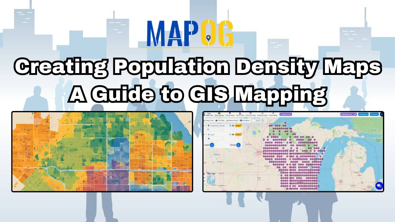
MAPOG’s population density map illuminates spatial patterns, guiding urban planning, healthcare, and policy decisions.

“Creating Cross-Country Routes by Distance and Bearing Angle” by MAPOG’s Route Compass simplifies cross-country route planning.
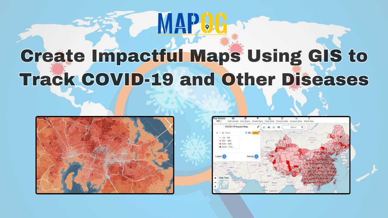
Mapping COVID-19 Impact: This analysis identifies hotspots, low case areas, and trends over time, aiding in effective resource allocation and policy-making.