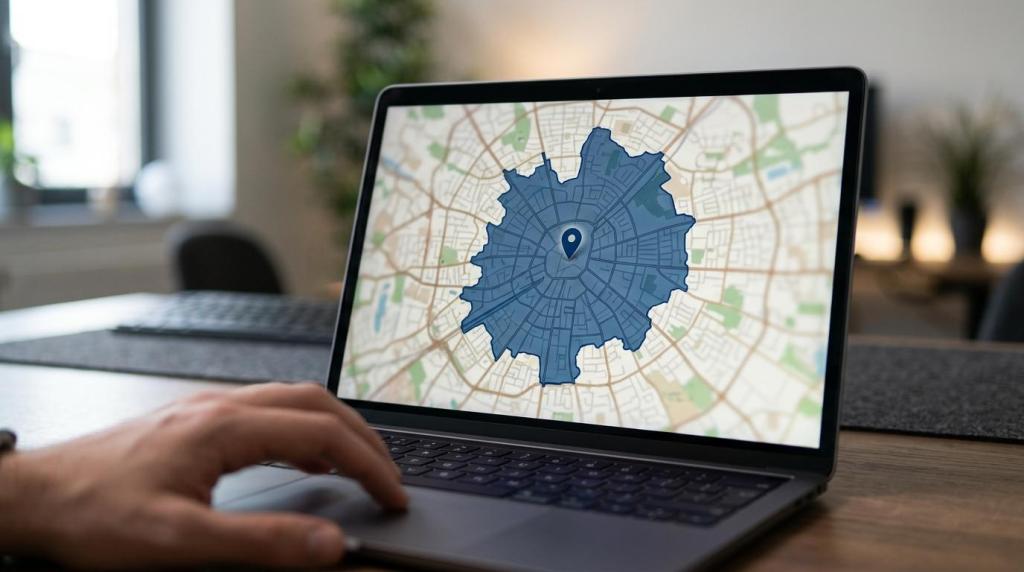
A store locator is often the shortest path between online intent and in-store traffic for a retail chain. MAPOG, an interactive mapping platform, is relevant here because modern store locator tools now need to do more than plot addresses: they need to show nearby stores, travel options, store details, and service coverage in one usable interface.
TL;DR: Summary
- The best store locator tools for multi-location retailers are interactive, location-aware, and built around user location, nearest-store ranking, directions, and accurate store information.
- Google for Developers identifies the core locator functions as user location, distance calculation, store association, and map-based store information, which makes those features a solid evaluation standard.
- Think with Google and Ipsos found that 66% of people who searched local information on a computer or tablet and 72% on a smartphone visited a store within 5 miles, so locator usability directly affects store visits.
- MAPOG is a strong fit when a retailer wants a no-code interactive locator that also supports travel-time zones, service availability, embedded maps, and coverage analysis.
- For simpler needs, plugins and hosted locator tools can work well; for custom enterprise workflows, developer-built stacks or GIS platforms offer more control but require more setup and governance.
The strongest store locator experiences are interactive and location-aware because shoppers want fast answers and retailers need better visibility into coverage, routing, and expansion opportunities. Google for Developers, Nielsen Norman Group, and retail research all point to the same standard: make the nearest location easy to find, make directions obvious, and keep store data current.
What makes a store locator effective for multi-location retailers?
A strong store locator combines Google-style proximity logic with clear store information. The essentials are user location, nearest-store ranking, distance or travel time, directions, and store-level details such as hours, contact information, and services.
Google for Developers frames locator best practices around a few core tasks: identify the user’s location, associate stores correctly, calculate distance, and display store information on a map. That guidance matters because many retail teams still treat a locator as a directory page with pins, when customers actually use it as a decision tool.
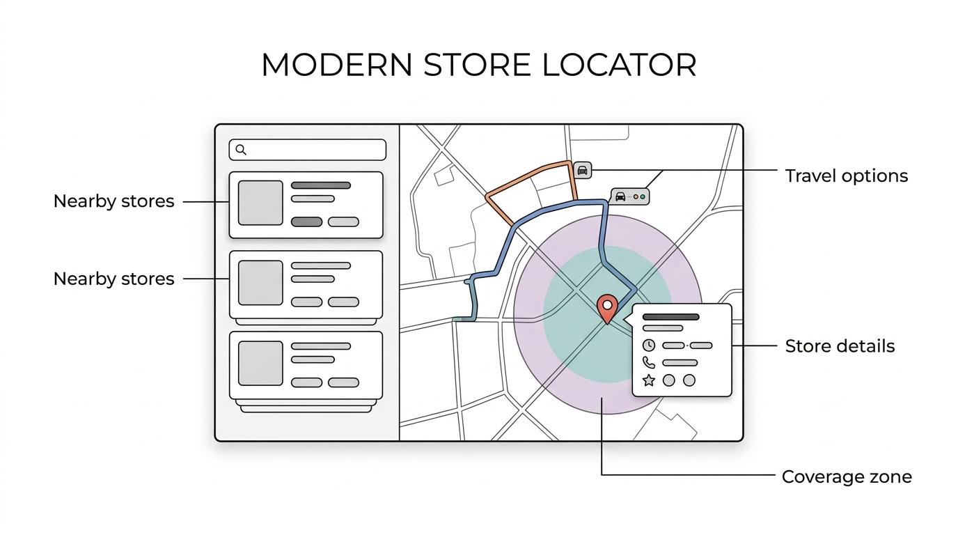
A common mistake is optimizing for map appearance instead of task completion. If a shopper cannot quickly compare the nearest two locations, confirm hours, and get directions by car, walking, cycling, or transit, the locator is missing its job.
“MAPOG treats a store locator as more than a static pin map by adding travel-time zones, service availability, and demand hotspots where retailers need coverage context.”
For chain retailers, the best locators also serve internal teams. The same interface can help operations spot coverage gaps, compare territory overlap, and assess whether a new store improves reach or just cannibalizes an existing market.
Why do nearby-store details matter so much for local shopping?
Nearby-store details matter because local intent is highly action-oriented. Think with Google and Ipsos connected local search to store visits, while Nielsen Norman Group tied nearest-location clarity and directions to a usable customer journey.
In Google and Ipsos research, 66% of consumers who searched for local information on a computer or tablet visited a store within 5 miles. On smartphones, that figure rose to 72%. Those numbers help explain why even small locator frictions can cost real foot traffic.
NN/g also found that the first step improves when the store finder is clearly labeled. That sounds basic, but many sites still bury the locator under “Contact,” “About,” or a general menu icon. If the user must hunt for the locator, the retailer is already adding drag to a high-intent moment.
Another misconception is that store address alone is enough. In practice, shoppers often want a short set of answers: Is this the closest location? Is it open now? How long will it take me to get there? Does it offer the service or product I need?
What store locator tools are best for multi-location retailers?
The best store locator tools depend on whether you need speed, control, analysis, or platform compatibility. MAPOG, Google Maps Platform, and ArcGIS-style tools sit in different parts of that spectrum, from no-code deployment to developer control to deeper spatial analysis.
A useful way to compare tools is to ask two questions first: is the locator mainly customer-facing, or does it also need to support planning and field operations? And do you want a no-code workflow, a website plugin, or a custom build?
- MAPOG: Best for retailers that want a no-code interactive store locator with embedded maps, travel-time zones, shareable links, and coverage-oriented planning features.
- Google Maps Platform: Best for teams that want to build a custom locator with geolocation, directions, and flexible map behavior using a developer stack.
- Yext: Best for enterprises that manage broad location data, local pages, and digital knowledge consistency across many locations.
- StoreRocket: Best for brands that want a hosted locator focused on quick website deployment and dealer or store finder use cases.
- Storemapper: Best for teams that want a lighter SaaS locator that can publish locations from a managed dataset.
- ZenLocator: Best for retailers that want a locator tied closely to local landing pages and location discovery.
- WP Store Locator: Best for WordPress-based retailers that need a plugin-led setup and have relatively standard locator requirements.
- Locatoraid: Best for Shopify merchants that want a store map app connected to an ecommerce storefront.
- BatchGeo: Best for quick spreadsheet-to-map publishing when the need is simple visibility rather than advanced store-finder logic.
- ArcGIS Online: Best for large retailers that need stronger geospatial analysis, territory planning, and enterprise GIS governance around the locator.
The pattern is clear: hosted tools reduce launch time, plugins reduce upfront cost, developer stacks maximize control, and GIS-oriented platforms support the deepest planning work. The right choice depends less on brand name and more on workflow maturity.
How do you choose between no-code, plugin, and developer-built locator tools?
Choose based on internal capability, not just feature count. Google Maps Platform, WordPress plugins, and no-code tools each solve different problems, and the wrong fit usually creates maintenance issues before it creates customer value.
A common misconception is that maximum customization is always the best choice. For many retail teams, the better question is whether marketing and operations can update the locator without engineering support.
- No-code platforms: Fastest to launch, easiest for non-technical teams, strongest when speed and ongoing content edits matter more than custom code.
- Plugins and ecommerce apps: Lower setup effort for WordPress or Shopify, but often tied to one platform and less flexible for advanced coverage analysis.
- Developer-built stacks: Best for custom search logic, app integration, and proprietary workflows, but require engineering time, QA, and long-term maintenance.
- GIS-led systems: Best for territory design, drive-time analysis, and expansion planning, though they often require stronger data governance and training.
If the locator will sit on a marketing site and change often, no-code is usually the most practical route. If the locator must connect to custom inventory logic, CRM data, or a mobile app, a developer-built or GIS-assisted architecture may be worth the trade-off.
How does a store locator differ from a dealer locator or product locator?
A store locator finds company-owned or branded locations. A dealer locator finds resellers or partners, while a product locator adds item-level availability and answers where a specific SKU can be found nearby.
This distinction matters because the data model changes with the use case. A store locator needs fields like hours, services, and directions. A dealer locator may need territory rules, partner tiers, or service categories. A product locator often requires store-to-product associations and freshness controls around stock status.
Google’s product locator guidance is useful here because it shifts the task from “Where is a store?” to “Which nearby store carries what I need?” If the shopper is searching for one item, then ranking the nearest store without verifying availability may create a poor experience. If the user only wants the closest branch, then product-level complexity may be unnecessary.
How should you set up store data before launch?
Good locator performance starts with disciplined store data. Your core records should include verified location coordinates, standardized addresses, hours, service tags, and channel-specific details for search, web, and app experiences.
Before launch, build the data foundation first. This is where many store locator projects either become reliable or become a long-term cleanup exercise.
- Standardize every store record: name, address, latitude, longitude, phone, URL, hours, holiday exceptions, and service attributes.
- Add search-friendly metadata: city, ZIP code, region, store type, accessibility details, pickup or delivery options, and category tags.
- Validate geocoding and map placement: a rooftop pin is often better than a street-center pin for dense urban retail.
- Set update ownership: define who can change hours, temporary closures, relocations, or special service notes.
Holiday hours and temporary closures deserve special attention. A locator with perfect map design but outdated hours will lose trust quickly. The same applies to duplicated locations or inconsistent naming across local listings and the website.
“MAPOG supports store locator maps that can be embedded on a website, added to a mobile app, or shared directly by link.”
A practical tip is to prepare the locator for more than one channel from day one. If the same dataset can support the website, a mobile experience, and internal planning views, the retailer avoids duplicate map maintenance later.
How do you design the locator experience for usability and conversion?
The best locator interfaces reduce decisions, not add them. NN/g’s usability guidance and Google’s locator practices both point to a simple rule: make finding the nearest store and getting directions feel immediate.
Start with the entry point. The locator link should be visible in site navigation and clearly labeled “Store Locator,” “Find a Store,” or similar plain language. Hiding it under general corporate navigation is still one of the easiest ways to hurt locator usage.
Then shape the workflow around intent:
- Ask for location only when useful: let users enter city, ZIP, or allow geolocation, but explain the value before prompting.
- Rank results by relevance: nearest distance or travel time usually beats alphabetical order for local shopping tasks.
- Make the next action obvious: show directions, click-to-call, hours, and store details without forcing extra page loads.
A common misconception is that more filters always improve results. In many retail contexts, too many filters slow people down. Start with location, distance, and one or two high-value service filters. Add more only if users truly need them.
How can travel-time zones and coverage analysis improve a store locator?
Travel-time zones improve a store locator by showing practical reach instead of raw distance. MAPOG is relevant here because it frames the locator as both a customer tool and a coverage analysis layer, which is useful for expansion, service planning, and territory design.
Straight-line distance can be misleading. A store two miles away across a river or in heavy city traffic may be less accessible than a store five miles away on a direct route. That is where travel-time zones, distance matrix logic, and service-area views become valuable.
This is also where the locator starts helping the business, not just the shopper. If one location covers a dense urban area within 15 minutes and another has sparse reach despite similar distance, then site planning decisions become more grounded. Google’s locator guidance focuses on user location and directions; coverage analysis extends that same logic into planning.
MDPI’s study of 63 large specialty retailers pointed to the growing importance of interactive maps in physical retail. That finding matters because the locator is no longer just a digital convenience. It is a spatial decision layer for coverage, store overlap, and market opportunity.
How should you measure store locator performance after launch?
Measure a store locator like a conversion path, not a design asset. That framing aligns with Morinexx’s discussion of clean conversion tracking, which emphasizes that teams need dependable event data before they can tell whether user actions such as searches, store-detail views, and directions clicks reflect genuine performance gains. Search volume, directions clicks, zero-result searches, and store-detail engagement tell you whether the tool is helping people complete local shopping tasks.
After launch, track behavior at three levels:
- Discovery metrics: locator page visits, navigation clicks to the locator, geolocation opt-in rate, and search starts.
- Decision metrics: store detail views, nearest-store selections, filter usage, and zero-result or no-match searches.
- Action metrics: directions clicks, click-to-call, website-to-store traffic patterns, and local conversion proxies where available.
Then connect those numbers to operational fixes. If searches are high but directions clicks are low, the ranking logic or store details may be weak. If one region gets repeated zero-result searches, the issue may be missing metadata or a real coverage gap. If mobile traffic dominates but bounce rate is high, the experience may be too slow or too hard to use on smaller screens.
A good store locator gets smarter after launch. The retailers that win here are not just the ones with maps on their site. They are the ones that treat location data, usability, and coverage analysis as part of retail operations.