Planning trips becomes easier and more engaging through interactive travel itinerary mapping. In fact, mapping platforms transform travel ideas into clear, visual routes that anyone can follow. Moreover, these tools integrate destinations, routes, and data layers, allowing travelers to Plan Travel Itineraries efficiently and explore confidently.
Key Concept: Plan Travel Itineraries
Interactive mapping unites all travel elements destinations, routes, and stays on one digital map through MAPOG. Consequently, users can view their complete journey, ensuring a balance between Plan Travel Itineraries time and experience. Furthermore, maps help identify scenic routes, nearby attractions, and essential amenities. Therefore, planners can adjust schedules quickly and make informed decisions with accuracy.
How to plan a travel itinerary?
Interactive mapping turns static location data into dynamic visuals. Travelers can zoom, explore, check hotels and transport, edit routes, add notes, and personalize plans effortlessly for a customized journey.
Methodology: Plan Travel Itineraries
To create a well-structured travel itinerary, follow these practical steps to map destinations, plan routes, and visualize your journey efficiently using MAPOG.
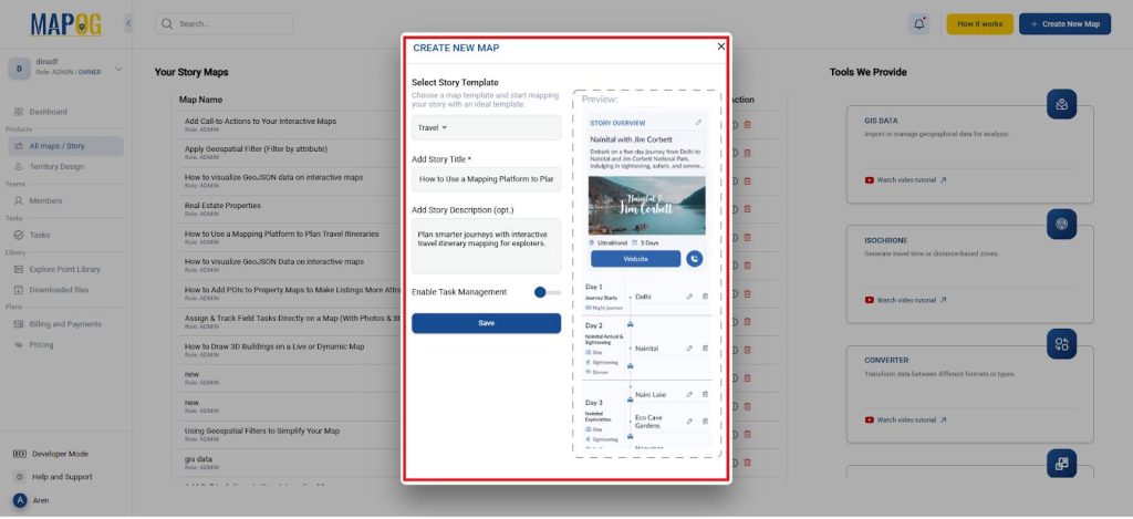
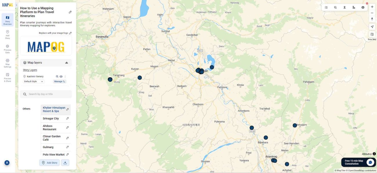
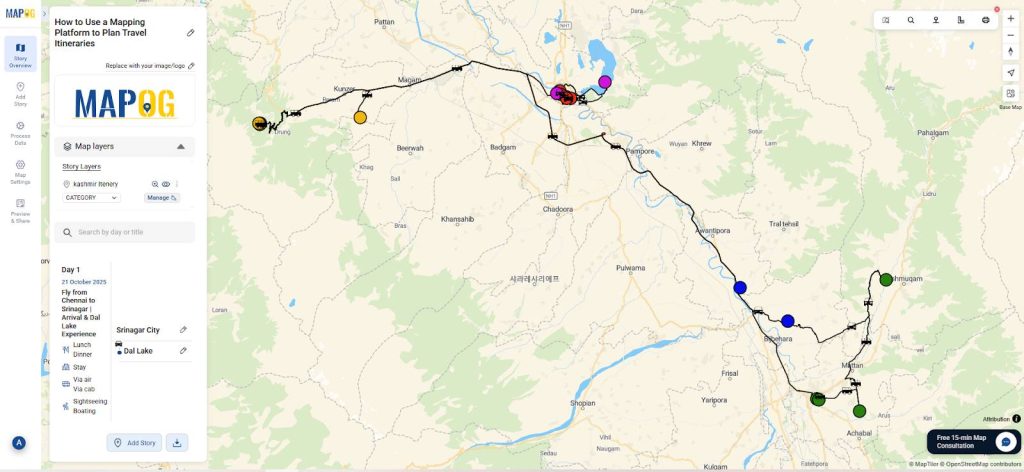
Create a New Map
- Firstly, open MAPOG and start a new project and give it title and description.
- Then select it as a travel map to plan the itinerary of the trip.
Upload Itinerary Data
- Afterward, upload your itinerary csv/excel file containing latitude, longitude, visit day, and duration.
- Using Add by uploading CSV/Excel form the Add story.
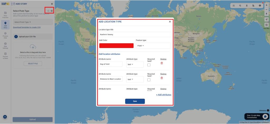
- In this select the select point type settings option and a dialog box opens for location type management.
- In which select add more location type and give it a title and set as point and any specific color as required.
- Also add attributes like Day of Visit, distance to next location and many and set it type also as shown, you can add as many as you require.
- Next, Select the location type you created in the location type and add the excel here.
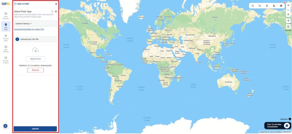
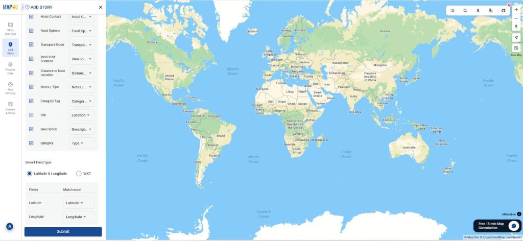
- By matching fields properly, MAPOG automatically plots your journey on the map.
- Also match the latitude and longitude perfectly.
- Consequently, you can review and refine locations efficiently.
Add Locations Details
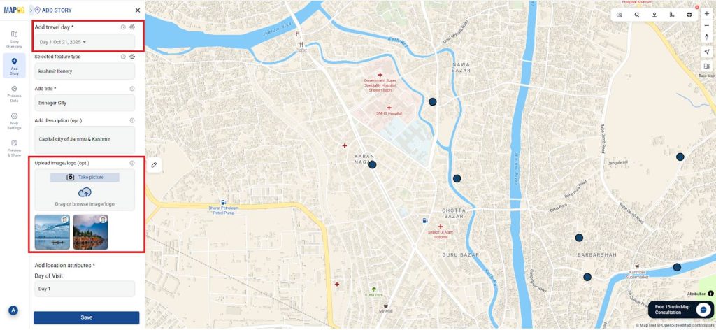
- Next, add the location details for each day, go to Edit point details and in travel day settings add all the days as shown.
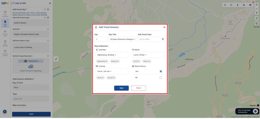
- Similarly, add all the days as shown using add more days.
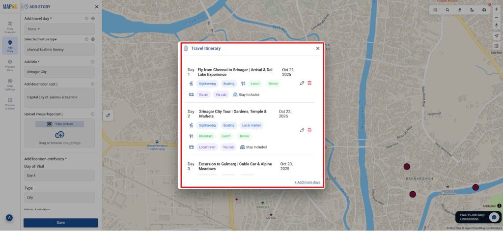
- In addition, attach photos for all the locations as shown and save it. This transforms your itinerary map into a complete digital travel guide.
- Therefore, travelers can visualize experiences even before the journey begins.
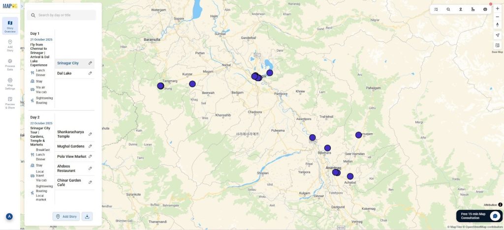
- This ensures your map remains structured and visually clean.
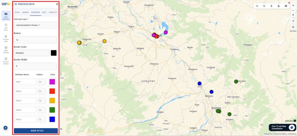
Style Category: Daywise
- Now go to the story layer and select the Add layer style and go to category.
- In that select the attribute to be mapped as day of visit and give a specific color for each day as shown and save it.
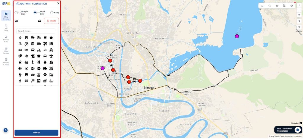
Define Routes and Order
- Then, connect all destinations using the location connection Tool.
- As a result, your route becomes practical, logical, and optimized for time-saving travel.
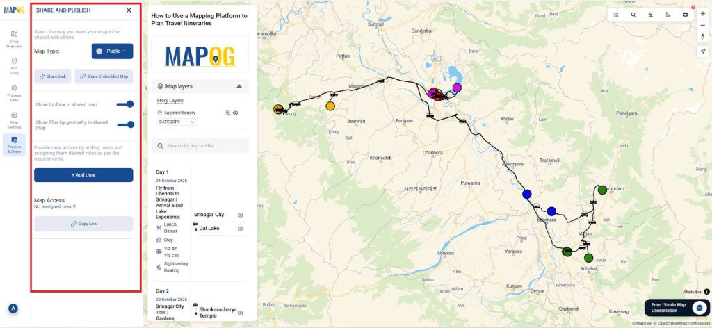
Share and Collaborate
- Finally, use Preview and Share to distribute your map. You can embed it on blogs, share it with friends, or allow others to edit collaboratively.
- Consequently, every participant stays informed and updated in real time.
Benefits of Planning
- Comprehensive Overview: Visualize your entire journey and stay organized.
- Efficient Planning: Adjust timing and stops with real-time flexibility.
- Smart Insights: View distances, travel time, and nearby amenities instantly.
- Collaboration: Share and co-edit with friends, agencies, or groups.
- Eco-Friendly: Replace printed itineraries with interactive digital maps.
Furthermore, these maps make travel planning transparent, data-driven, and enjoyable for everyone involved.
Conclusion
In conclusion, MAPOG revolutionized how we design travel itineraries. Through dynamic visuals and easy sharing, travelers can explore destinations efficiently while enjoying flexibility. Moreover, interactive travel itinerary mapping bridges technology and experience, helping users plan journeys that are smarter, greener, and more memorable.
As demonstrated by several planners and researchers, MAPOG’s mapping tools ensure that every route and destination aligns perfectly with traveler goals and preferences.