Mapping Hospital Coverage and Categories, locations in rural areas ensures that communities have access to essential healthcare during emergencies. Visualising hospital distribution and overall coverage helps identify underserved regions and gaps in healthcare infrastructure. With MAPOG, users can build interactive GIS maps showing hospital points, health facility types, and Convex Hull polygons that represent the outer boundary of existing healthcare coverage.
Ultimately of complex network models, this method uses Convex Hull geometry to create a simple polygon enclosing all hospitals or category-specific facilities.
Key Concept: Mapping Hospital Coverage and Categories
Hospitals exist across rural landscapes, but their impact depends on distribution and accessibility. By applying Convex Hull for different hospital categories (General Hospitals, PHCs/CHCs, Specialty Hospitals), planners can quickly answer critical questions:
- What is the overall coverage area for all hospitals?
- Which regions fall outside any hospital network?
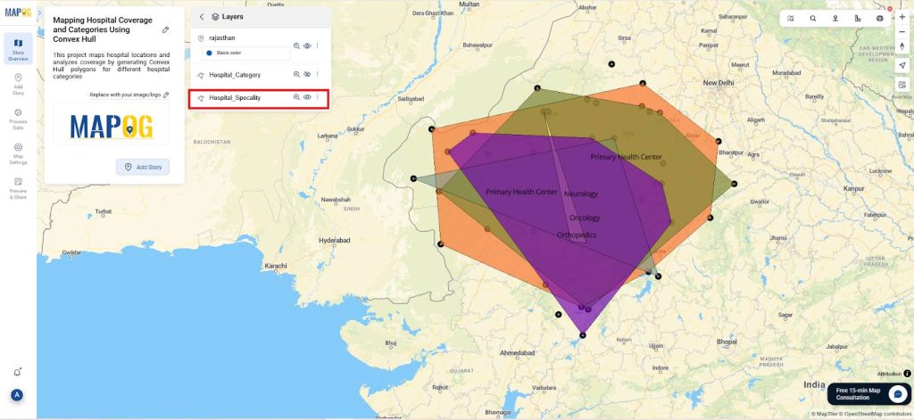
- Are specialised hospitals (Cardiology, Orthopedic, etc.) evenly distributed?
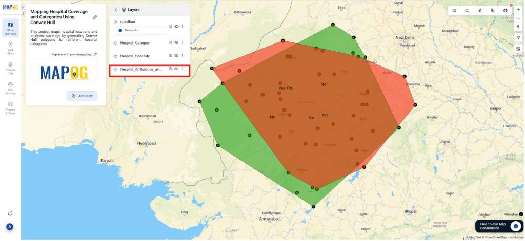
- How many points have ambulance availability within these boundaries?
Finally, Thus simple Convex Hull-based visualisation provides a clear, category-wise picture of healthcare access and helps plan new facilities in uncovered zones.
Uses of Mapping Hospital Coverage and Categories
- Enhances GIS learning for students in geography, public health, and spatial planning.
- Builds knowledge of spatial algorithms and real-world applications.
- In fact, it strengthens visual and analytical thinking for healthcare distribution planning.
- Connects classroom learning to data-driven decision-making in health infrastructure development.
Methodology: Mapping Hospital Coverage and Categories
Project Focus: Visualizing healthcare facility distribution and coverage for rural regions using hospital categories (General Hospitals, PHCs, Specialty Hospitals) and applying Convex Hull in GIS.
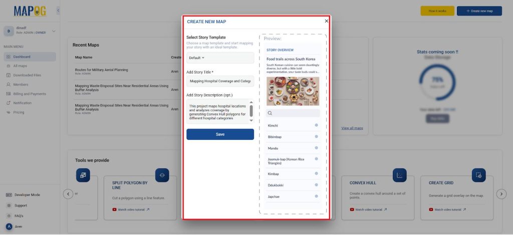
1. Start a New Story and Add a Project Title
- Go to the MAPOG website and click “Create New Map.”
- Assign a project name and provide a description.
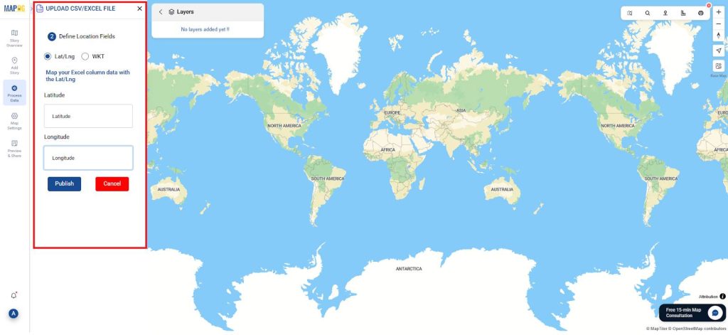
2. Upload Layer Data
- In process data select the upload CSV/Excel file and browse the Hospital file that has the hospital data like type of hospital, specialisation and its ambulance availability and upload it.
- Define Location Fields and give the latitude and longitude and Publish it.
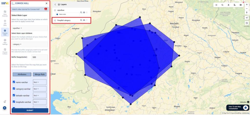
3. Convex Hull
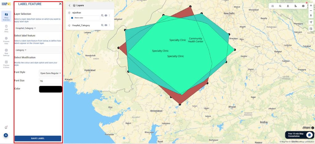
- Go to process data select Convex hull and Select Main Layer as the hospital file. (i.e, Rajasthan) And the Select Main Layer Attribute as Category and give the buffer as 500 m and rename the layer accordingly.
- Thus, go to the style editor and select type as category and layer as convex hull output and the attribute as category in excel.
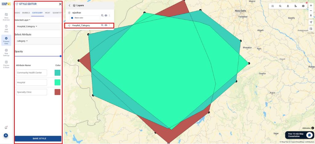
- Then go to Label feature, and select the layer and attribute as category and save it.
- Similarly, prepare a convex hull for the Speciality column and style it as category.
- Further once again, prepare a convex hull for the Ambulance availability and style it as a category.
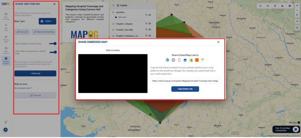
4. Publish and Share the Map
- Additionally, use MAPOG’s “Publish & Share” capability to generate a live, interactive map link or an embeddable code for integration into reports, presentations, or web-based dashboards.
- Finally, this converts your map into an operational geospatial asset, facilitating situational awareness, emergency preparedness simulations, and data-driven planning discussions.
Insights and Applications
- This analysis highlights areas beyond existing hospital coverage and identifies regions lacking specialty care or ambulance support, offering actionable insights for healthcare planning.
- It further guides strategic decisions for new hospital site selection, ensuring equitable service distribution and improved accessibility across communities.
Relevance Across Disciplines
- Thus GIS-based approach benefits critical domains such as public health, urban and rural planning, emergency management, and medical resource allocation.
- Additionally, it promotes collaboration among students, planners, and healthcare policymakers, driving informed, data-driven decisions for community well-being.
Conclusion
In conclusion, Convex Hull-based healthcare mapping using MAPOG is a powerful yet simple method. It transforms raw location data into actionable maps that highlight coverage gaps, specialty service imbalance, and ambulance availability.
Ultimately, this project connects geospatial thinking to real-world healthcare challenges, making planning data-driven and community-focused.
Several studies referenced in this context employed MAPOG
- Role of GIS In Irrigation Planning and Water Resource Management
- How GIS and Smart Mapping Reduce Urban Heat Islands
- GIS in Infrastructure Development and Road Network Analysis
- Flood Risk Mapping with Interactive Web Maps: SaaS Approach
- Optimizing Warehouse Location Selection with GIS for Supply Chain Efficiency