Mapping has become an essential tool in the real estate industry to display property data and attract potential buyers visually. One such powerful and easy-to-use tool is MAPOG, which allows users to Create real estate Property Map with filters such as price, location, and property type.
This article walks you through the methodology step-by-step, explains the key concepts behind real estate mapping, outlines its industrial benefits, and concludes with a final thought on its potential.
Key Concepts Behind Creating a Real Estate Property Map
A well-designed real estate map allows users to explore properties interactively based on criteria like property type, price range, BHK, and location. MAPOG supports category-based mapping with features like polygon drawing, attribute tagging, amenity marking, and distance measurement, making the experience more user-friendly and informative.
Step-by-Step Methodology
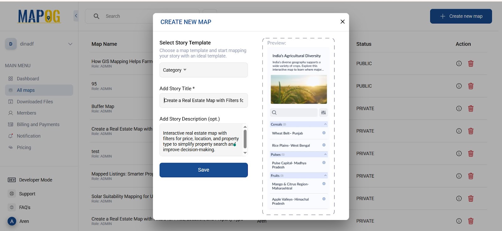
1.Log in and Select Map Type
To begin, log in to your MAPOG account, then create a new map and select the map type as “Category”. This will allow you to categorize your listings based on different filters. Add a relevant title and a short description, then save your map.
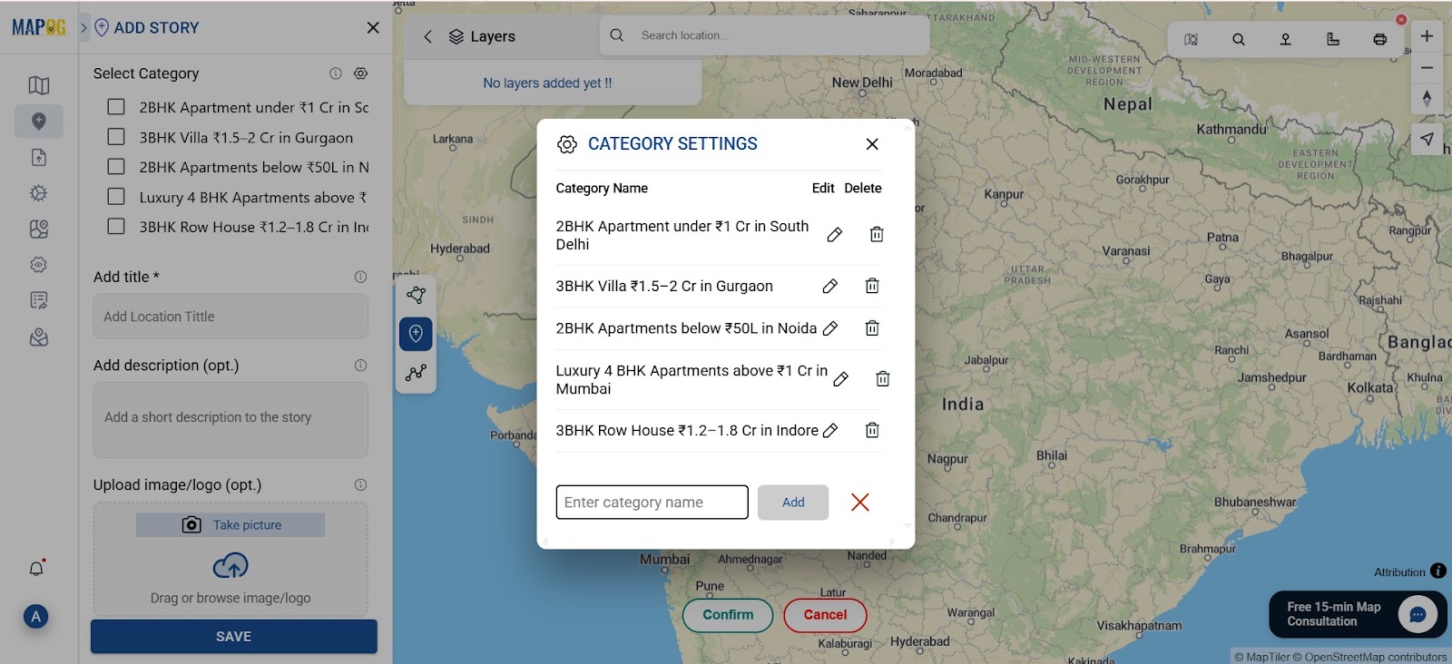
2. Create a Story and Define Property Categories
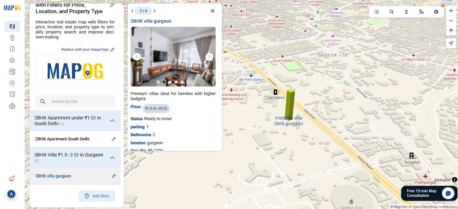
Go to the “Add Story” section. Here, you can create multiple categories by going to “add manually” section then go to the settings of select category add category like “2BHK under 1 Cr” etc. Categories will help organize your properties .
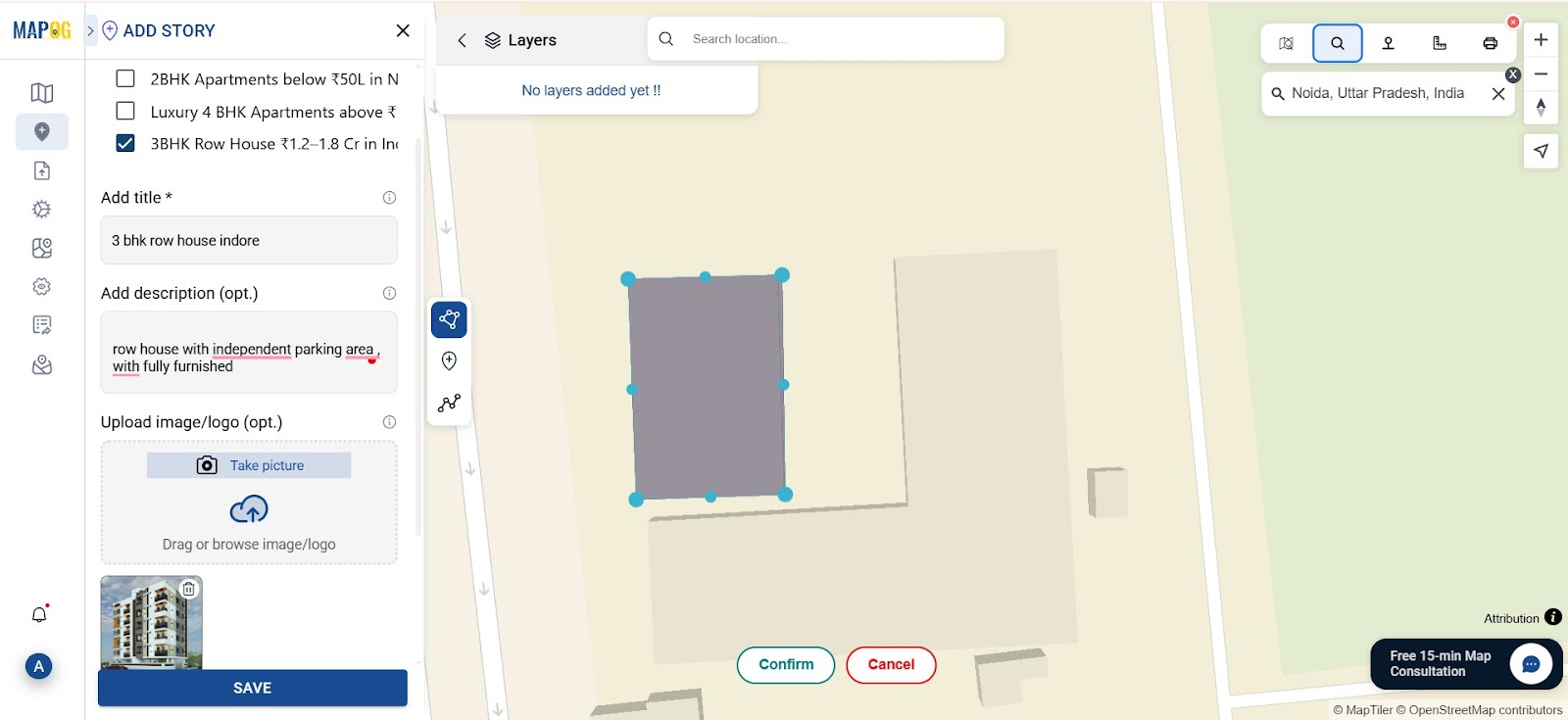
3. Search and Mark the Location
Use the search tool to find the desired location. Once found, draw a polygon around the specific area using the polygon tool. After drawing, confirm the shape and provide a title and description. Also upload images to represent the property or location visually.
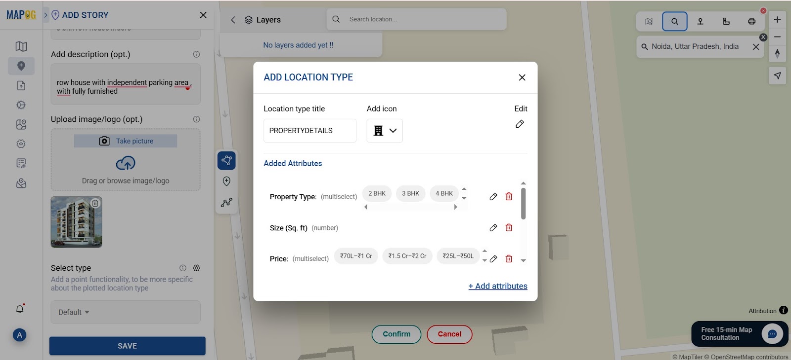
4. Set Attributes to Create Real Estate Property Map Details
Navigate to Settings, and under the select type, create a new type called “property details.” After that, go to Property Attributes and define the key details (like price range and size). Again, select the polygon and fill in all the necessary attribute fields, then save.
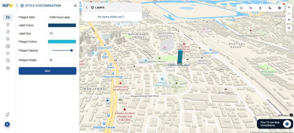
5. Customize the Polygon on Your Property Map
Next, go to Polygon Customization, then add a label, applying color codes based on property type or price, and setting its height for better 3D visualization.
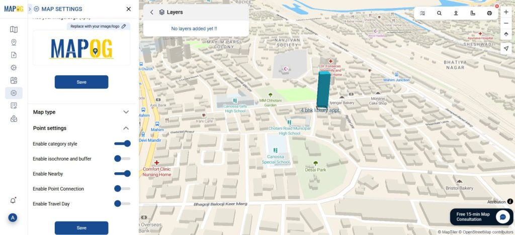
6. Enable Nearby Amenities
Go to Map Settings, then open Point Settings and enable the Nearby feature. This will allow you to showcase amenities around a property, like hospitals, schools, or fuel stations.
7. Measure Distances to Amenities
First, go to the location. Then, use the distance tool in the top-right corner to draw a line between the property and the nearby amenity so the distance appears in meters.
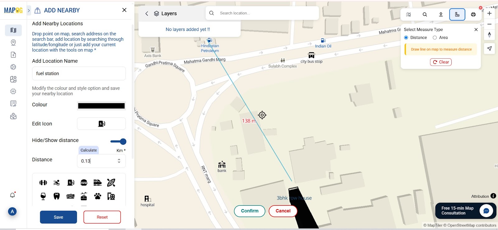
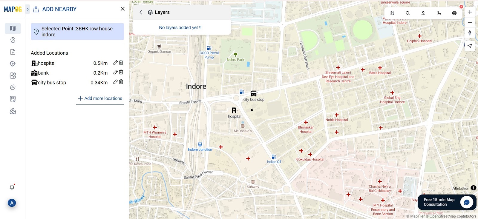
8. Add Amenity Points on Your Real Estate Map
To show amenities on the map, first go to “Add Nearby Points.” Then, create points for each facility. Next, choose suitable icons, such as for hospitals, for fuel stations, or for schools. After that, enter the amenity name, add the distance in kilometers, and assign the icon. Finally, repeat for all amenities and save.
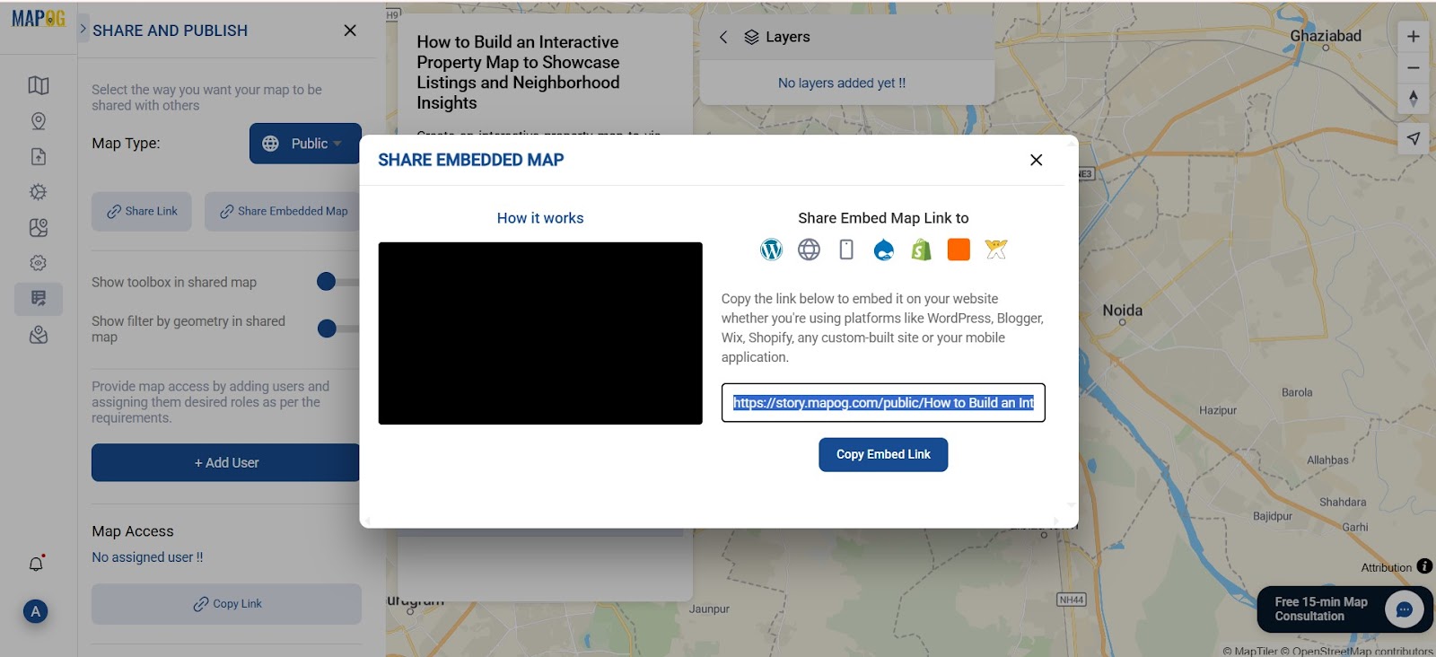
9. Preview, Publish, and Share Your Real Estate Property Map
Click Preview and Share to check your final map. Make any last edits, then click Publish. You’ll get a shareable link to embed on your website or promote through emails and social media.
Industrial Benefits:Create real estate Property Map
Interactive real estate maps are highly effective. Firstly, they boost user engagement. Secondly, filters help find listings faster. Moreover, clear attributes improve understanding. In addition, nearby amenities and distance tools aid smart decisions. Overall, they enhance the entire property search experience.
Final Thought on Createing Real Estate Property Map
Using MAPOG to create customized real estate maps offers a significant technological edge in today’s competitive market. By mapping properties with filters, real estate agents and developers can provide a transparent and interactive experience to buyers.