Create a country-wise UNESCO Guide Map that highlights both cultural brilliance and natural wonders. On the other hand, by integrating GIS tools, this project enhances public awareness, encourages responsible tourism, and supports heritage preservation. It offers users an educational and immersive storytelling experience that makes exploring global heritage sites more accessible, insightful, and engaging.
Key Concept: Why to Create Countrywise UNESCO Map Guide Matter
UNESCO World Heritage Sites protect places of outstanding universal value representing architectural, historical, and ecological excellence mapping these sites by country offers an insightful perspective. Meanwhile these sites serve as cultural bridges, preserving global identity, continuity, and environmental resilience amid growing modern threats.
Importance and Uses: Create Countrywise UNESCO Map Guide
Namely, UNESCO sites connect past traditions with future goals, serving as hubs for education, tourism, research, and cultural exchange.
- Cultural Preservation – Communities safeguard monuments and traditions to maintain cultural identity and connect past and present.
- Environmental Protection – Conservation efforts protect fragile ecosystems, biodiversity, and support climate resilience.
- Education and Awareness – Experts and institutions educate the public on heritage value through exhibitions and site visits.
- Sustainable Tourism – Eco-friendly tourism supports local economies and preserves landmarks.
- International Cooperation – Countries unite through shared heritage efforts, strengthening global ties.
- Scientific Research – Scholars study these sites to advance knowledge in history, ecology.
Methodology: Create Countrywise UNESCO Map Guide Using GIS
Furthermore, Map UNESCO sites country-wise with MAPOG’s accurate, visual GIS workflow.
1. Selection of UNESCO Sites
- Experts select sites from the UNESCO World Heritage List by value.
- Also, Sites are categorized as cultural, natural, or mixed.
- Then, Priority is given to recognized or at-risk sites for balance.
2. Collection of Geographic Coordinates
- Accurate coordinates from UNESCO databases ensure precise site mapping.
- Also, Metadata like country, year, and site type are also collected.
- then, MAPOG uses this data to create precise, interactive heritage maps.
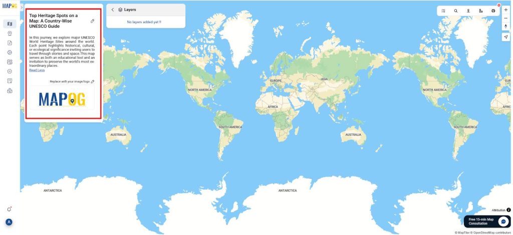
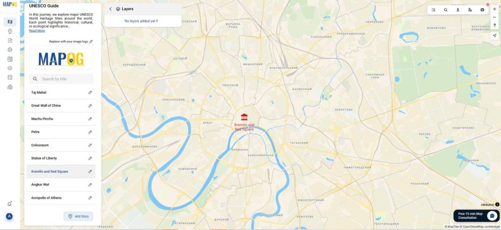
3. Create a new story
- MAPOG Story Instructions, create a new story titled: “Top Heritage Spots on a Map: A Country-Wise UNESCO Guide” and description.

3. Creation of Point Features
- Next, use Add Point Manually to input locations directly on the digital map from “Add Story”.
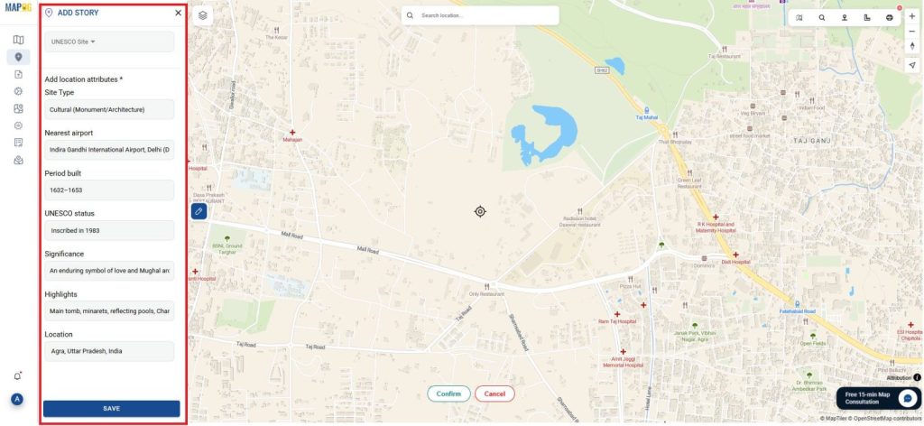
- Under settings, go to Location Type Management, add a new type called UNESCO Site, and include an attribute like “Site Type” (Cultural/Natural/Mixed), “Nearest airport”, “Period built”, “UNESCO status”, “Description”, “Significance” and “Highlights”.
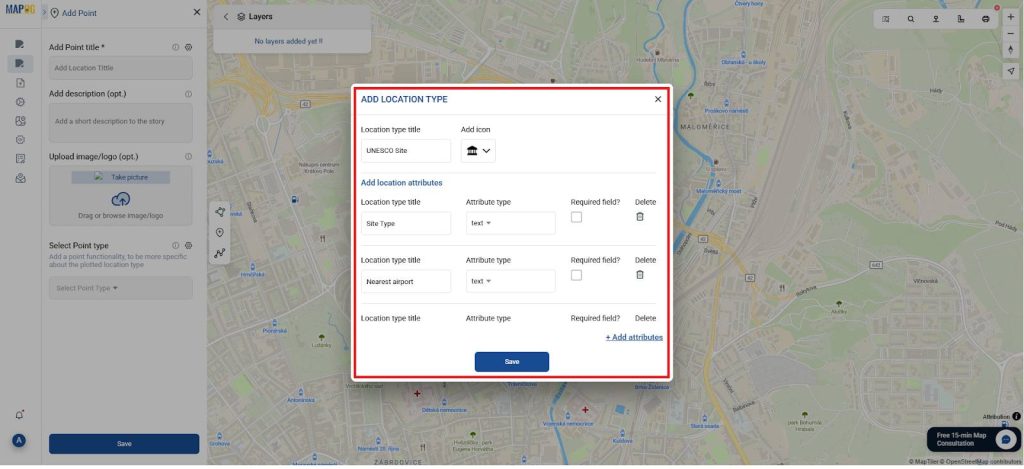
- Then, save your settings to activate the location category. After that, return to the toolbox, input the latitude and longitude, and confirm.
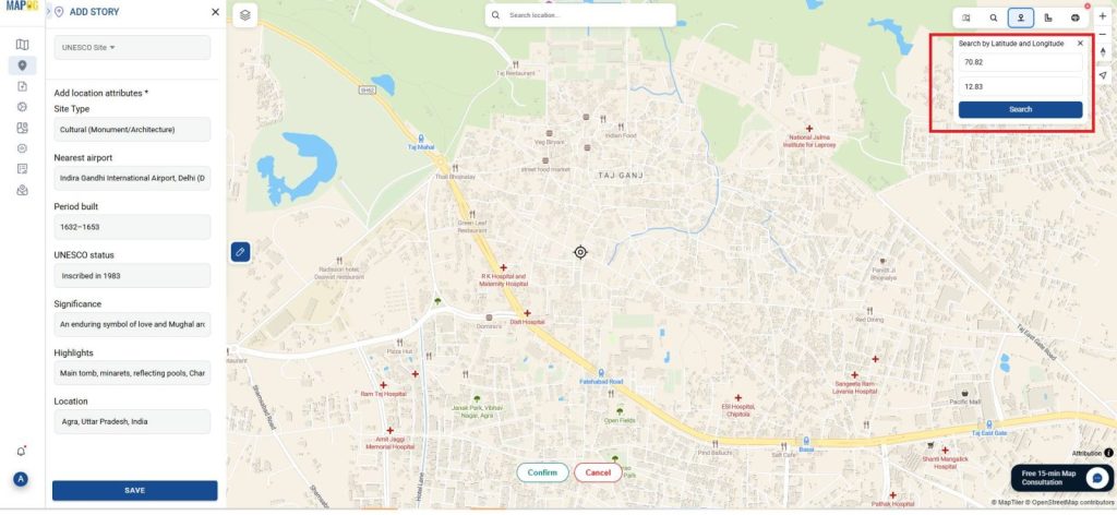
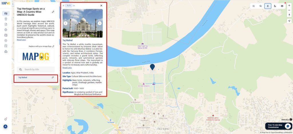
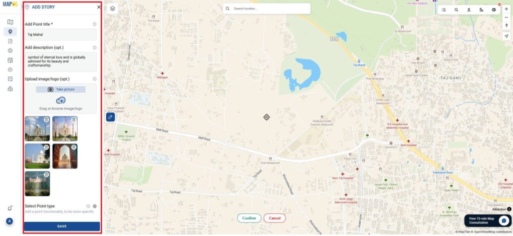
- Finally, once confirmed, select the location type as “UNESCO Site,” and provide the site’s name, description, and an appropriate image
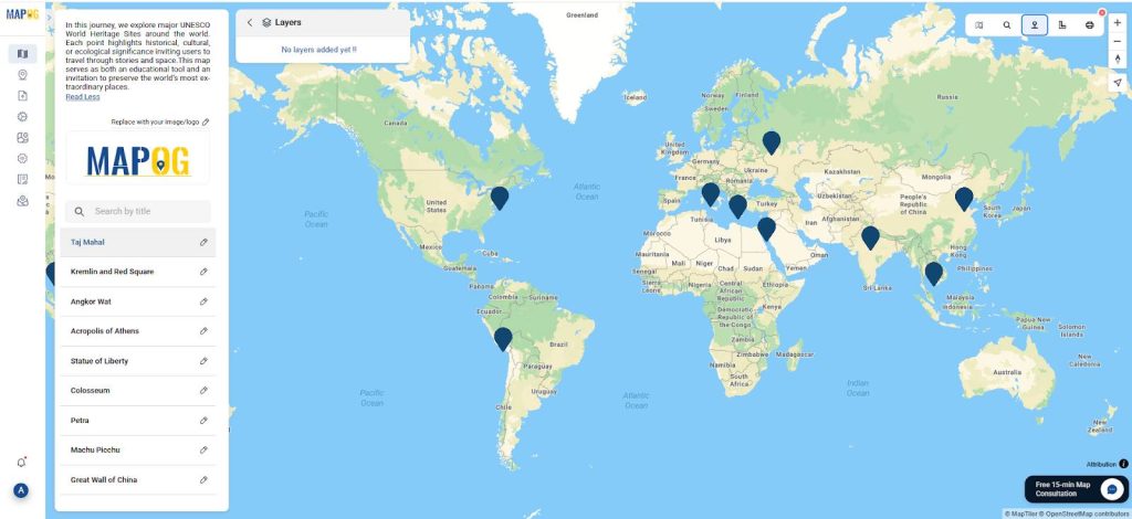
- Repeat this process for all chosen sites, ensuring consistency and accuracy throughout the dataset. Doing so allows viewers to learn key details at each point of interest.
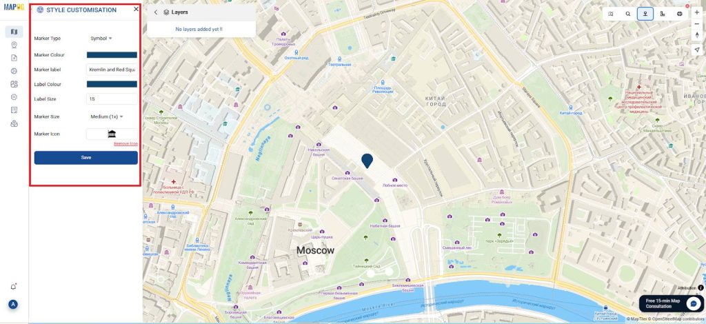
4. Visualization and Styling
- In terms of design, the map is enhanced using “color codes and symbols” for clarity from “Style Customisation”.
- Furthermore, each “point label” includes essential information such as the country name.
- Consequently, viewers can compare sites based on their location, cultural focus, or environmental value. Overall, this visualization strategy makes the map more interactive and informative.
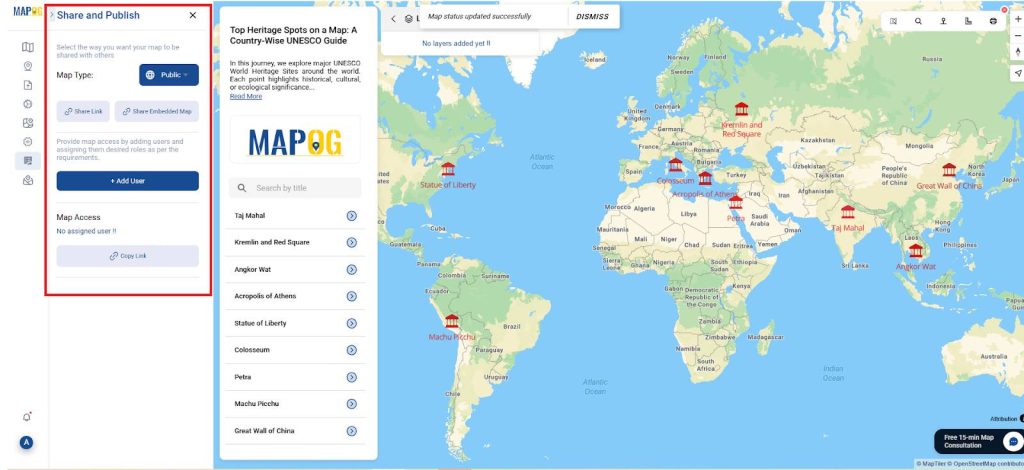
5. Presentation and Sharing
- Finally, Once the map is complete, it can be published using MAPOG’s “Publish & Share“ function.
- then the interactive UNESCO map enables learning, conservation, tourism, and global outreach.
Industry and Domain
- Industry: GIS technology supports heritage tourism and cultural preservation through spatial storytelling, making platforms like MAPOG vital to sustainable travel and heritage promotion efforts.
- Domain: GIS-powered heritage mapping bridges geospatial science with cultural awareness in environmental education, world heritage management, and global history.
Conclusion
Finally, MAPOG empowers users to map UNESCO World Heritage Sites, blending education, conservation, and exploration. By visualizing cultural and historical value, users foster awareness and responsible tourism. Ideal for learning, teaching, and research, this GIS platform promotes cultural pride, environmental responsibility, and global engagement through interactive, story-driven heritage mapping.
MAPOG was utilized across multiple studies referenced in this context.
- Role of GIS In Irrigation Planning and Water Resource Management
- How GIS and Smart Mapping Reduce Urban Heat Islands
- GIS in Infrastructure Development and Road Network Analysis
- Flood Risk Mapping with Interactive Web Maps: SaaS Approach
- Optimizing Warehouse Location Selection with GIS for Supply Chain Efficiency