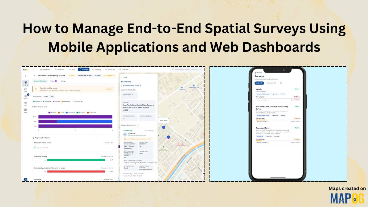
#geospatial

How to Conduct Field Surveys and Store Data on a Map for Analysis

How to Conduct Field Surveys and Store Data on a Map for Analysis

Healthcare systems often face fragmented data and limited visibility, therefore planning and service delivery become challenging. However, MAPOG mobile data collection capability helps teams conduct Healthcare Facility Surveys and analyze accessibility by capturing accurate field surveys and store data in real time, ensuring consistency and enabling faster, data-driven decisions. Key Concepts: Field Surveys and Store … Read more

How to Create Interactive Maps Online - Featured Image

Interactive Map Online – A Beginner’s Guide

With tools like Story by MAPOG, anyone can begin their journey in online mapping or build a digital interactive map without technical skills. With tools like MAPOG, anyone—whether you’re a student, traveler, business owner, or researcher—can create beautiful, clickable maps in just a few steps. These maps help you tell stories, plan trips, share information, … Read more

Create map online | Mapping Education Institute Places | Category Style based on type

Create map online | Mapping Education Institute Places | Category Style based on type

Category style, a fundamental feature within Geographic Information Systems (GIS), serves as a powerful tool for visually organizing data categories. By assigning distinct visual attributes such as colors, shapes, or icons to different data categories, category style enhances the clarity and interpretability of spatial data representations. In this article, we delve into the application of … Read more