Looking to make your real estate property listings stand out? With MAPOG, real estate agents can map real estate properties with nearby amenities easily to create interactive property maps that enhance clarity, transparency, and decision-making for potential buyers and renters. By integrating accurate location coordinates with valuable contextual data—such as proximity to schools, hospitals, shopping centers, and public transport—you deliver an informed and engaging property-viewing experience.
Understanding the Key Concept: Mapping Real Estate Properties
An interactive real estate map allows you to visualize your property data—including locations, property details, and nearby amenities—directly on a GIS-based platform. With this tool, real estate agents can map real estate properties with nearby amenities, helping prospective buyers and investors easily understand the advantages of a property’s location. Simultaneously, makes your listings attractive and trustworthy. With its user-friendly interface, MAPOG simplifies the process of mapping and managing multiple property listings.
Step-by-Step guide for Mapping Real Estate Properties on an interactive map
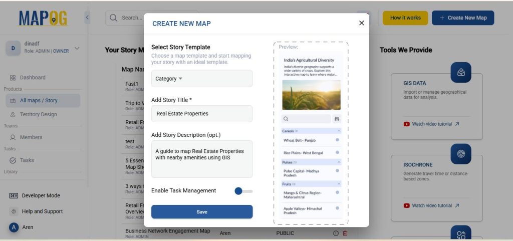
1. Start with a New Map
Open MAPOG and click on “Create New Map.” After that select Category as your story template, give your project a title and brief description, then hit save.
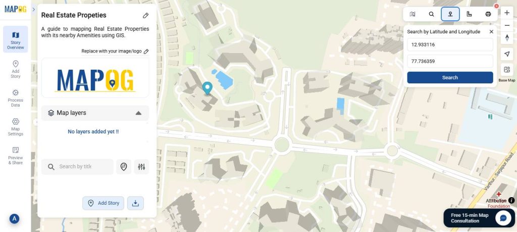
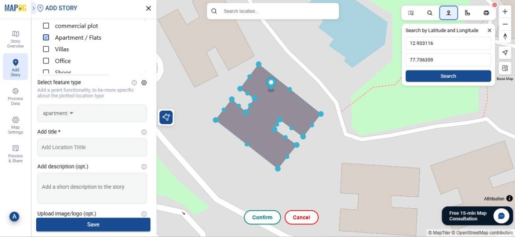
2. Add Property Location Using Coordinates
Go to the toolbox in the upper-right corner and select the Search by Latitude and Longitude option. Enter the exact coordinates of your property—accuracy here is essential, especially because it will later help you measure distances to nearby amenities.
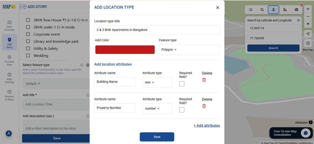
3. Add Property Details as Attributes
Click on “Add Story” and select “Add Manually”. After that, in Select Feature Type settings, choose “Add More Location Type” and set a location title & feature type to be polygon. This allows you to define your property area and include key attributes using “Add attributes” such as Property ID, BHK Size, Furnishing Status, and more.
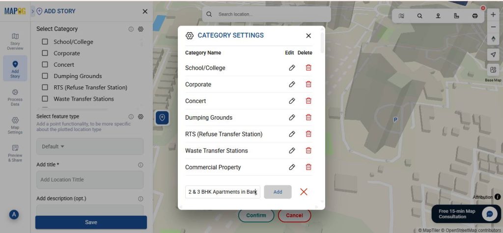
4. Categorize Your Property
Under Select Category, create classifications such as Apartment, Villa, or more specific ones like 2BHK Apartments in Delhi. After that, tag each property appropriately to make your listings organized.
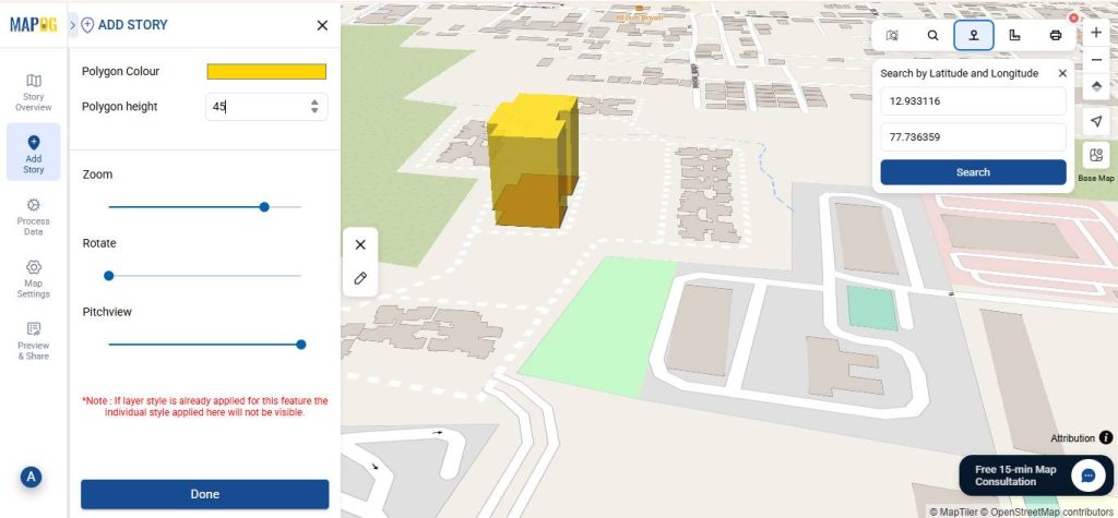
5. Create and Customize the Property Area
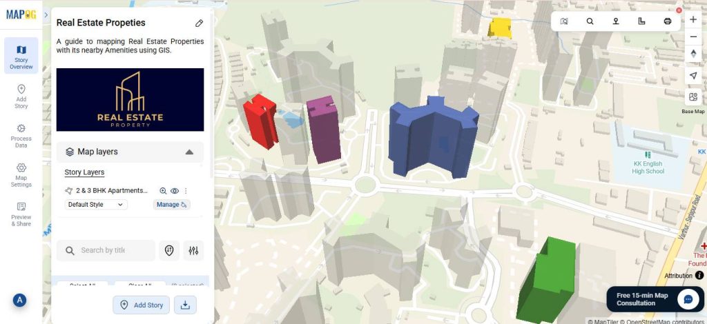
Use the Draw Polygon Tool to outline your property’s boundary on the map. When done click confirm. Now, add the title, a short description and fill in the attributes details, then click save. As a result, these attributes will enrich your listings.
Additionally, customize each property by adjusting its height and color to make it distinct. Repeat this for all the properties you wish to display on your map.
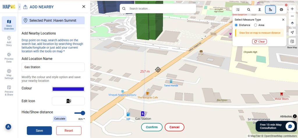
6. Showcase Location Advantages by adding Nearby Amenities
As we know, homebuyers and tenants often prioritize proximity to essential amenities like schools, hospitals, banks, and supermarkets. First, use the Distance Tool to measure the proximity of your property to these facilities, then click “Add Nearby Points” to place markers for each amenity. Subsequently, use colors and icons to differentiate types the of amenities and include the distance from the property to each point of interest—thereby, highlighting your property’s location advantage.
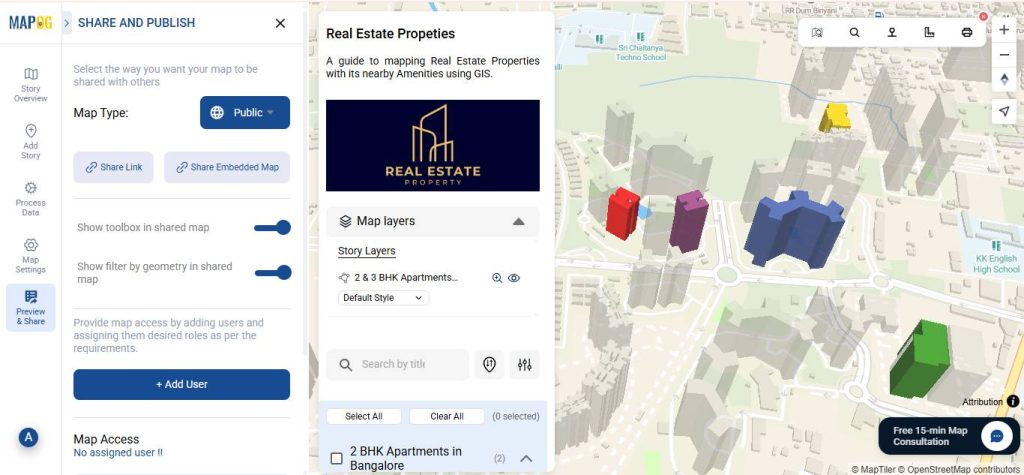
7. Preview and Share Your Interactive Map
Once your property map is ready, click “Preview and Share”. Set your map to public for wider visibility, or embed it directly on your website. This makes your real estate listings engaging, informative, and at the same time makes it easy to explore.
Industry Relevance
Interactive property mapping provides key advantages for real estate professionals. It enables faster decision-making by allowing buyers and renters to quickly visualize details and nearby amenities. Listings with spatial context gain a competitive edge, while the approach also supports easy scalability, making it simple to update multiple properties consistently and efficiently.
Conclusion
In conclusion, real estate agents can boost listing appeal by using interactive maps to showcase properties and nearby amenities. By adding accurate locations, property details, and proximity to nearby facilities, listings become informative, engaging, and transparent. Moreover, MAPOG simplifies managing multiple properties, giving agents a competitive edge in the rental as well as real estate market.
Here are some other blogs you might be interested in:
- How to Showcase Your Hotel with an Interactive Property Map for Better Guest Engagement
- How to Create Interactive Real Estate Portfolio Maps: Organize, Visualize, and Showcase Projects
- How GIS Identifies Medical Investment Hubs for Strategic Healthcare Real Estate Growth