Want to create interactive maps without coding? Whether you’re planning a road trip, showcasing local businesses, or working on a school project—interactive mapping has never been easier. With Story by MAPOG, anyone can build stunning, clickable maps to visualize places, add media, and share stories—no tech skills required.
How to Create Interactive Maps Without Coding: A Simple Scenario
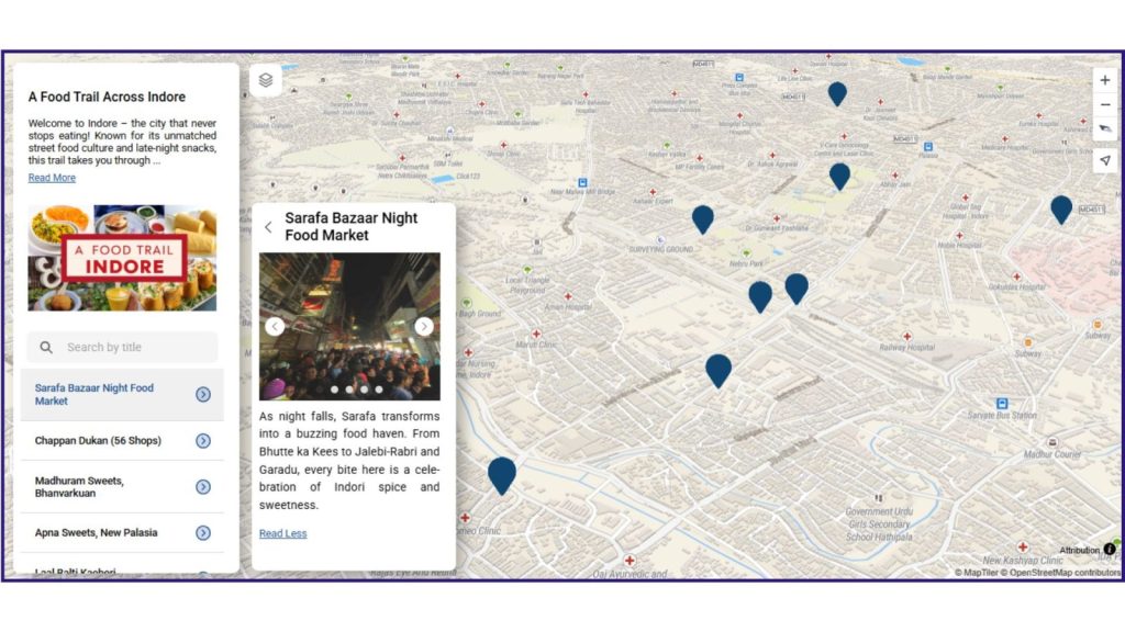
Meet Priya. She’s planning a food trail across Indore for her travel blog.
She’s tired of messy Google Docs and static screenshots. She wants a map where:
- Each restaurant is marked with photos
- Viewers can click and read descriptions
- She can embed the map directly on her blog
Enter: Interactive Mapping Software.
Within 20 minutes, Priya’s map is live, stunning, and shareable.
What Is Interactive Mapping Software and How to Use It Without Coding?
Think of it like a visual editor for maps.
You’re not just marking locations—you’re telling a story with data, images, and clickable points.
It’s like this:
- Instead of saying “We visited 10 cities”
→ you show where you went, what you did, and why it mattered - Instead of just listing school campuses
→ you let people explore them virtually
Why Story by MAPOG Is the Best Tool to Create Interactive Maps Without Coding
| Feature | What It Means for You |
|---|---|
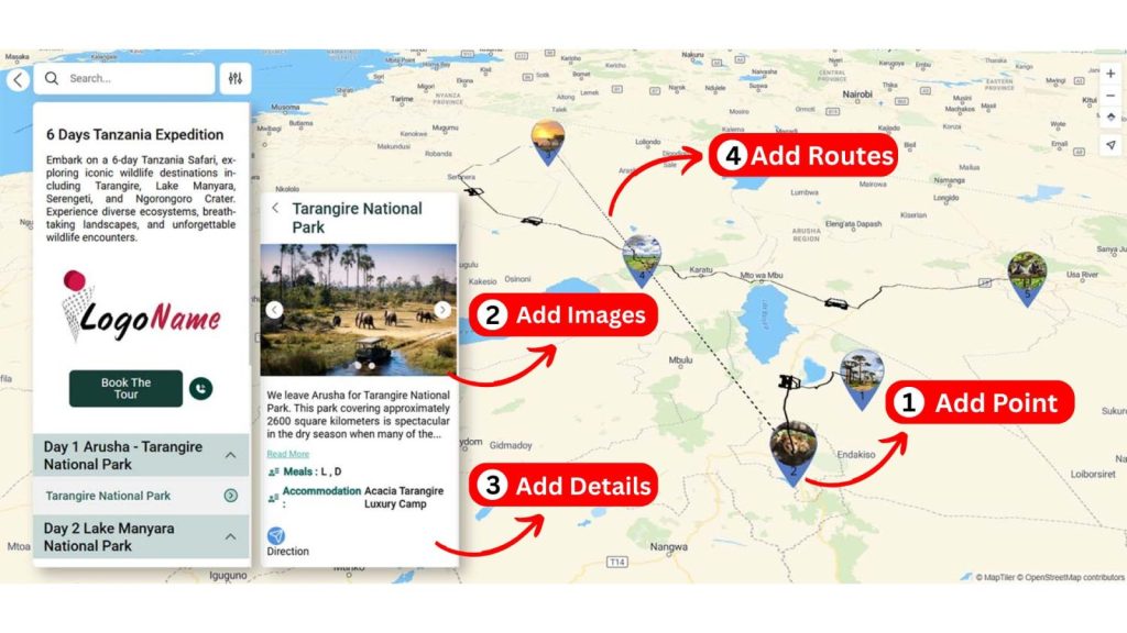
| Visual Pinning | Click on the map to add places |
| Descriptions + Media | Add stories, facts, photos, and details |
| Colorful Categories | Group locations using icons and color labels |
| Collaborative Sharing | Work together and share maps publicly or privately |
| No Logins for Viewers | Viewers can access maps without creating accounts |
| Mobile-Ready | View or edit maps on the go from your phone |
| 200+ GIS Layers | Instantly add rivers, roads, city borders, and more with a click |
3 Easy Map Projects to Create Interactive Maps Without Coding
Let’s say you’re just getting started. Here are three quick project ideas you can create this weekend:
1. A Dream Travel Map
Plot your dream destinations—add photos, routes, and why you want to go.
2. A School History Project
Map out ancient civilizations or war routes with details and images.
3. Local Business Guide
Create a map of the best cafes, boutiques, or service providers in your neighborhood.
Additional Features of No-Code Interactive Mapping
- Built-in GIS data: Already tagged with global boundaries, transport networks, landmarks
- Embed anywhere: Blog, portfolio, resume, or presentation
- Works great for storytelling, planning, education, and data visualization
Zero coding required—none. Nada.
Get Started: Create Interactive Maps Without Coding in Minutes
You don’t need a full-blown course. Just visit Story by MAPOG, hit “Create New Story,” and let your curiosity take over.
Start with something simple:
“My 5 Favorite Places in My City.”
Drop pins. Add a memory. Upload a picture. You’ll be surprised how fun it gets.
Need help with any mapping requirement or want us to help you create a story?
Reach out to us at support@mapog.com — we’ll be happy to guide you!
BONUS READ:
Interactive Map Online – A Beginner’s Guide
Free Custom Mapping – Visualise, Plan & Share
How to Create Grid Maps for Analysis?
Mapping Top University Nations: A Quantitative Approach