Real Estate

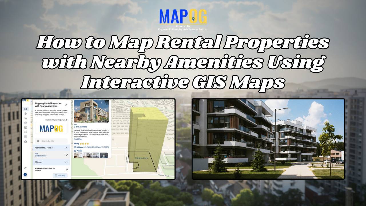
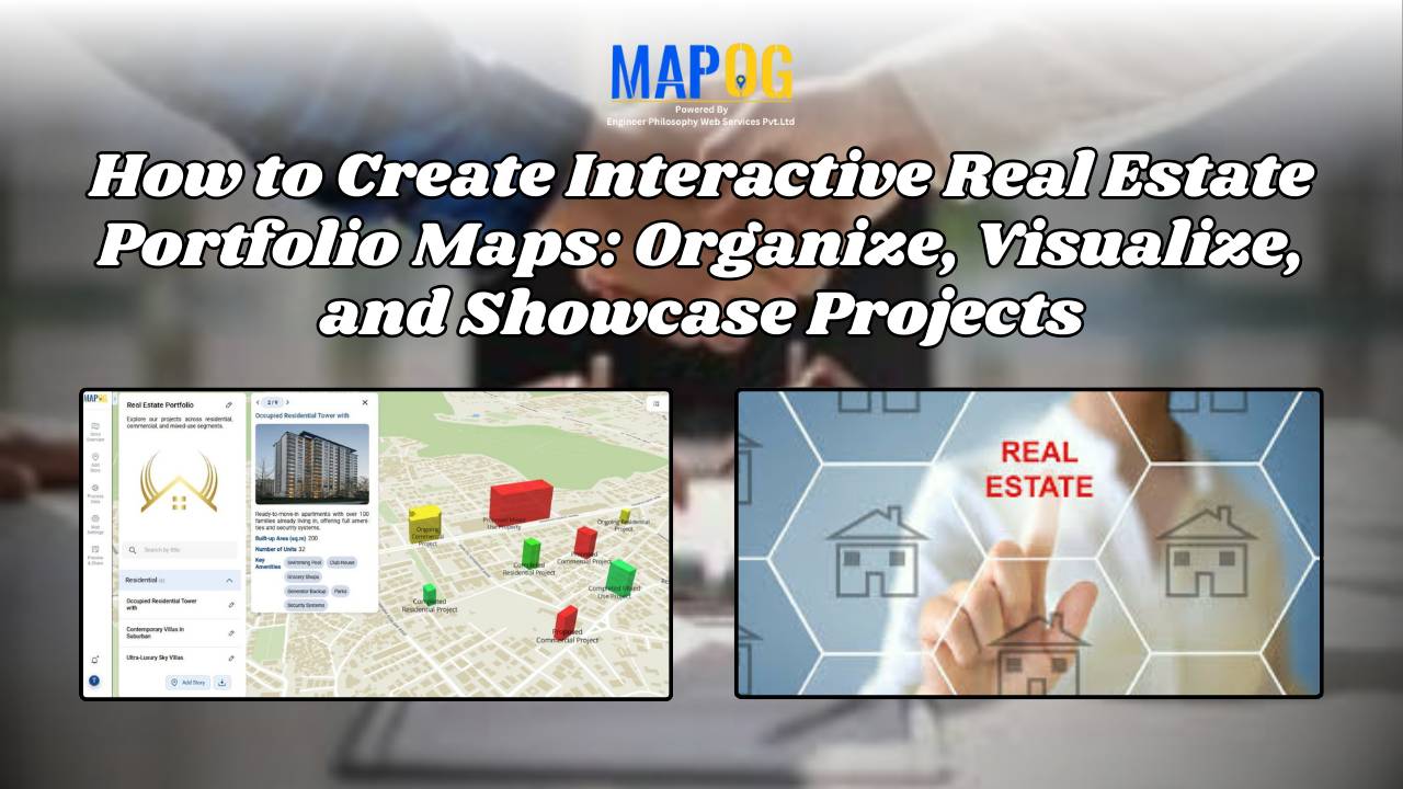
How to Create Interactive Real Estate Portfolio Maps: Organize, Visualize, and Showcase Projects

In real estate development, success isn’t just built—it’s mapped. Today’s developers are moving beyond static brochures to embrace tools like interactive real estate portfolio map. Hence, these dynamic tools allow developers to present their projects with clarity, connectivity, and context. For example, just as agents use maps to help homebuyers understand surroundings, developers are now … Read more

How to Map Rental Properties with Nearby Amenities Using Interactive GIS Maps

Whether you’re a real estate agent, property manager, or investor, mapping rental properties with key nearby amenities gives your listings the edge. In fact, visual maps offer clarity, transparency, and better decision-making for both renters and owners. By combining precise coordinates with contextual data—such as distance from schools, hospitals, or parks—you ultimately make the rental … Read more

Create a Real Estate Map with Filters for Price, Location, and Property Type

Mapping has become an essential tool in the real estate industry to display property data and attract potential buyers visually. One such powerful and easy-to-use tool is  MAPOG, which allows users to Create real estate Property Map with filters such as price, location, and property type. This article walks you through the methodology step-by-step, explains … Read more

How Real Estate Agents Use Maps to Sell Properties Smarter

How Real Estate Agents Use Maps to Sell Properties Smarter

In real estate, using real estate map tools helps agents present not just the property, but its location benefits too. More agents now use interactive maps to help buyers understand not just the home, but its surroundings—like nearby parks, schools, transit, and conveniences. Embedding maps into property listings makes websites more engaging. When buyers can … Read more