In the era of smartphones, build mobile web maps has become essential for real-time navigation, planning, and communication. Traditional GIS software can be complex and desktop-oriented, but MAPOG makes it simple to build fully responsive, mobile-friendly interactive maps without coding. From visualizing city infrastructure to projects like “Showcase Your Hotel with an Interactive Property Map for Better Guest Engagement” these tools highlight how easily spatial storytelling can be adapted for any sector. Hence, a mobile web map enables users to visualize spatial data, filter categories, and access essential information instantly from their phones. Whether used by planners, researchers, or citizens, mobile mapping enhances efficiency, engagement, and accessibility anywhere.
Key Features
Mobile web maps are designed for speed, interactivity, and accessibility. Thus, their primary strength lies in being responsive—they automatically adjust to different screen sizes, ensuring usability on any device. They use lightweight data handling, so even large datasets load smoothly on mobile networks.
Through touch-friendly interfaces, users can tap on points to view information, explore locations, or search with ease. Projects like “Interactive Campus Map” demonstrate how mobile mapping improves on-the-go accessibility. Lastly, instant sharing tools—like direct links—make it easy to embed and distribute maps anywhere. Finally, together these features turn mobile web maps into fast, practical tools for everyday use.
Steps to Build a Mobile Web Map with MAPOG
Step 1: Start a New Project
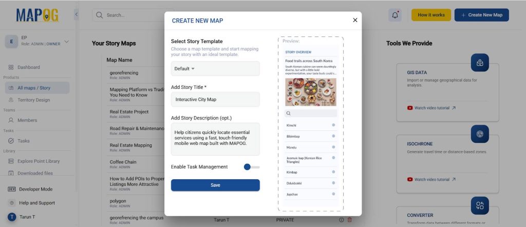
Log in to MAPOG and click Create Story Map.
Select Default Category and give your project a title such as “Interactive City Map”. Then, add a short description explaining your purpose.
Step 2: Import Data Efficiently
Go to “Add Story” → “Add by Uploading CSV/Excel”
Then, upload a lightweight CSV/Excel dataset with fields like:
- Name
- Category
- Latitude / Longitude
- Description
- Contact / Link

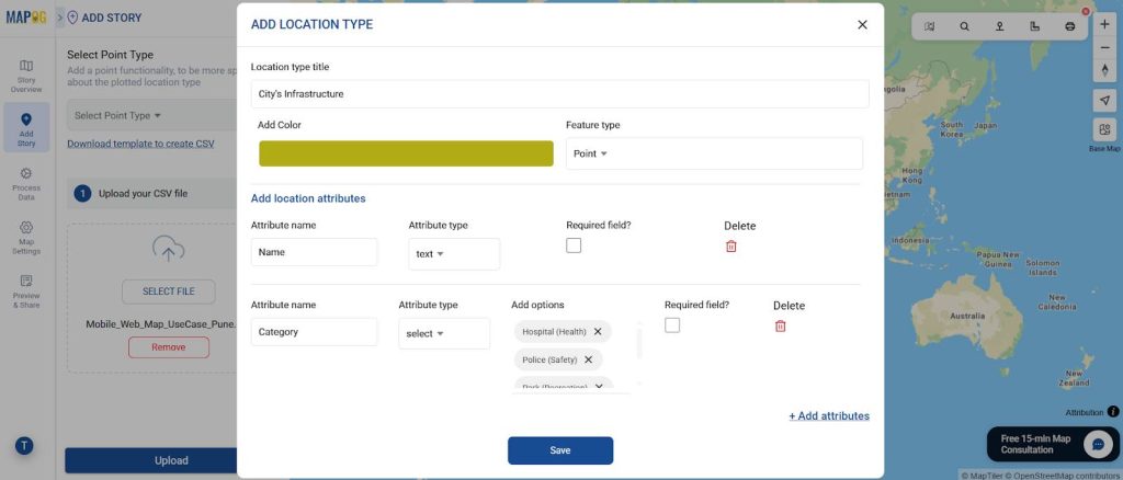
Step 3: Create Mobile-Optimized Attributes
Then go to the select point type. In “Location Type Management”, define only essential attributes.
Mobile users prefer concise, visual information, so add short fields like:
- Open Hours
- Rating
- Emergency Available (Yes/No)
Avoid lengthy text — instead, include a short popup description with icons or bullet points.
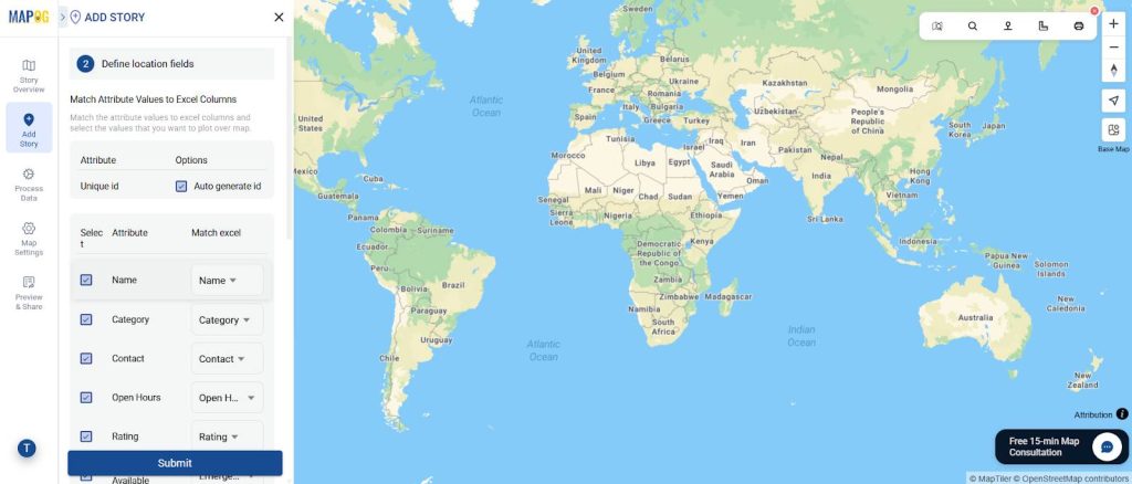
Step 4: Match Attributes with CSV
- Use “Match Excel” to link your custom attributes with CSV columns, including Latitude and Longitude.
- Finally, submit to auto-fill points—MAPOG populates large datasets quickly.
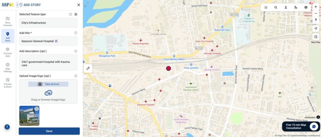
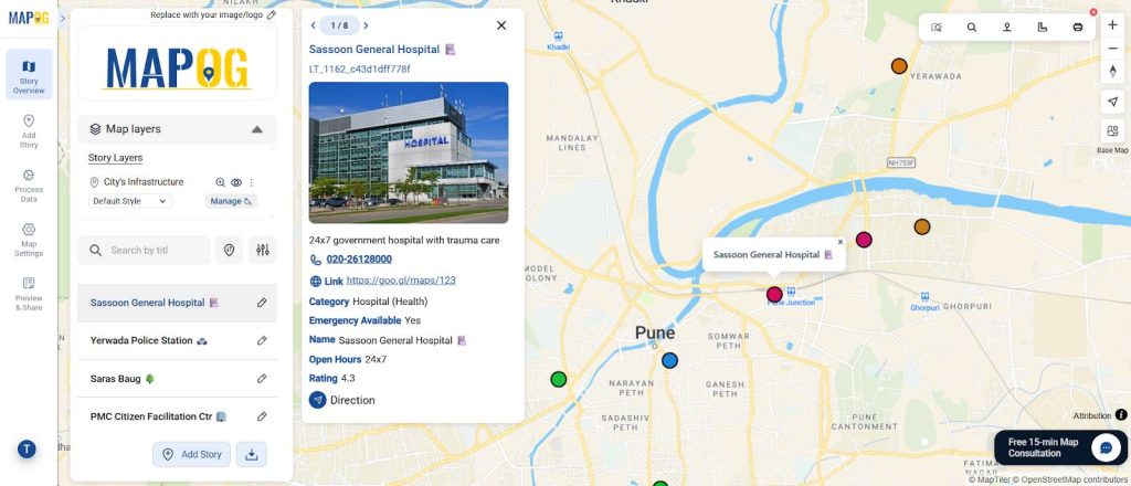
Step 5: Add Images
Then, go to each mapped point and add relevant images to make your map visually rich and recognizable. Hence, these visuals give each location context and make the map more engaging to explore.
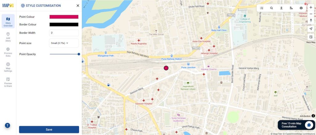
Step 6: Style Customization
Make your map visually intuitive by assigning colors based on business categories using the “Style Customization” tab:
- 🟥 Red: Emergency Facilities
- 🟩 Green: Parks & Open Spaces
- 🟦 Blue: Public Services
Use smaller markers for dense clusters and enable auto-labels for clarity.
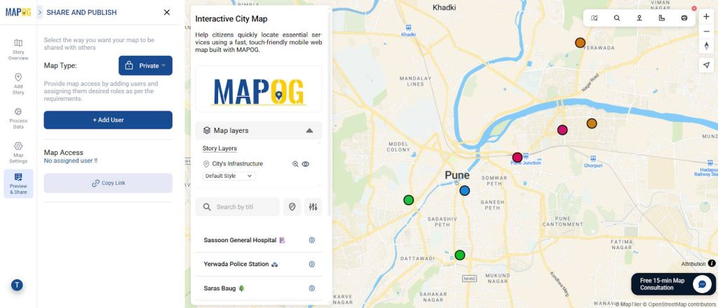
Step 7: Share & Publish
Go to “Share & Publish”
Then, choose Public or Private access.
Finally, share the link, email it to stakeholders, or embed it on your website.
Industry World Applications
Mobile web maps provide real-time, interactive access to spatial data, turning complex information into actionable insights. Projects like “On-Map Travel Planning: How to Build and Share Interactive Itineraries Transform Client Experiences” show their value in enhancing user engagement.
Key Applications:
- Urban Planning: Visualize infrastructure and zoning directly from the field.
- Business & Retail: Locate outlets, plan delivery routes, and track customers.
- Tourism & Travel: Interactive guides and itineraries improve visitor experiences.
- Research & Academia: Quickly display field data and survey results.
- Public Services: Finally, support emergency management, healthcare mapping, and waste monitoring.
Mobile maps make information fast, actionable, and accessible on any device.
Conclusion: Fast, Mobile, and Effective Mapping
Creating web maps no longer requires coding or GIS software.
With MAPOG, users can build mobile web maps quickly and easily, making data accessible anywhere.
Hence, by focusing on performance, simplicity, and interactivity, you can turn any dataset into a fast-loading, tap-driven web map that works anywhere — from classrooms to city streets.