Adding a georeferenced image overlays, such as PNGs or GeoTIFFs, to a map can be challenging, whether it’s a scanned map, satellite image, or custom visual. The main challenge lies in aligning images with real-world locations so landmarks appear at the correct scale. MAPOG simplifies this process, users can upload PNGs and GeoTIFFs, manually align PNGs with key landmarks, and automatically position GeoTIFFs using embedded coordinates.
Key concept: Why Georeferenced Image Overlays Matter in Mapping?
Georeferenced image overlays, like PNGs or GeoTIFFs, turn static visuals into spatially meaningful map layers. Specifically, they help place scanned maps or sketches onto a base map with geographic accuracy. As a result, georeferenced image overlays on map improve spatial analysis and add real-world context. This enhances context, supports analysis, and helps communicate location-based insights clearly, especially in planning, disaster response, or community mapping. Here, a university campus base map is taken as an example to show how building layouts, pathways, or service zones can be overlaid and aligned with real-world features.
Steps to add georeferenced image overlays on map
1. Add your PNG file
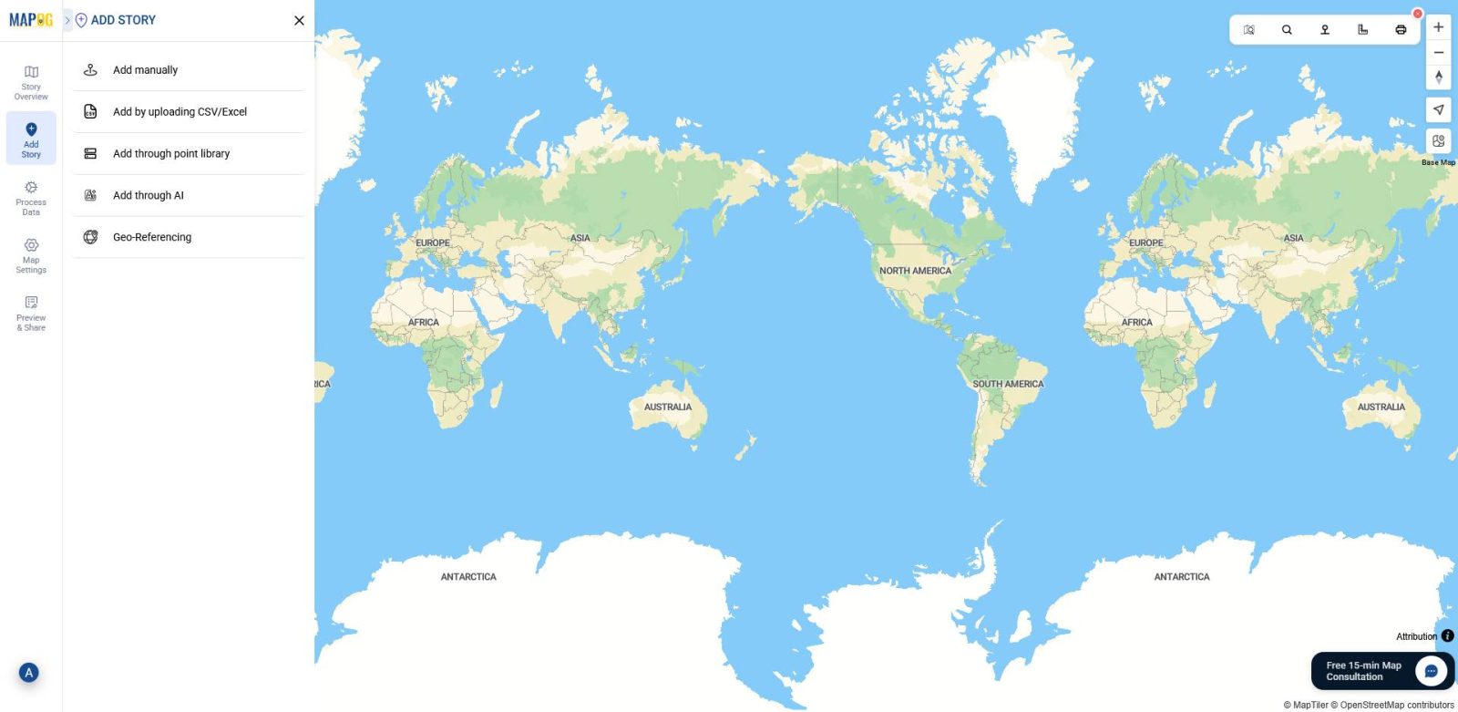
In MAPOG, after creating a new map, head to ‘Add Story,’ then select “Georeferencing” to enable image overlay.
2.Upload your image
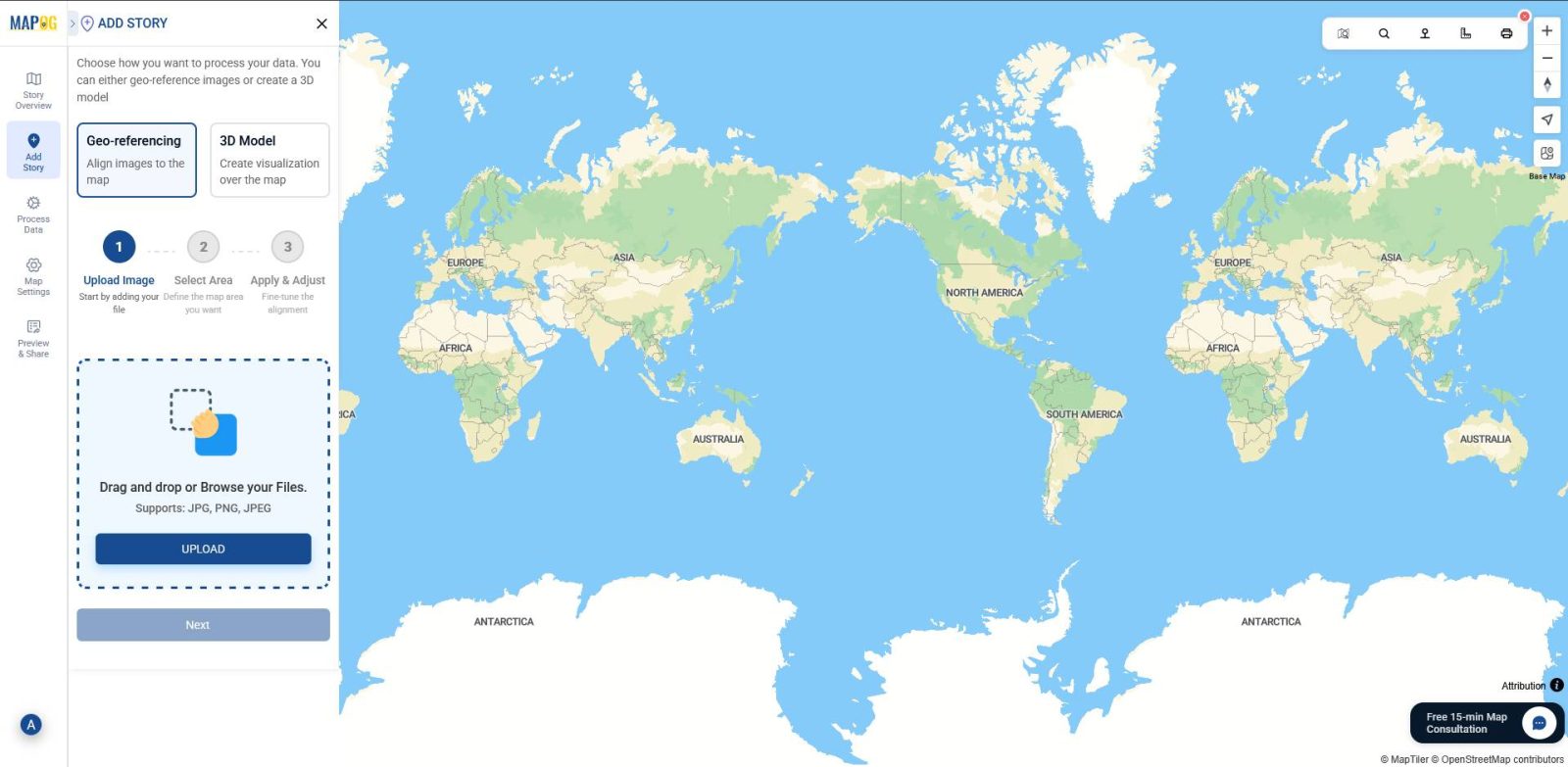
Next, click on the “Upload” button.
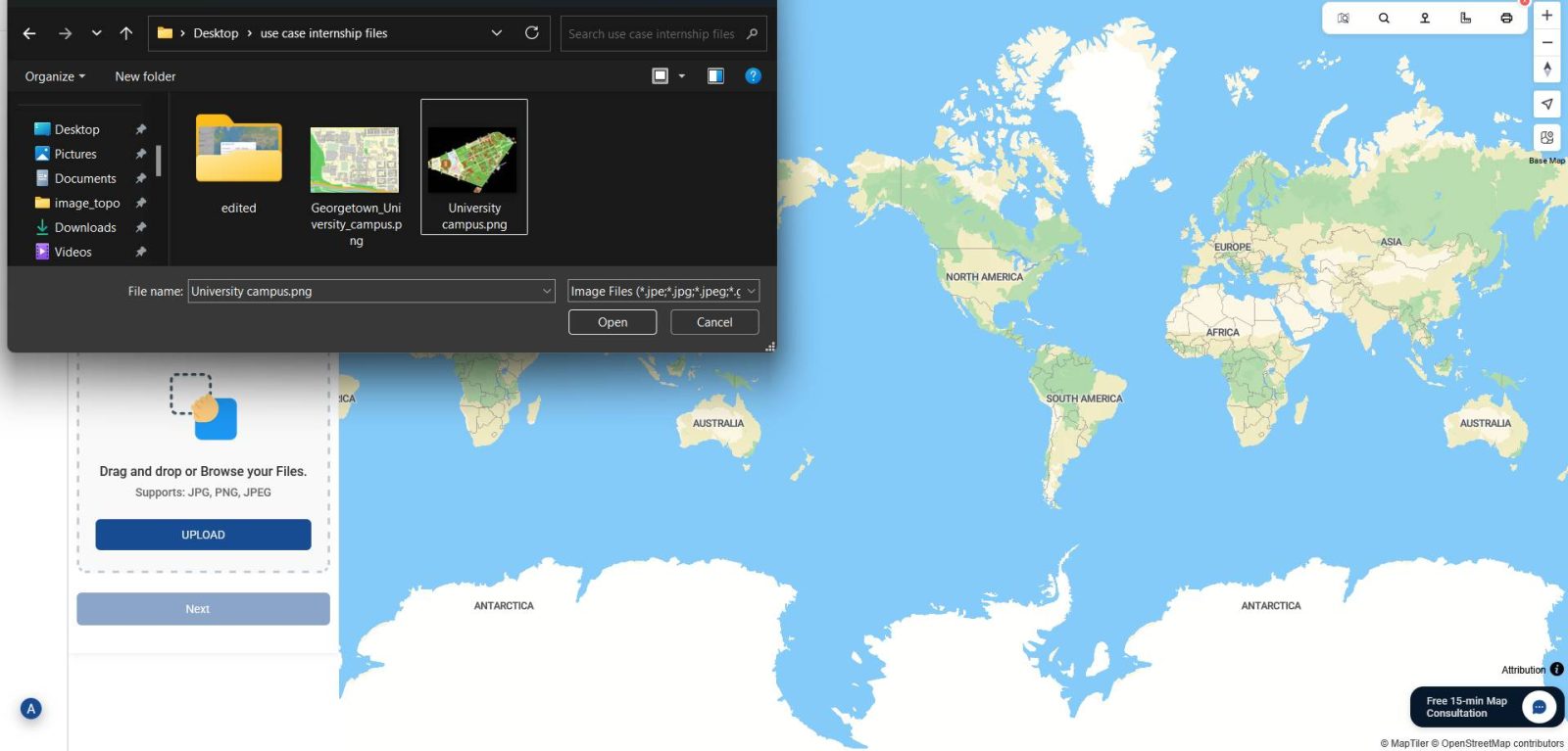
Then, choose your PNG file from your device. This will load the image into the platform for placement.
3. Search for your location of interest
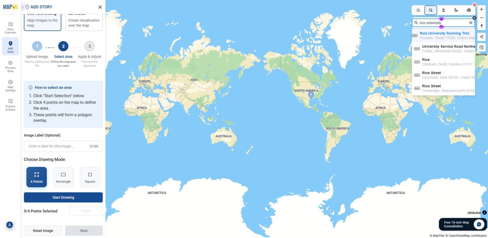
Before drawing, use the search icon in the toolbox section to locate the area where your PNG image should be overlaid. This ensures you’re working in the correct geographic context.
4. Choose a drawing mode
Once your image is uploaded and the location is set, proceed by clicking “Next.” At this point, you’ll be prompted to choose a drawing mode, either “4 Points” , “Rectangle” or “Square”, depending on how you want to anchor your image. Then click “Start Drawing” to continue.
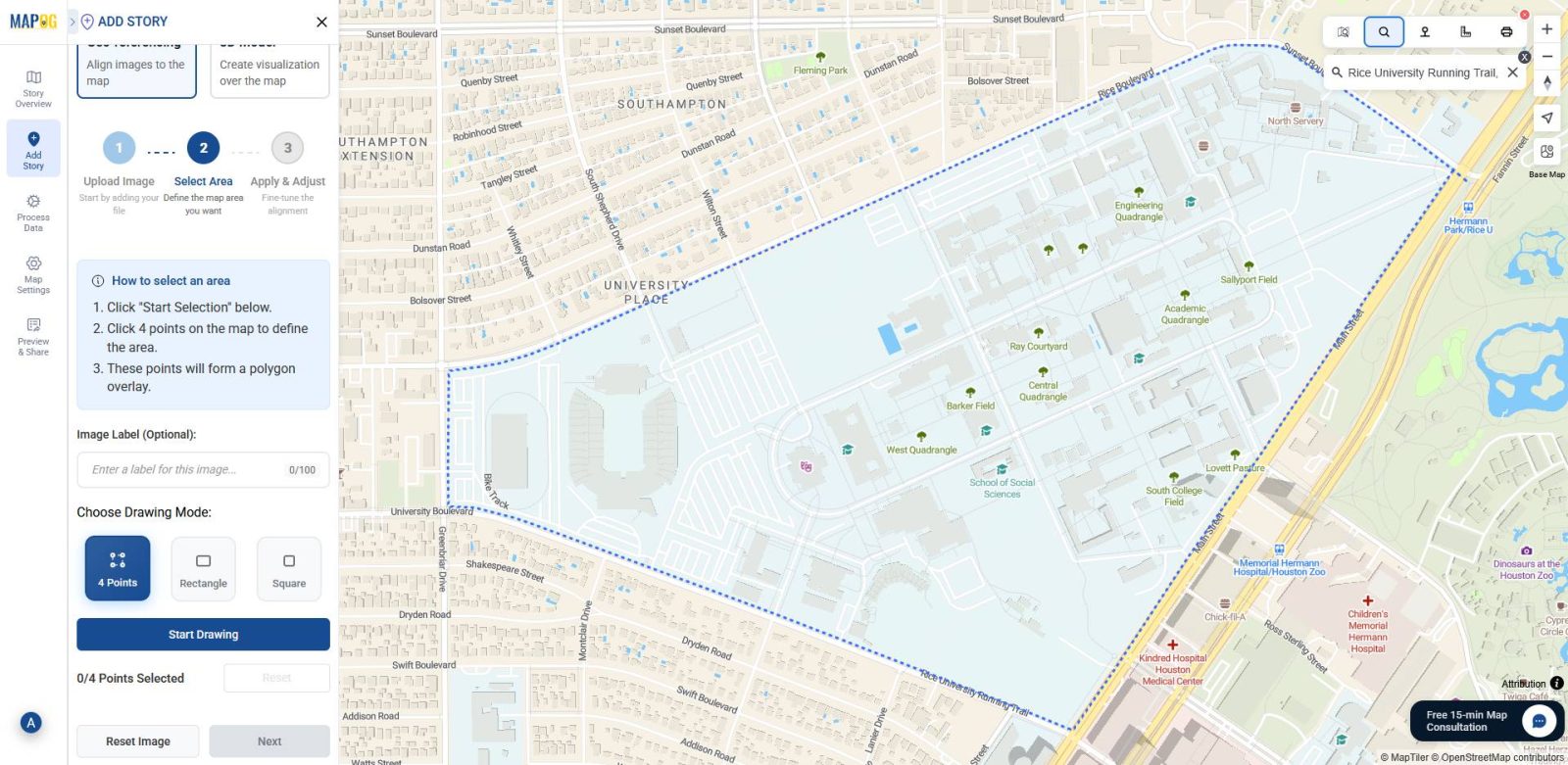
5. Mark the area on the map
Now, on the map interface, select the region of interest and place your PNG image within it. This step sets the boundaries for overlaying the image.
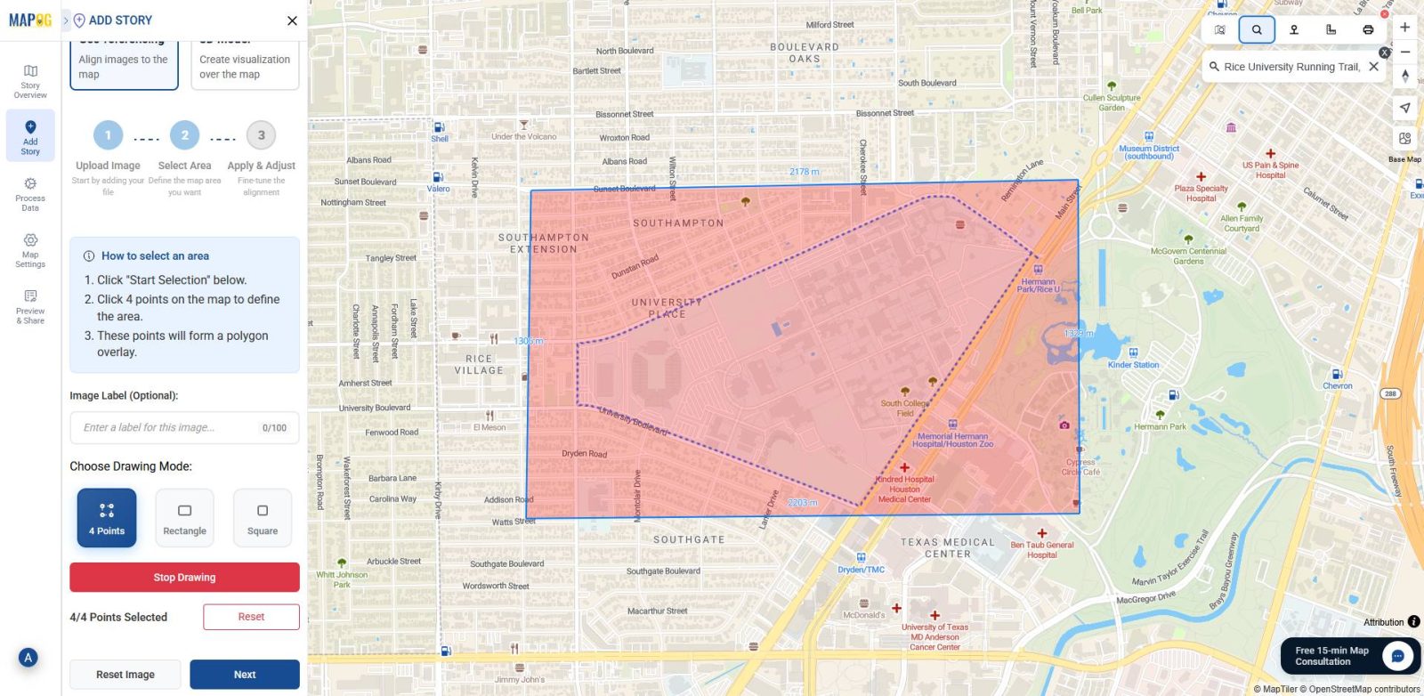
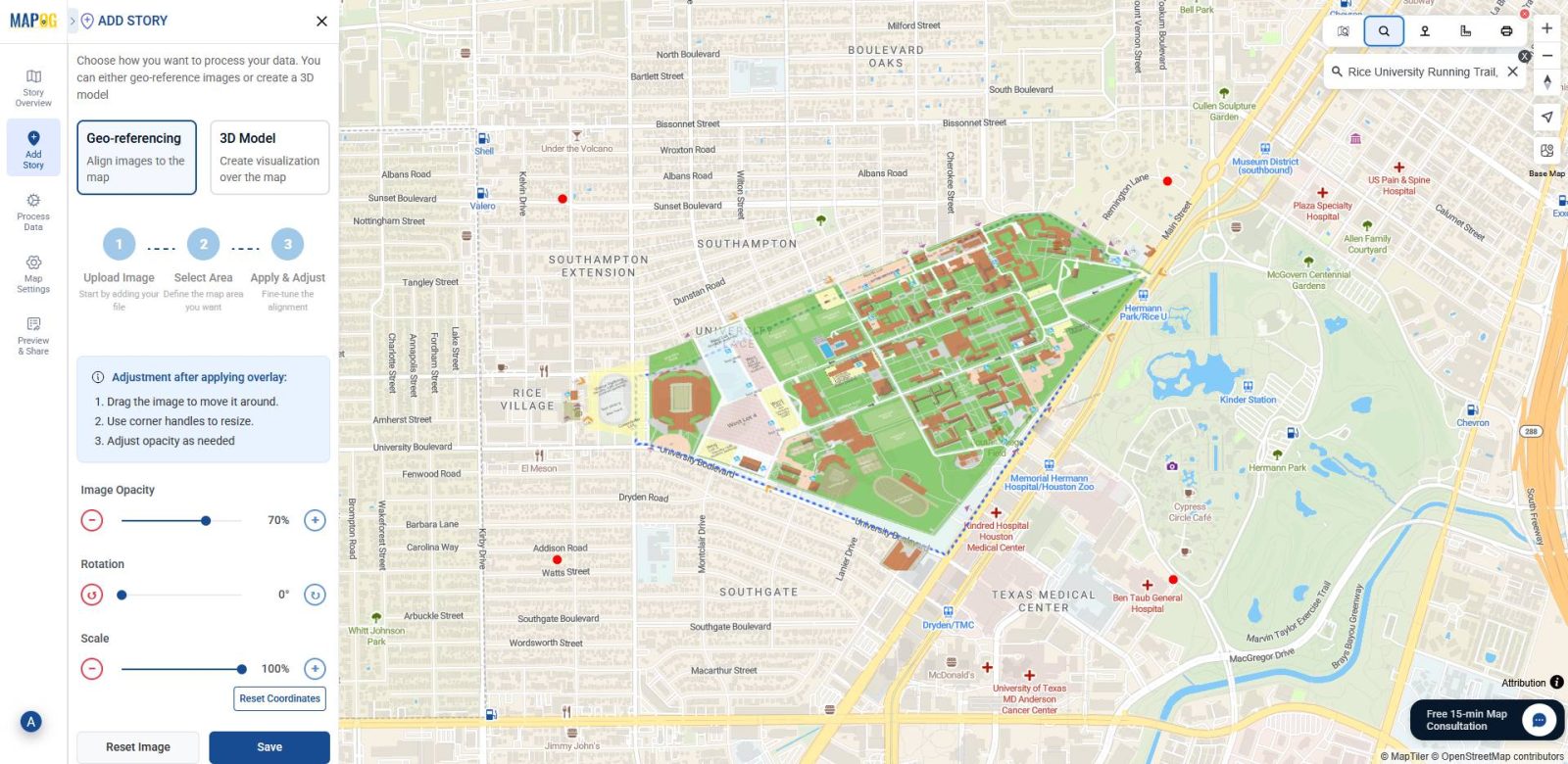
6.Align the PNG with the base-map
Next, align your campus base-map PNG with the actual base-map map by matching key landmarks like buildings, roads, and open spaces using the corner points. You can also fine-tune the placement with the image opacity slider, scale, and rotation tools, then save, once accurately aligned.
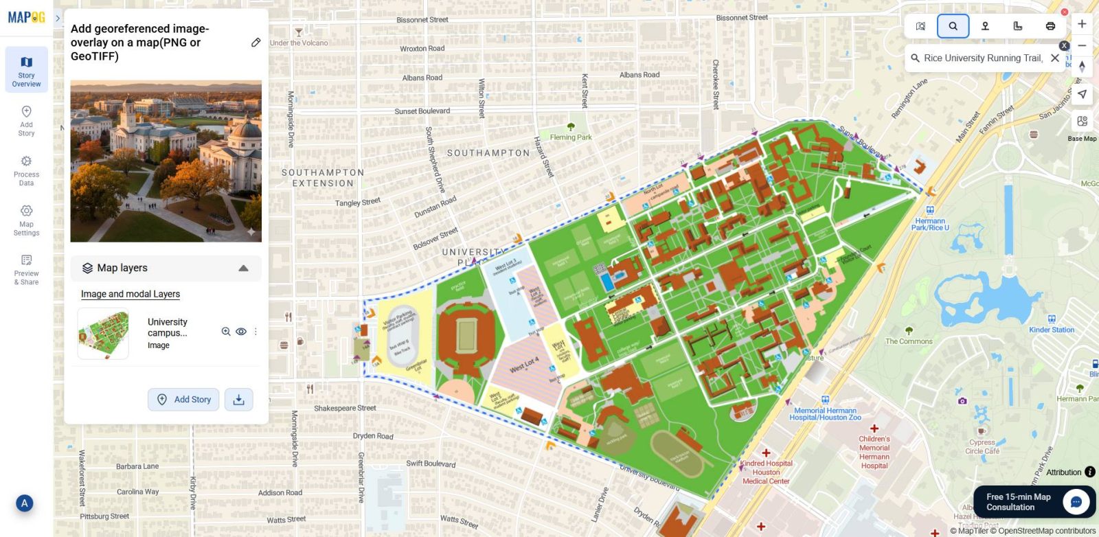
7.Final visualization
Finally, after you align and save the image, MAPOG overlays your georeferenced PNG directly onto the map.
Industrial use and benefits
Georeferencing PNG and GeoTIFF images helps industries align visual data with real-world coordinates for better planning and analysis. In MAPOG, users can overlay scanned maps, field sketches, or satellite outputs directly onto base-maps. Fields that benefit significantly from this approach include:
- Urban Planning and Campus Development
To start with, planners can overlay campus layouts and zoning maps to visualize expansion, assess accessibility, and monitor service coverage. - Disaster Management and Risk Mapping
During emergencies, agencies rely on flood extent GeoTIFFs and hazard zone PNGs to identify risks, plan evacuations, and support recovery efforts. - Environmental Monitoring and Agriculture
Meanwhile, researchers use vegetation and soil maps to track changes and encourage sustainable land use practices. - Healthcare and Public Services
Lastly, health departments overlay service zones and facility layouts to locate under served areas and improve emergency response planning.
Conclusion
Overall, georeferencing image overlays like PNGs and GeoTIFFs let you to align static visuals with real-world geography. Through MAPOG’s intuitive workflow, users can upload, position, and adjust overlays using drawing models, location search, and opacity tools. As a result, scanned maps and satellite outputs turn into spatially accurate layers that support planning and analysis across key sectors.
Check out other blogs you might find interesting:
- Hotel Campus Map: How to Create an Interactive Guide to Amenities, Dining & Activities for Better Guest Experience & Operations
- Interactive Campus Map: Visualize Your Entire College with Smart Digital Navigation
- How to Use GIS Mapping for Solar Development: A Step-by-Step Guide to Smart Site Selection
- Smart Hospital Maps: How Interactive Mapping Improves Patient Navigation & Care