In today’s data-driven world, the ability to map retail store locations for your franchise is one of the smartest moves you can make. Just as visualizing a Safari Itinerary on a map helps travelers craft immersive and efficient journeys, or mapping Spatial Retail Store Analysis with GIS tools enables cities to improve safety and planning, mapping store locations goes beyond simply knowing where your outlets are.
Moreover, with intuitive platforms like MAPOG, you can turn a basic Excel sheet of store addresses into a dynamic, branded map that showcases your retail footprint.
Key concepts
Mapping store data is no longer a technical hurdle — thanks to modern tools, you can now also map EV Charging stations in few steps. In fact, the process has become so streamlined that even non-technical users can create detailed, professional maps.
Whether you’re adding new branches, exploring underserved areas, or assessing store performance, knowing how to map retail store locations for your franchise gives you a clear competitive edge. Furthermore, it supports better planning, enhances visibility, and improves strategic decision-making across departments
GIS Mapping for Franchise Retail Stores: What You Need to Know:
First, upload your store location data using Excel or CSV files that include coordinates such as Latitude and Longitude. Then, customize each store marker with details like opening hours, product focus, or contact information to enrich the user experience. Additionally, you can use bubble maps or point maps to visually represent store size, performance, or sales metrics. For more context, merge in supporting GIS layers such as population heat maps, transportation routes, or zoning boundaries.
Step-by-Step Guide to GIS-Based Store Mapping
Prepare Your Location Data
I compiled the data with columns like:
- Shop Name
- Address
- Latitude
- Longitude
- Status (e.g., Active/Closed)
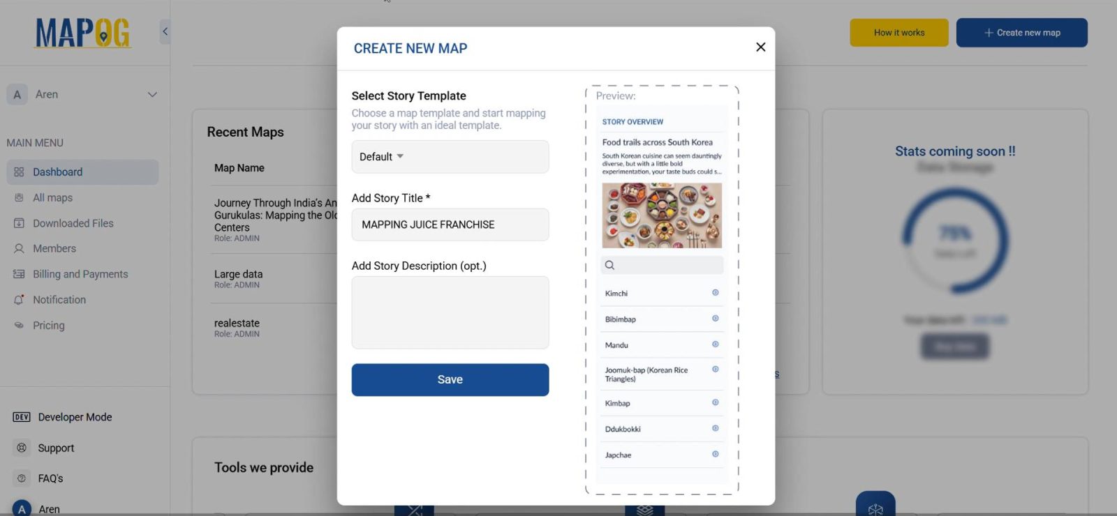
1. Login and Start a New Story
- Go to MAPOG
- Click on Create New
- Enter a title like “Juice Shops in District”
- Write a brief description (e.g., “Mapping juice shop locations for retail planning”) and click Save
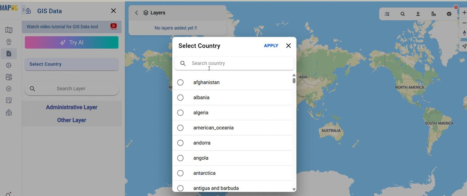
2. Add Administrative Boundary Layer for Context
- Use the GIS Data option
- Select: Country > State > District
- Add the administrative boundary layer to provide spatial context
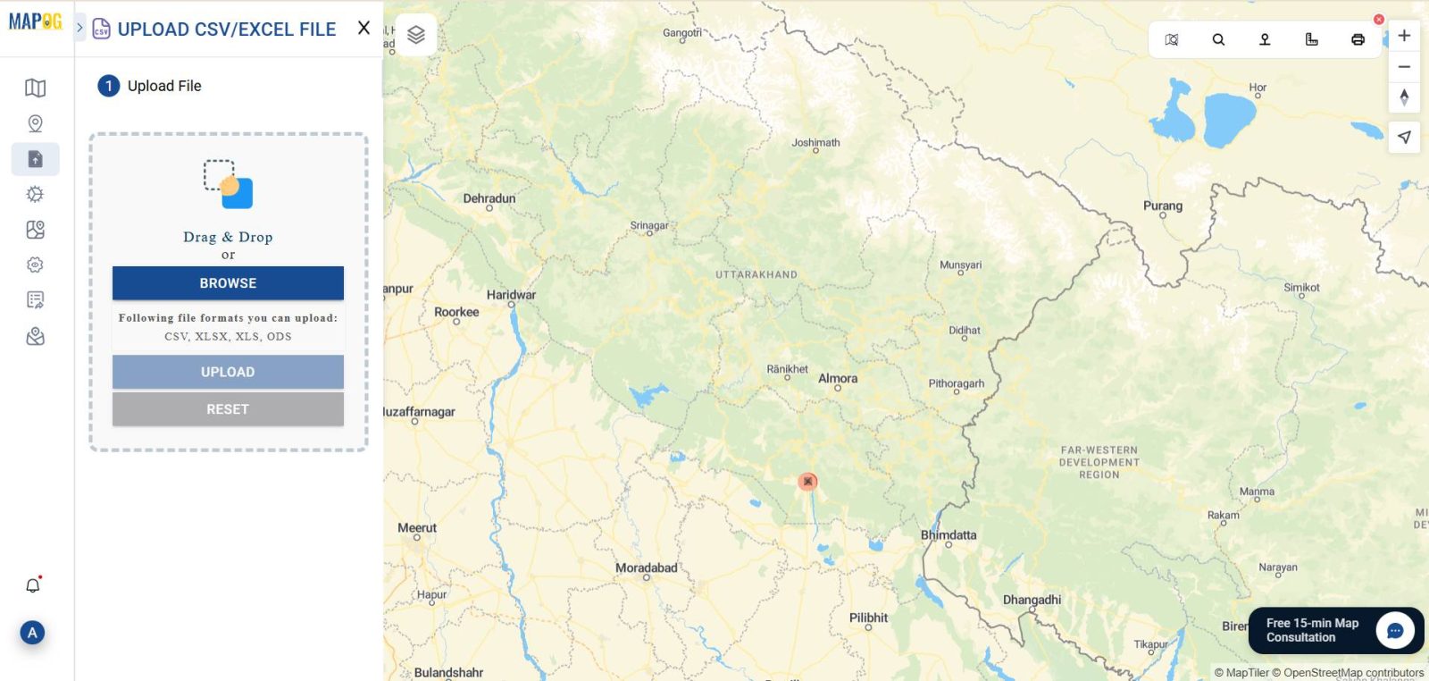
3. Upload the Juice Shop Data
- Click on Add/Upload Data > Upload CSV/Excel
- Select your prepared Excel file
- Match the column headers with field types:
- Latitude → Latitude
- Longitude → Longitude
- Name or Shop Title → Name
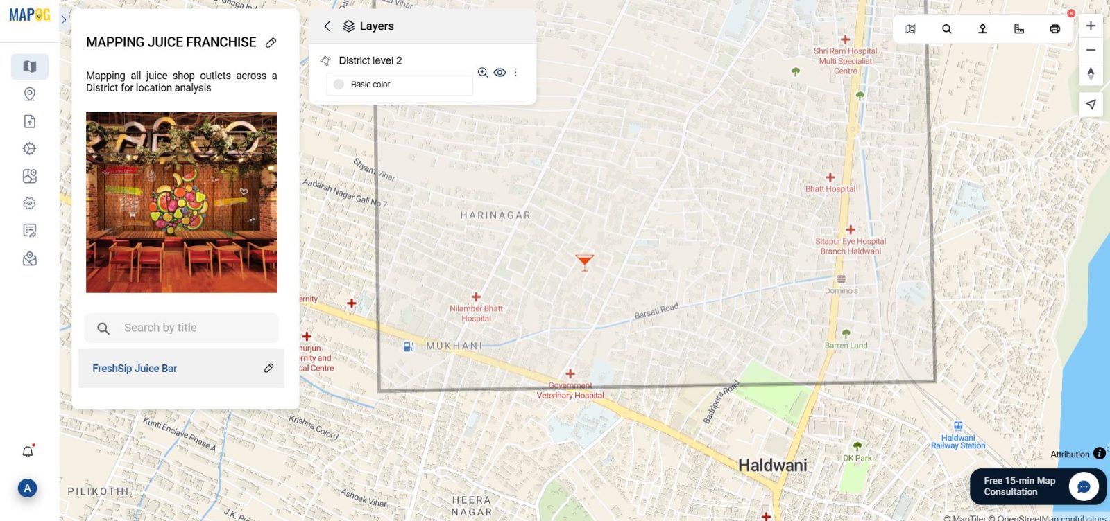
4. Customize the Style Using the Style Editor
- Go to Style Layer
- Choose Point Map or Bubble Map
- Set color coding based on shop status (e.g., green for active, grey for closed)
- Adjust icon size or shape for visibility
5. Add Additional Information (Optional)
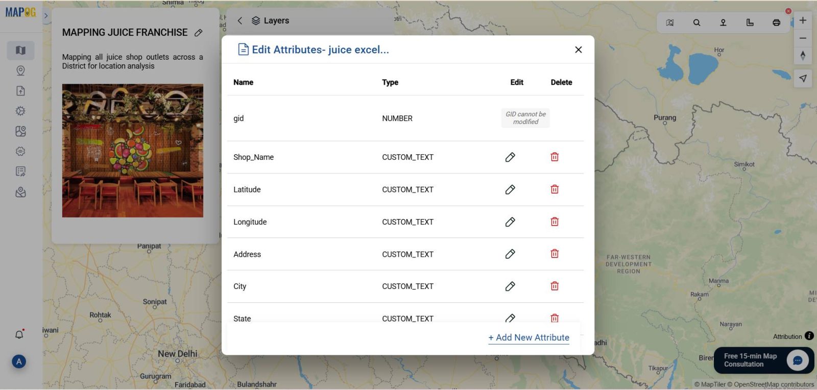
- Open the Attribute Table of the uploaded layer
- Add columns like “Shop Type,” “Rating,”
6. Preview and Publish Your Map
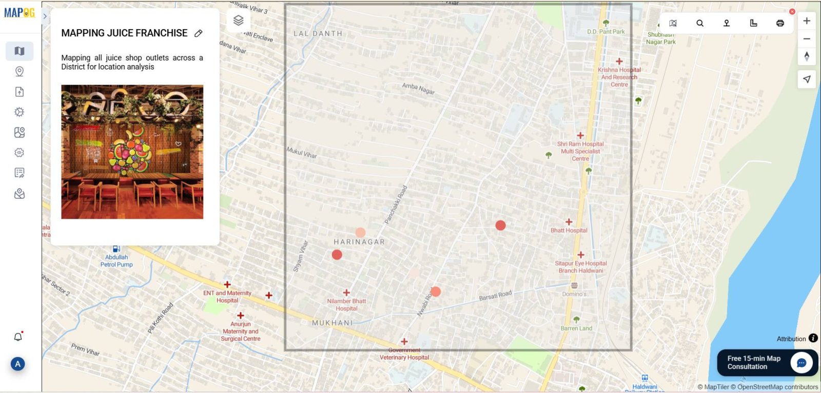
- Click on Preview to review your map layout
- Ensure all points are accurately placed
- Hit Share & Publish
Future Trends in Franchise Store Location Mapping with GIS
Franchises in retail, food services, healthcare, and fitness are already leveraging GIS to streamline operations and make growth strategies more visible and data-backed. With MAPOG, GIS is no longer just for analysts—it’s for business leaders looking to scale smartly.
Industry & benefits
This guide is especially relevant for the retail, franchising, and consumer services sectors.
Benefits of Mapping Retail Stores Using GIS:
- Centralized Store Visibility: Firstly, easily visualize where each franchise store is located on a single, interactive map.
- Market Gap Analysis: Moreover, identify underserved areas where new outlets could thrive by analyzing geographic clustering and customer reach.
- Improved Customer Experience: As a result, sharing interactive maps publicly helps customers find the nearest store, thereby boosting convenience and footfall.
GIS Data Used
Conclusion
Mapping your franchise store locations is more than a tech upgrade—it’s a strategic move. Not only does it bring visibility, but it also provides insight and engagement through one simple interface.
Exploring Our Previous Blogs
You might also be interested in our insights on Creating a Responsive EV Charging Map and GIS in Infrastructure Development and Road Network Analysis, which show how spatial data helps shape sustainable cities.
- Role of GIS In Irrigation Planning and Water Resource Management
- How GIS and Smart Mapping Reduce Urban Heat Islands
- GIS in Infrastructure Development and Road Network Analysis
- Flood Risk Mapping with Interactive Web Maps: SaaS Approach
- Optimizing Warehouse Location Selection with GIS for Supply Chain Efficiency