Planning a wildlife safari involves more than just booking a jeep and packing a camera. In fact, to make the most of your adventure—especially in biodiversity-rich parks like Kaziranga—it’s essential to prepare a detailed safari itinerary on map. By doing so, you can visualize routes, mark important safari zones, and stay organized throughout the journey. Moreover, having a mapped-out plan allows for better coordination and ensures you don’t miss any must-see spots. In this post, we’ll guide you through the step-by-step process of creating an interactive safari itinerary using mapping tools and explain why this approach significantly enhances your travel experience.
Key concepts
By leveraging spatial tools like Add/upload data, Location Connection, and layer styling, travelers can craft detailed and visually engaging safari itineraries. Additionally, MAPOG’s layer styling and Add Story feature streamline this process, making it easy to map routes, highlight park zones, and understand the spatial flow of your wildlife adventure with both clarity and precision. In turn, this ensures a more organized and immersive travel experience.
Why Do We Need a Safari Itinerary on Map?
Creating a safari itinerary on map provides clarity, direction, and flexibility. Instead of relying on handwritten notes or text-based plans, a mapped itinerary helps:
- Visualize your daily movements and accommodations
- Identify key park zones, gates, and rest areas
- Coordinate with guides and drivers more efficiently
- Share your plan with fellow travellers or friends in real time
Moreover, when you’re exploring expansive protected zones like Kaziranga National Park, a visual itinerary ensures you don’t miss any must-see region or safari route.
Step-by-Step Guide to Creating Your Safari Itinerary on Map
To build a fully functional safari itinerary map, follow these steps using tools like MAPOG
1) Selecting the Base map & Importing Key GIS Layers
Once you’re in the MAPOG interface, first, choose a suitable base map that aligns with your topic. Then, navigate to the GIS Data option to explore a wide range of preloaded spatial datasets.
These ready-to-use layers can be seamlessly added to your map, enabling the immediate initiation of your analysis.
Import critical datasets such as:
- Kaziranga national park boundary
- Jorhat airport
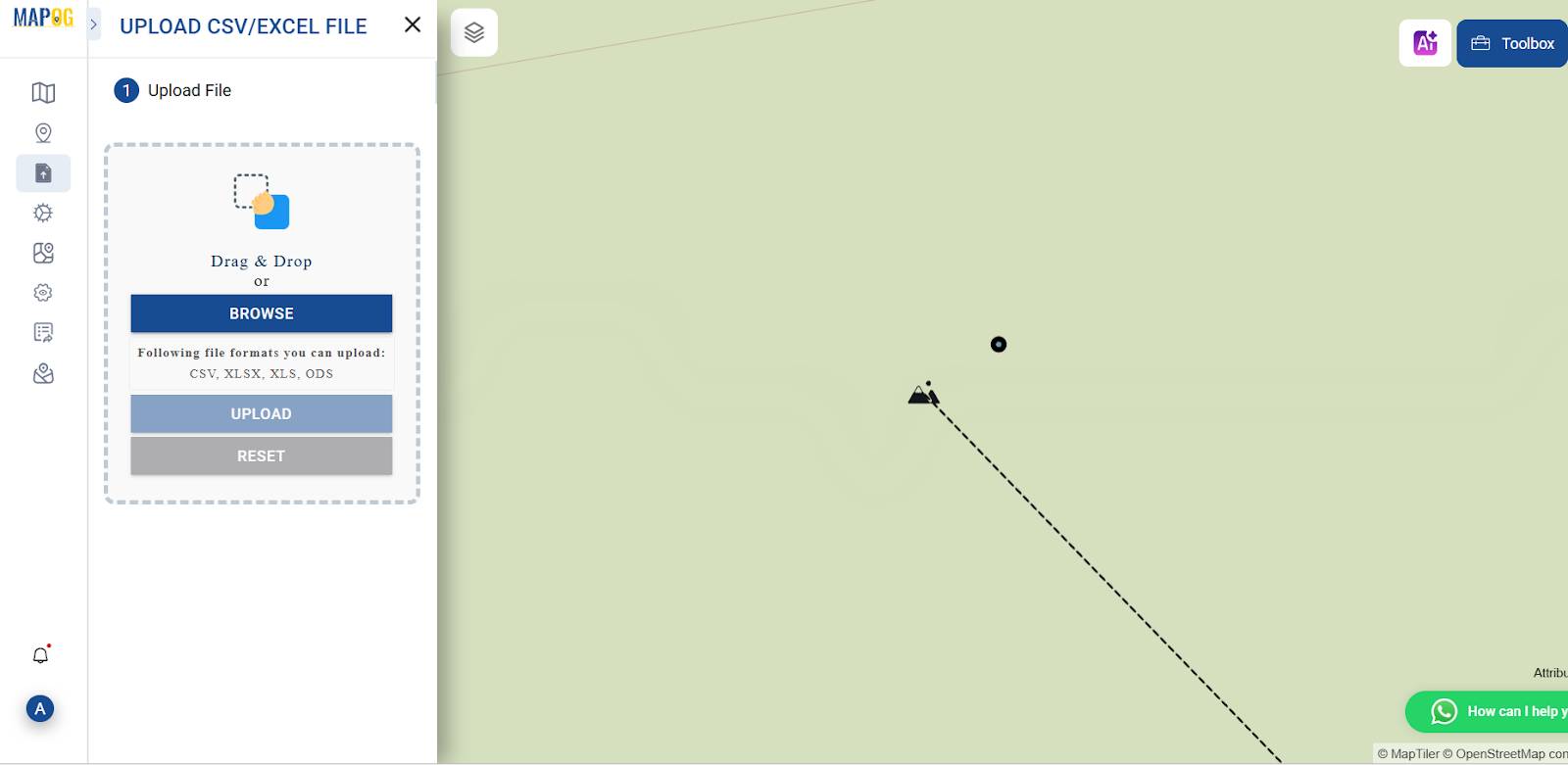
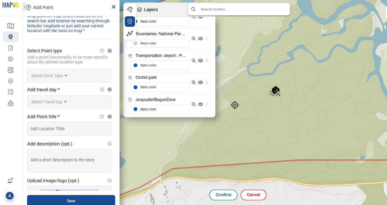
Now, start by uploading important CSV files of points. First, prepare a .csv file containing your key coordinates. Once prepared, this file can be uploaded directly into MAPOG to plot locations on the map. Next, go to Add/upload data, select your CSV/Excel file, and ensure you use columns like Name, Latitude, Longitude, and Description.
You can upload important locations such as
- Accommodation
- Safari points
- Sites to visit
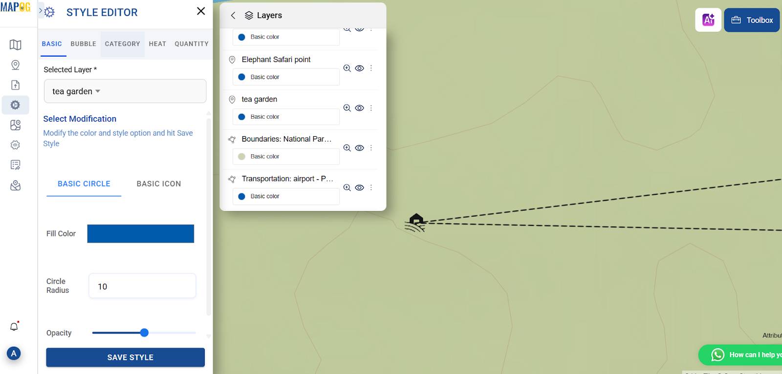
2. Styling Layers for Clarity
Using the Style Layer option in MAPOG, you can enhance map clarity by customizing each point with relevant icons—like jeeps for safaris or tents for stays. As a result, this makes your safari itinerary visually intuitive and engaging.
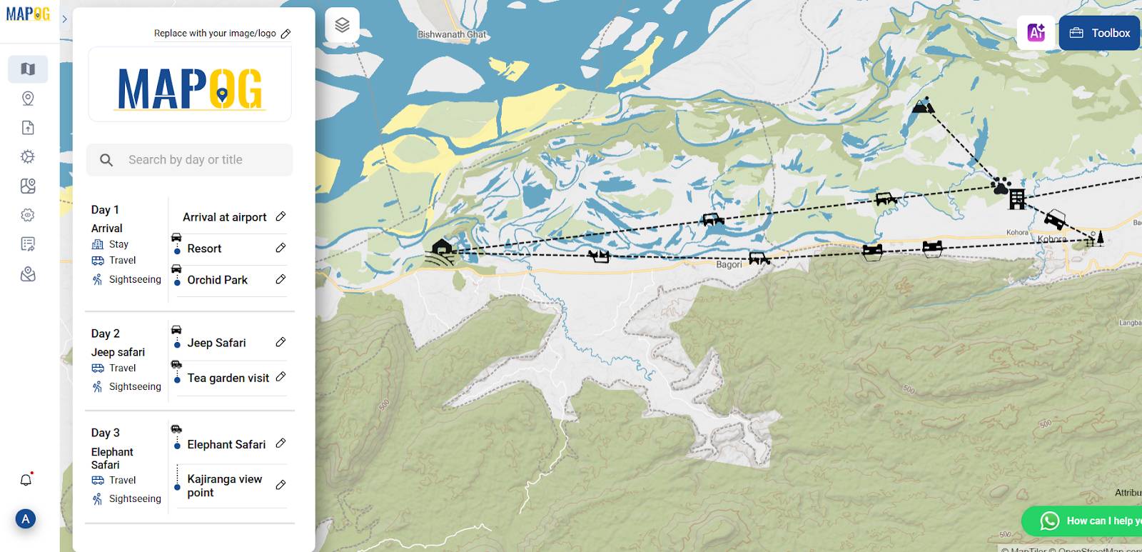
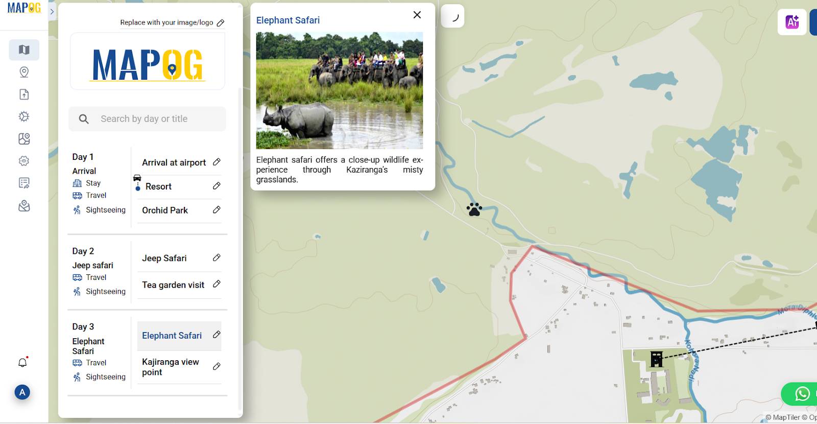
3. Bringing Your Safari Itinerary to Life with the Add Story Feature
In the “Add Story” section of MAPOG, first, manually select your uploaded points or polygons. For each point, assign a travel day, add a clear title, include descriptive text, attach relevant images, and save. Then, repeat this process to craft a compelling, day-wise itinerary map that brings your safari journey to life.
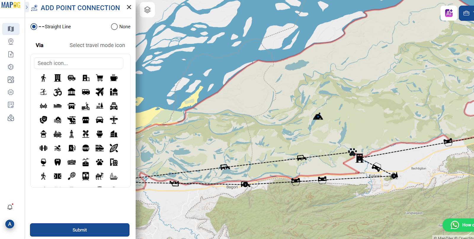
4. Enhancing Your Safari Map with Connected Routes
To elevate your safari itinerary map, first, head to the Story Overview and use the Edit option to customize each point. Next, under point customization, activate Location Connection to visually link your travel path. Finally, repeat this for all stops to create a seamless and engaging route visualization.
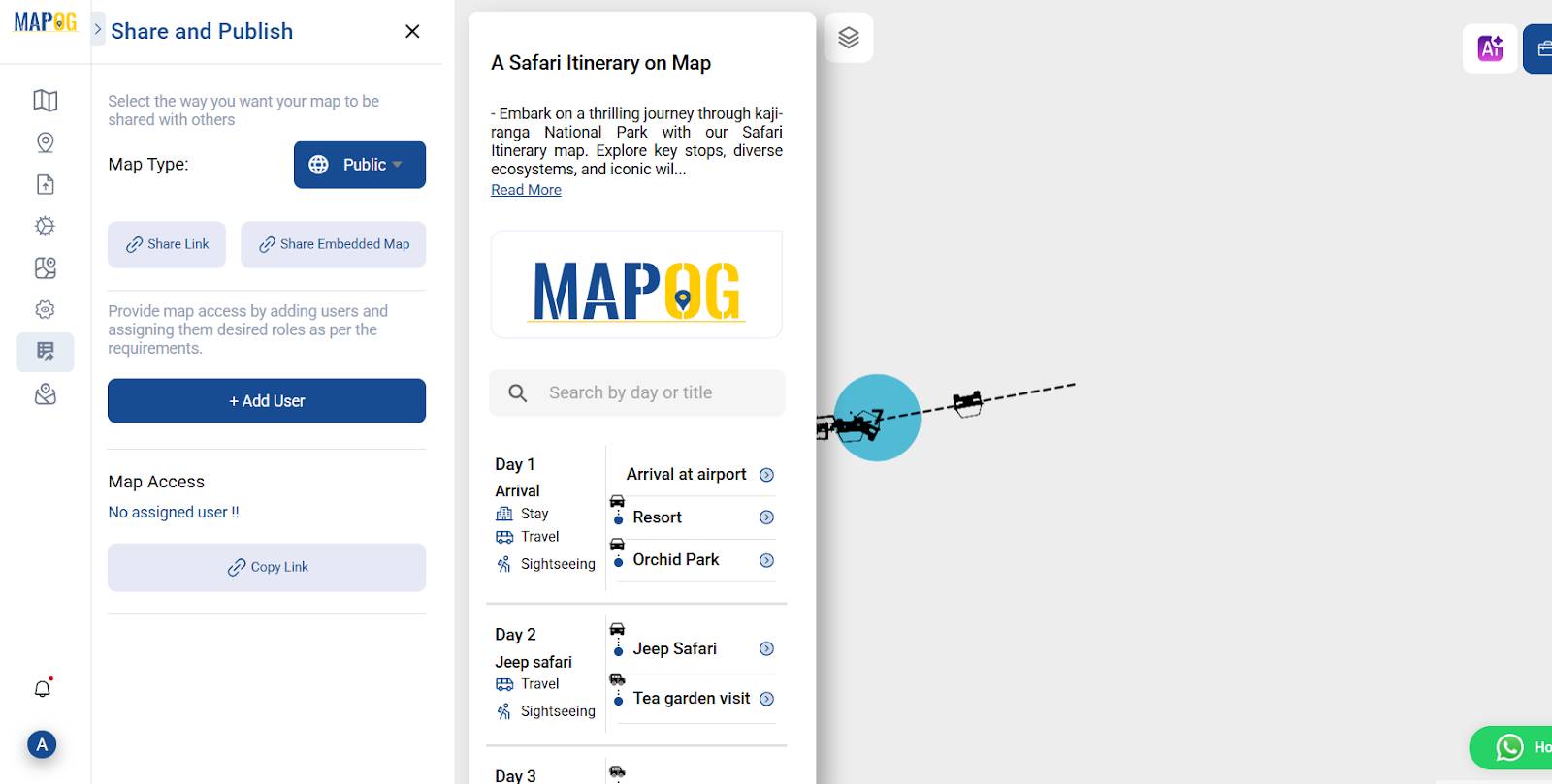
5. Sharing Your Safari Itinerary with the World
Once your map is fully edited, head to the Preview & Share section and choose the map type as Public. You can then share your interactive safari itinerary via a direct link or embed it on a website—making it accessible and immersive for travel companions or blog readers alike.
Why MAPOG Can Be a Good Option to Create a Safari Itinerary
MAPOG stands out as an excellent tool to map out your safari plans for several reasons:
- Firstly, its User-Friendly Interface makes it easy for beginners to upload, edit, and style points without hassle.
- Additionally, the Layer Customization feature allows you to add multiple layers to distinguish between day-wise routes, accommodation, and safari gates.
- Moreover, the Icon Library lets you use thematic icons to personalize your map and make it more informative.
- What’s more, MAPOG’s Storytelling Support feature allows you to add descriptions, images, and captions alongside your map points — turning your map into a travel journal.
- Finally, it’s Collaboration Ready, allowing you to share editable links or view-only access with co-travelers, guides, or tour operators.
With these features, MAPOG transforms a basic itinerary into an engaging digital experience combining safari, itinerary, and map elements seamlessly.
Ever wonder how to align your travel routes with actual on-ground logistics and experiences? Create a Map– Travel Route Planning Made Simple with Story Maps . Explore how mapping technology helps identify key points of interest, visualize day-wise paths, and support more personalized, seamless journeys.
GIS Data used :
Final Thoughts
In conclusion, planning a safari itinerary on map is not just a creative process — it’s a practical one that adds clarity, structure, and visual impact to your travel plans. Tools like MAPOG simplify this by offering map uploads, interactive editing, and powerful storytelling features. Whether you’re heading into the wilds of Kaziranga or another reserve, a mapped itinerary ensures you’re not just exploring — you’re exploring with purpose and precision.
So, before you set off on your next adventure, take a moment to visualize it — on a map.
Explore more insightful blogs you might find useful:
Offbeat Travel in India: Create Personalized Maps of Hidden Gems
Create a Tourist Itinerary Map for the Ultimate Travel Experience
The Travel Map: Effortless Route Planning & Navigation with GIS | Best Travel Tech